Estimated Value: $79,630 - $158,000
Studio
1
Bath
560
Sq Ft
$210/Sq Ft
Est. Value
About This Home
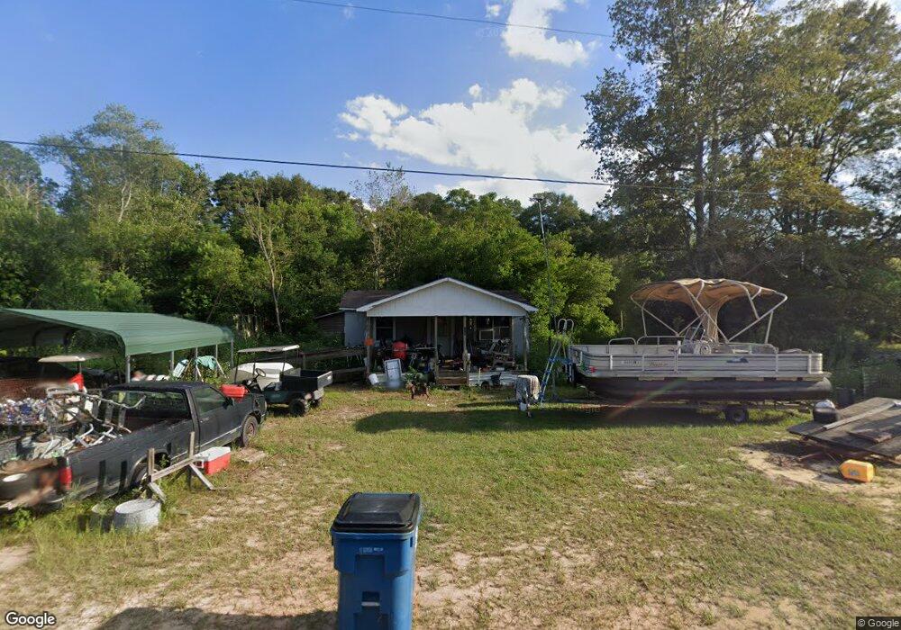
This home is located at 490 John Smith Rd, Jesup, GA 31545 and is currently estimated at $117,658, approximately $210 per square foot. 490 John Smith Rd is a home located in Wayne County with nearby schools including Martha Rawls Smith Elementary School, Arthur Williams Middle School, and Wayne County High School.
Ownership History
Date
Name
Owned For
Owner Type
Purchase Details
Closed on
Jun 28, 2024
Sold by
Knight Jimmy
Bought by
Knight Angela and Knight Jimmy
Current Estimated Value
Purchase Details
Closed on
Jun 24, 2024
Sold by
Knight Jimmy
Bought by
Knight Jimmy
Purchase Details
Closed on
Apr 12, 2024
Sold by
Knight Jimmy
Bought by
Knight Angela and Knight Jimmy
Purchase Details
Closed on
Aug 9, 2023
Sold by
Knight Jimmy Lavon
Bought by
Knight Jimmy
Purchase Details
Closed on
Sep 1, 1985
Bought by
Knight Jimmy L
Purchase Details
Closed on
Dec 1, 1980
Purchase Details
Closed on
Jan 1, 1974
Create a Home Valuation Report for This Property
The Home Valuation Report is an in-depth analysis detailing your home's value as well as a comparison with similar homes in the area
Purchase History
| Date | Buyer | Sale Price | Title Company |
|---|---|---|---|
| Knight Angela | -- | -- | |
| Knight Angela | -- | -- | |
| Knight Jimmy | -- | -- | |
| Knight Angela | -- | -- | |
| Knight Jimmy | -- | -- | |
| Knight Jimmy L | $2,000 | -- | |
| -- | $1,500 | -- | |
| -- | -- | -- |
Source: Public Records
Tax History
| Year | Tax Paid | Tax Assessment Tax Assessment Total Assessment is a certain percentage of the fair market value that is determined by local assessors to be the total taxable value of land and additions on the property. | Land | Improvement |
|---|---|---|---|---|
| 2025 | $355 | $18,042 | $7,680 | $10,362 |
| 2024 | $469 | $17,720 | $7,680 | $10,040 |
| 2023 | $302 | $10,050 | $4,156 | $5,894 |
| 2022 | $123 | $8,921 | $3,027 | $5,894 |
| 2021 | $132 | $8,921 | $3,027 | $5,894 |
| 2020 | $178 | $10,103 | $4,209 | $5,894 |
| 2019 | $183 | $10,103 | $4,209 | $5,894 |
| 2018 | $183 | $10,103 | $4,209 | $5,894 |
| 2017 | $158 | $10,103 | $4,209 | $5,894 |
| 2016 | $153 | $10,102 | $4,209 | $5,894 |
| 2014 | $153 | $10,102 | $4,209 | $5,894 |
| 2013 | -- | $10,101 | $4,208 | $5,893 |
Source: Public Records
Map
Nearby Homes
- 50 Sangster Rd
- 24 Sangster Rd
- 370 Briarwood Rd
- 2636 Beechwood Dr
- 2606 Beechwood Dr
- 47 Yellow Pine Rd
- 1275 Rayonier Rd
- 290 Yellow Pine Rd
- 391 Rodman Rd
- 404 River Ridge Cir
- 111 Pine Ridge Rd
- 166 Pine Ridge Rd
- 106 Rodman Rd
- 629 Sierra Rd
- 200 W Melody Dr
- 376 Fannie Branch Dr
- 931 River Ridge Cir
- 1814 Killingsworth Rd
- 121 Kiowa Dr N
- 151 Pine Ridge Rd
- 2242 Rayonier Rd
- 2191 Rayonier Rd
- 2121 Rayonier Rd
- 110 Mellon St
- 3 Rayonier Rd
- 2 Rayonier Rd
- 1 Rayonier Rd
- 92 Atwood Rd
- 188 Mellon St
- 2271 Rayonier Rd
- 150 Atwood Rd
- 2075 Rayonier Rd
- 159 Atwood Rd
- 2301 Rayonier Rd
- 225 Riddle Rd
- 2110 Rayonier Rd
- 2132 Rayonier Rd
- 2266 Rayonier Rd
- 65 Sangster Rd
- 89 Sangster Rd
Your Personal Tour Guide
Ask me questions while you tour the home.