Estimated Value: $632,000 - $724,000
6
Beds
3
Baths
3,584
Sq Ft
$191/Sq Ft
Est. Value
About This Home
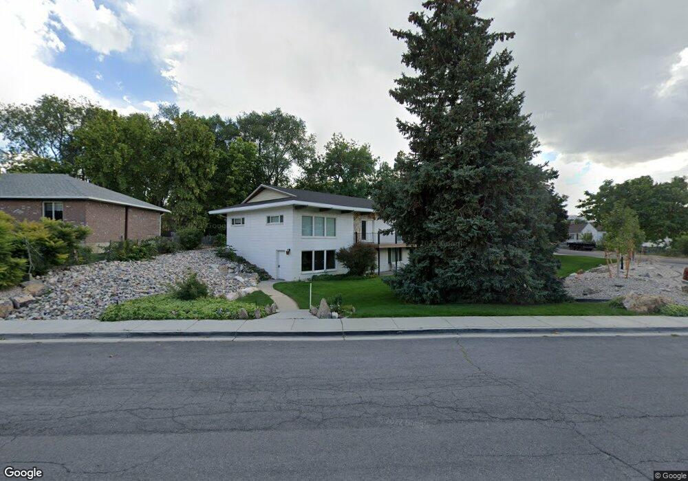
This home is located at 490 N 100 W, Lehi, UT 84043 and is currently estimated at $683,385, approximately $190 per square foot. 490 N 100 W is a home located in Utah County with nearby schools including Lehi Elementary School, Lehi Junior High School, and Lehi High School.
Ownership History
Date
Name
Owned For
Owner Type
Purchase Details
Closed on
Aug 20, 2014
Sold by
Adamson Melissa
Bought by
Adamson Melissa and Melissa Adamson Trust
Current Estimated Value
Purchase Details
Closed on
Mar 24, 2014
Sold by
Adamson Melissa and Blaine Walter Adamson Revocabl
Bought by
Adamson Melissa
Purchase Details
Closed on
Mar 11, 2014
Sold by
Adamson Melissa and Blaine Walter Adamson Revocabl
Bought by
Adamson Melissa
Purchase Details
Closed on
Aug 31, 2011
Sold by
Adamson Blaine W
Bought by
Adamson Blaine Walter and Blaine Walter Adamson Revocabl
Create a Home Valuation Report for This Property
The Home Valuation Report is an in-depth analysis detailing your home's value as well as a comparison with similar homes in the area
Home Values in the Area
Average Home Value in this Area
Purchase History
| Date | Buyer | Sale Price | Title Company |
|---|---|---|---|
| Adamson Melissa | -- | None Available | |
| Adamson Melissa | -- | None Available | |
| Adamson Melissa | -- | None Available | |
| Adamson Blaine Walter | -- | None Available |
Source: Public Records
Tax History Compared to Growth
Tax History
| Year | Tax Paid | Tax Assessment Tax Assessment Total Assessment is a certain percentage of the fair market value that is determined by local assessors to be the total taxable value of land and additions on the property. | Land | Improvement |
|---|---|---|---|---|
| 2025 | $2,674 | $335,500 | $245,700 | $364,300 |
| 2024 | $2,475 | $312,895 | $0 | $0 |
| 2023 | $2,475 | $314,490 | $0 | $0 |
| 2022 | $2,531 | $311,795 | $0 | $0 |
| 2021 | $2,283 | $425,200 | $121,100 | $304,100 |
| 2020 | $2,153 | $396,300 | $112,100 | $284,200 |
| 2019 | $2,071 | $396,300 | $112,100 | $284,200 |
| 2018 | $1,960 | $354,500 | $102,500 | $252,000 |
| 2017 | $1,734 | $166,760 | $0 | $0 |
| 2016 | $1,607 | $143,385 | $0 | $0 |
| 2015 | -- | $127,875 | $0 | $0 |
| 2014 | $1,368 | $115,225 | $0 | $0 |
Source: Public Records
Map
Nearby Homes
- 4561 N McKechnie Way Dr Unit 1119
- 143 W 300 N
- 281 N Center St
- 171 E 400 N
- 255 W 100 N
- 443 W 820 N
- 174 E 100 N
- 7 E State St
- 68 W State St
- 155 W State St Unit TRLR 3
- 705 N 400 E
- 485 W Main St
- 428 E 500 N
- 996 N 200 W
- 595 S 600 E
- 1150 N 200 W Unit 6
- 578 N Woods Dr
- 453 S 230 W
- 1329 N 100 E Unit 21
- 1295 N 190 E