
Seller's Agent in 2025
Kristi Whitten
Keller Williams Realty-Metropolitan
(603) 674-4985
1 in this area
189 Total Sales
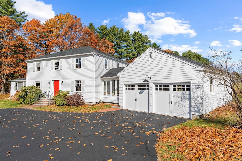
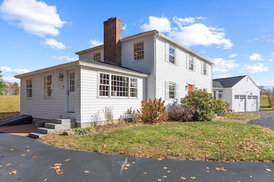
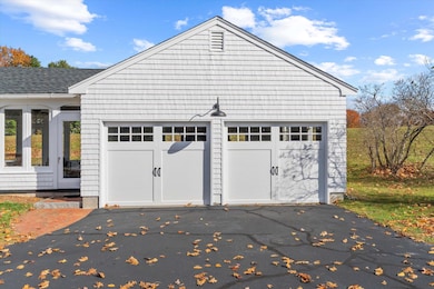
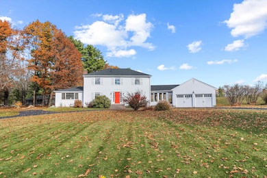
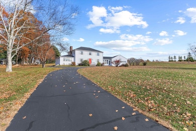
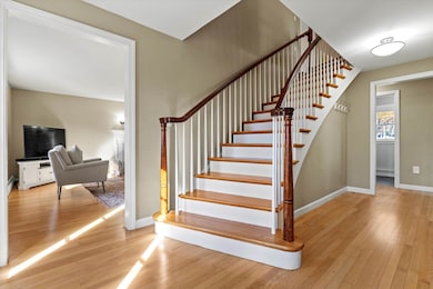
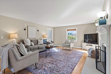
Welcome to 490 Page Road — a beautifully maintained home nestled in one of Bow’s most sought-after areas. This spacious property offers the perfect blend of modern updates and classic New England charm. Step inside to find a bright and open floor plan featuring hardwood floors, a stylishly updated kitchen with concrete counters and stainless-steel appliances, and multiple living spaces ideal for entertaining or relaxing. The primary suite provides a peaceful retreat with a private bath, while additional bedrooms offer generous space for family or guests. Enjoy morning coffee or evening gatherings in the three-season room overlooking the private, landscaped yard. The home also includes an attached garage, ample storage, and energy-efficient systems. Conveniently located near top-rated Bow schools, commuter routes, and local amenities — this home offers the best of small-town living just minutes from Concord and Manchester.
Last Agent to Sell the Property
Keller Williams Realty-Metropolitan License #062990 Listed on: 11/06/2025
| Date | Type | Sale Price | Title Company |
|---|---|---|---|
| Warranty Deed | $760,000 | -- | |
| Warranty Deed | -- | None Available | |
| Warranty Deed | -- | None Available | |
| Warranty Deed | -- | None Available | |
| Warranty Deed | $250,000 | -- | |
| Warranty Deed | $250,000 | -- |
| Date | Status | Loan Amount | Loan Type |
|---|---|---|---|
| Open | $608,000 | New Conventional | |
| Closed | $0 | No Value Available |
| Date | Event | Price | List to Sale | Price per Sq Ft |
|---|---|---|---|---|
| 12/15/2025 12/15/25 | Sold | $760,000 | +4.1% | $326 / Sq Ft |
| 11/06/2025 11/06/25 | For Sale | $729,900 | -- | $314 / Sq Ft |
| Year | Tax Paid | Tax Assessment Tax Assessment Total Assessment is a certain percentage of the fair market value that is determined by local assessors to be the total taxable value of land and additions on the property. | Land | Improvement |
|---|---|---|---|---|
| 2025 | $10,673 | $532,300 | $164,400 | $367,900 |
| 2024 | $10,529 | $532,300 | $164,400 | $367,900 |
| 2023 | $9,525 | $342,500 | $111,600 | $230,900 |
| 2022 | $9,083 | $342,500 | $111,600 | $230,900 |
| 2021 | $8,582 | $336,700 | $111,600 | $225,100 |
| 2020 | $8,613 | $336,700 | $111,600 | $225,100 |
| 2019 | $8,825 | $336,700 | $111,600 | $225,100 |
| 2018 | $8,490 | $305,600 | $102,900 | $202,700 |
| 2017 | $8,439 | $303,900 | $102,900 | $201,000 |
| 2016 | $7,990 | $303,900 | $102,900 | $201,000 |
| 2015 | $7,774 | $272,400 | $102,900 | $169,500 |
| 2014 | $8,039 | $272,400 | $102,900 | $169,500 |
| 2011 | $7,374 | $271,600 | $102,300 | $169,300 |
Seller's Agent in 2025
Kristi Whitten
Keller Williams Realty-Metropolitan
(603) 674-4985
1 in this area
189 Total Sales
Buyer's Agent in 2025
Connie Mullen
The Mullen Realty Group, LLC
(603) 848-9999
4 in this area
99 Total Sales
Source: PrimeMLS
MLS Number: 5068682
APN: BOWW-000003-000004-000038-A000000
Disclaimer: Certain information contained herein is derived from information provided by parties other than Homes.com. All information provided is deemed reliable, but is not guaranteed to be accurate and should be independently verified.
![]() Copyright 2026 PrimeMLS, Inc. All rights reserved. This information is deemed reliable, but not guaranteed. The data relating to real estate displayed on this display comes in part from the IDX Program of PrimeMLS. The information being provided is for consumers’ personal, non-commercial use and may not be used for any purpose other than to identify prospective properties consumers may be interested in purchasing.
Copyright 2026 PrimeMLS, Inc. All rights reserved. This information is deemed reliable, but not guaranteed. The data relating to real estate displayed on this display comes in part from the IDX Program of PrimeMLS. The information being provided is for consumers’ personal, non-commercial use and may not be used for any purpose other than to identify prospective properties consumers may be interested in purchasing.
Ask me questions while you tour the home.