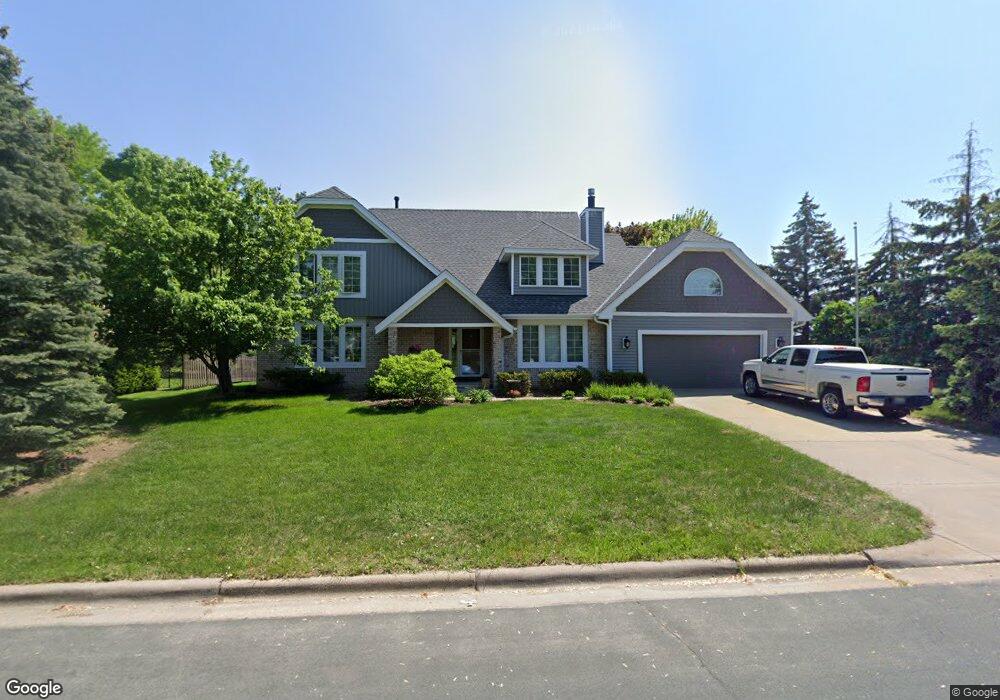
490 Preserve Path West St. Paul, MN 55118
Estimated Value: $549,732 - $703,000
4
Beds
3
Baths
2,350
Sq Ft
$262/Sq Ft
Est. Value
About This Home
This home is located at 490 Preserve Path, West St. Paul, MN 55118 and is currently estimated at $614,683, approximately $261 per square foot. 490 Preserve Path is a home located in Dakota County with nearby schools including Garlough Environmental Magnet, Friendly Hills Middle School, and Two Rivers High School.
Ownership History
Date
Name
Owned For
Owner Type
Purchase Details
Closed on
Jun 15, 2010
Sold by
Not Provided
Bought by
Not Provided
Current Estimated Value
Create a Home Valuation Report for This Property
The Home Valuation Report is an in-depth analysis detailing your home's value as well as a comparison with similar homes in the area
Home Values in the Area
Average Home Value in this Area
Purchase History
| Date | Buyer | Sale Price | Title Company |
|---|---|---|---|
| Not Provided | $317,000 | -- |
Source: Public Records
Tax History Compared to Growth
Tax History
| Year | Tax Paid | Tax Assessment Tax Assessment Total Assessment is a certain percentage of the fair market value that is determined by local assessors to be the total taxable value of land and additions on the property. | Land | Improvement |
|---|---|---|---|---|
| 2024 | $6,374 | $496,300 | $112,500 | $383,800 |
| 2023 | $6,374 | $511,800 | $119,200 | $392,600 |
| 2022 | $5,672 | $462,400 | $118,800 | $343,600 |
| 2021 | $5,392 | $429,700 | $103,300 | $326,400 |
| 2020 | $5,394 | $405,900 | $98,400 | $307,500 |
| 2019 | $5,476 | $394,900 | $93,700 | $301,200 |
| 2018 | $4,786 | $382,100 | $87,600 | $294,500 |
| 2017 | $4,532 | $350,900 | $83,400 | $267,500 |
| 2016 | $4,762 | $320,700 | $75,800 | $244,900 |
| 2015 | $4,370 | $328,455 | $72,838 | $255,617 |
| 2014 | -- | $291,831 | $66,699 | $225,132 |
| 2013 | -- | $266,652 | $60,924 | $205,728 |
Source: Public Records
Map
Nearby Homes
- 485 Preserve Path
- 1810 Delaware Ave
- 492 Deer Run Trail
- 614 Hidden Creek Trail
- 600 Sibley Ct
- 1912 South Ln
- 685 Hidden Creek Trail
- 1774 Dodd Rd
- 2122 Delaware Ave
- 1620 Charlton St Unit 109
- 2012 Pine Ridge Dr
- 2148 Delaware Ave
- 1513 Smith Ave S
- 170 Wentworth Ave W Unit F
- 180 Wentworth Ave W Unit E
- 688 Wentworth Ave W
- 2194 Charlton Rd
- 1941 Dodd Rd
- 25 W Kraft Rd
- 389 Edith Dr
- 490 Preserve Path
- 485 485 Preserve Path
- 480 Preserve Path
- 1918 Delaware Ave
- 472 Preserve Path
- 1885 Heather Ct
- 466 Preserve Path
- 451 451 Preserve-Path-
- 461 Preserve Path
- 1878 Delaware Ave
- 475 Nature View Ct
- 1869 Heather Ct
- 1878 1878 Delaware-Avenue-
- 1878 1878 Delaware Ave
- 1869 Heather Ct
- 485 Nature View Ct
- 457 Preserve Path
- 1874 1874 Heather Ct
- 462 Preserve Path
- 469 Nature View Ct