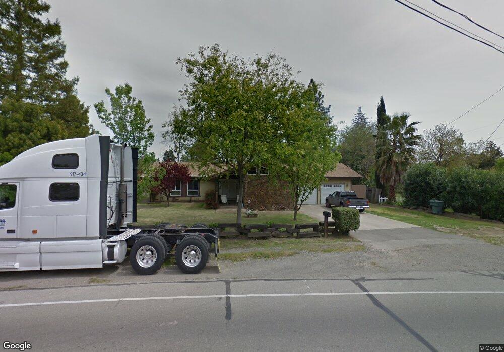
490 S Barrett Rd Yuba City, CA 95991
Estimated Value: $471,000
3
Beds
3
Baths
1,912
Sq Ft
$246/Sq Ft
Est. Value
About This Home
This home is located at 490 S Barrett Rd, Yuba City, CA 95991 and is currently priced at $471,000, approximately $246 per square foot. 490 S Barrett Rd is a home located in Sutter County with nearby schools including Park Avenue Elementary School, Gray Avenue Middle School, and Yuba City High School.
Ownership History
Date
Name
Owned For
Owner Type
Purchase Details
Closed on
Dec 2, 2009
Sold by
Winfree Raymond K and Winfree Sheilene R
Bought by
Winfree Raymond K and Winfree Shellene R
Current Estimated Value
Home Financials for this Owner
Home Financials are based on the most recent Mortgage that was taken out on this home.
Original Mortgage
$127,000
Outstanding Balance
$83,303
Interest Rate
5.01%
Mortgage Type
New Conventional
Purchase Details
Closed on
Sep 9, 2009
Sold by
Department Of Veterans Affairs Of The St
Bought by
Winfree Raymond K and Winfree Shellene R
Create a Home Valuation Report for This Property
The Home Valuation Report is an in-depth analysis detailing your home's value as well as a comparison with similar homes in the area
Home Values in the Area
Average Home Value in this Area
Purchase History
| Date | Buyer | Sale Price | Title Company |
|---|---|---|---|
| Winfree Raymond K | -- | First American Title Company | |
| Winfree Raymond K | -- | None Available |
Source: Public Records
Mortgage History
| Date | Status | Borrower | Loan Amount |
|---|---|---|---|
| Open | Winfree Raymond K | $127,000 |
Source: Public Records
Tax History Compared to Growth
Tax History
| Year | Tax Paid | Tax Assessment Tax Assessment Total Assessment is a certain percentage of the fair market value that is determined by local assessors to be the total taxable value of land and additions on the property. | Land | Improvement |
|---|---|---|---|---|
| 2021 | $1,301 | $249,960 | $49,992 | $199,968 |
| 2020 | $1,301 | $247,396 | $49,479 | $197,917 |
| 2019 | $1,286 | $242,545 | $48,509 | $194,036 |
| 2018 | $1,291 | $237,789 | $47,558 | $190,231 |
| 2017 | $1,275 | $233,127 | $46,625 | $186,502 |
| 2016 | $1,259 | $228,556 | $45,711 | $182,845 |
| 2015 | $1,175 | $220,000 | $45,000 | $175,000 |
Source: Public Records
Map
Nearby Homes
- 1075 Briar Ln
- 1196 Hunn Rd
- 564 Queensbury Way
- 511 Trinity Ave
- 285 S Barrett Rd
- 582 Camino Cortez
- 1224 Highland Ave
- 862 Murray Ct
- 910 Marcia Ave
- 1421 Richland Rd
- 988 Carolina Ave
- 1255 Lincoln Rd Unit 29
- 1040 Franklin Ave
- 64 Clark Ave
- 741 E Hillcrest Ave
- 241 Littlejohn Rd
- 157 Morton St
- 770 Crestmont Ave
- 914 Taber Ave
- 368 N Lawrence Ave
- 1122 Briar Ln
- 510 S Barrett Rd
- 1116 Briar Ln
- 1121 Hillcrest Ave
- 495 S Barrett Rd
- 530 S Barrett Rd
- 1104 Briar Ln
- 1119 Briar Ln
- 1115 Hillcrest Ave
- 1135 Hillcrest Ave
- 1154 Normandy Ct
- 529 S Barrett Rd
- 550 S Barrett Rd
- 1096 Briar Ln
- 0 S Barrett Rd
- 1107 Hillcrest Ave
- 1164 Normandy Ct
- 1110 Hillcrest Ave
- 1067 Hillcrest Ave
- 1151 Hillcrest Ave