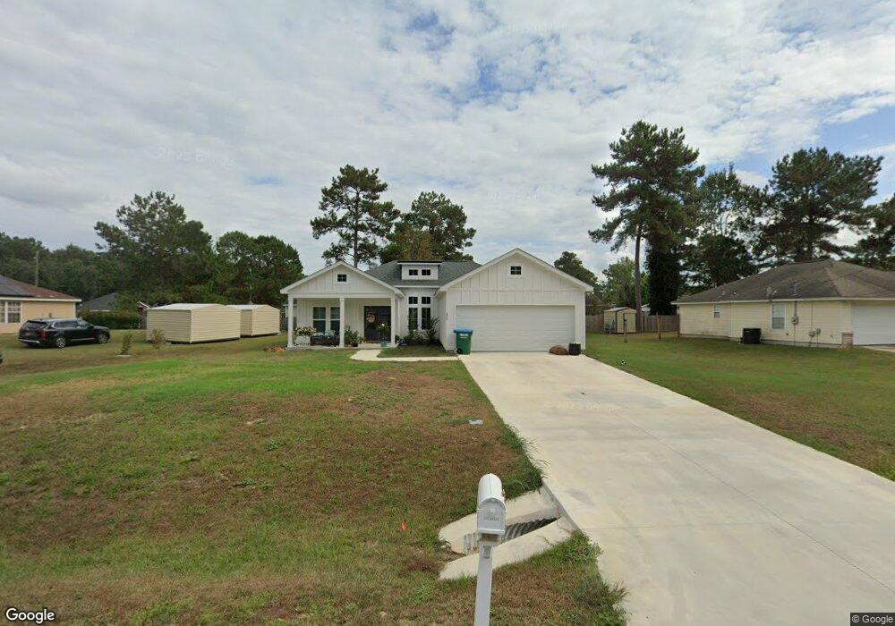
490 Slash Cir Unit 20 Midway, FL 32343
Estimated Value: $140,000 - $389,000
--
Bed
--
Bath
1,812
Sq Ft
$166/Sq Ft
Est. Value
About This Home
This home is located at 490 Slash Cir Unit 20, Midway, FL 32343 and is currently estimated at $300,938, approximately $166 per square foot. 490 Slash Cir Unit 20 is a home located in Gadsden County with nearby schools including Robert F. Munroe Day School.
Ownership History
Date
Name
Owned For
Owner Type
Purchase Details
Closed on
May 13, 2024
Sold by
Tranquility Realty Llc
Bought by
Abernathy Phillip and Abernathy Amanda D
Current Estimated Value
Home Financials for this Owner
Home Financials are based on the most recent Mortgage that was taken out on this home.
Original Mortgage
$340,714
Outstanding Balance
$335,246
Interest Rate
6.82%
Mortgage Type
FHA
Estimated Equity
-$34,308
Purchase Details
Closed on
Jul 13, 2022
Sold by
Toks Kassim
Bought by
Tranquility Real77 Llc
Purchase Details
Closed on
Oct 27, 2017
Sold by
Adejokun Adeolu David
Bought by
Kassim Toks
Purchase Details
Closed on
Nov 30, 2009
Sold by
Kp Investments Llc
Bought by
Adejokun Adeolu
Create a Home Valuation Report for This Property
The Home Valuation Report is an in-depth analysis detailing your home's value as well as a comparison with similar homes in the area
Home Values in the Area
Average Home Value in this Area
Purchase History
| Date | Buyer | Sale Price | Title Company |
|---|---|---|---|
| Abernathy Phillip | $347,000 | None Listed On Document | |
| Tranquility Real77 Llc | $35,000 | Smith W Crit | |
| Tranquility Real77 Llc | $35,000 | Smith W Crit | |
| Kassim Toks | $8,000 | None Available | |
| Adejokun Adeolu | $19,500 | Attorney |
Source: Public Records
Mortgage History
| Date | Status | Borrower | Loan Amount |
|---|---|---|---|
| Open | Abernathy Phillip | $340,714 |
Source: Public Records
Tax History Compared to Growth
Tax History
| Year | Tax Paid | Tax Assessment Tax Assessment Total Assessment is a certain percentage of the fair market value that is determined by local assessors to be the total taxable value of land and additions on the property. | Land | Improvement |
|---|---|---|---|---|
| 2025 | $4,838 | $298,849 | $40,500 | $258,349 |
| 2024 | $645 | $37,000 | $37,000 | -- |
| 2023 | $575 | $30,000 | $30,000 | $0 |
| 2022 | $288 | $22,000 | $22,000 | $0 |
| 2021 | $251 | $17,000 | $17,000 | $0 |
| 2020 | $196 | $10,030 | $10,030 | $0 |
| 2019 | $194 | $10,030 | $10,030 | $0 |
| 2018 | $179 | $8,755 | $0 | $0 |
| 2017 | $174 | $8,500 | $0 | $0 |
| 2016 | $176 | $8,500 | $0 | $0 |
| 2015 | $175 | $8,500 | $0 | $0 |
| 2014 | $243 | $12,000 | $0 | $0 |
Source: Public Records
Map
Nearby Homes
- 65 Deloris Madison Dr
- 6 Slash Ln
- 420 N Charles Willis Dr
- 62 Frank Run
- 50 Frank Run
- 49 Francis Harrell Way
- 7 Mae Cato Dr
- 17 Pine Bark Ln
- 25 Pine Bark Ln
- 315 Mae Cato Dr
- 407 Mae Cato Dr
- 668 M l King Blvd
- 137 Monroe Creek Dr
- 0 Central Rd Unit 381525
- 8873 High Bridge Rd
- 81 Knight Rd
- 8877 High Bridge Rd
- 274 Forest Cir S
- 69 Buckskin Cir
- XX S Lanier Rd
- 490 Slash Cir
- 0 Slash Pine Unit 20 225447
- 460 Slash Cir
- 313 Slash Ln
- 550 Slash Cir Unit 1
- 550 Slash Cir
- 325 Slash Ln
- 440 Slash Cir
- 515 Slash Cir Unit LT
- 515 Slash Cir
- 295 Slash Ln
- 475 Slash Cir Unit 1
- 475 Slash Cir
- 545 Slash Cir
- 455 Slash Cir
- 420 Slash Cir
- 420 Slash Pine Cir
- 735 Rustling Pines Blvd Unit Non
- 735 Rustling Pines Blvd
- 277 Slash Ln