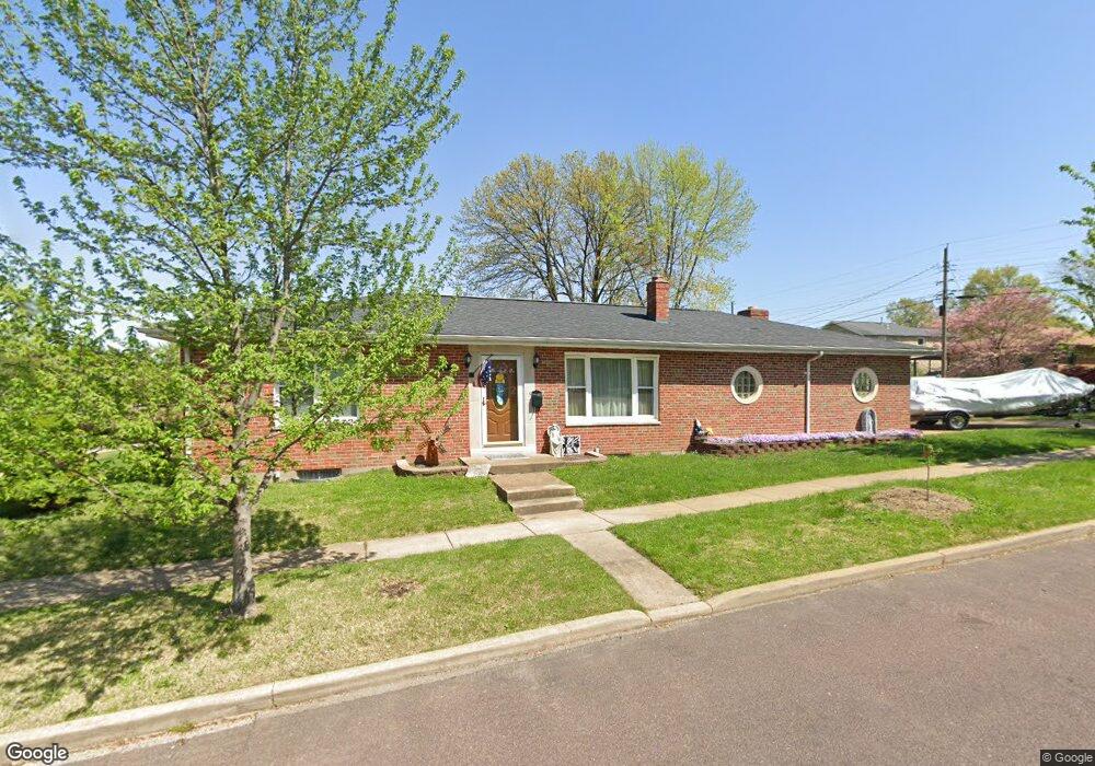
4900 Deville Ave Saint Louis, MO 63119
Estimated Value: $278,392 - $307,000
2
Beds
1
Bath
1,374
Sq Ft
$216/Sq Ft
Est. Value
About This Home
This home is located at 4900 Deville Ave, Saint Louis, MO 63119 and is currently estimated at $296,848, approximately $216 per square foot. 4900 Deville Ave is a home located in St. Louis County with nearby schools including Edgar Road Elementary School, Hixson Middle School, and Webster Groves High School.
Ownership History
Date
Name
Owned For
Owner Type
Purchase Details
Closed on
Jan 28, 2015
Sold by
Keil Carolina S and Keil Abel
Bought by
Revocable Living Trust Of Abel Keil & Ca
Current Estimated Value
Purchase Details
Closed on
Apr 23, 2010
Sold by
Torrence Jane L and Torrence Michael
Bought by
Keil Carolina S and Keil Abe
Create a Home Valuation Report for This Property
The Home Valuation Report is an in-depth analysis detailing your home's value as well as a comparison with similar homes in the area
Home Values in the Area
Average Home Value in this Area
Purchase History
| Date | Buyer | Sale Price | Title Company |
|---|---|---|---|
| Revocable Living Trust Of Abel Keil & Ca | -- | None Available | |
| Keil Carolina S | $57,000 | None Available |
Source: Public Records
Mortgage History
| Date | Status | Borrower | Loan Amount |
|---|---|---|---|
| Closed | Keil Carolina S | $0 |
Source: Public Records
Tax History
| Year | Tax Paid | Tax Assessment Tax Assessment Total Assessment is a certain percentage of the fair market value that is determined by local assessors to be the total taxable value of land and additions on the property. | Land | Improvement |
|---|---|---|---|---|
| 2025 | $3,049 | $51,590 | $27,780 | $23,810 |
| 2024 | $3,049 | $42,370 | $13,870 | $28,500 |
| 2023 | $3,035 | $42,370 | $13,870 | $28,500 |
| 2022 | $2,950 | $38,300 | $13,870 | $24,430 |
| 2021 | $2,699 | $38,300 | $13,870 | $24,430 |
| 2020 | $2,913 | $37,530 | $13,870 | $23,660 |
| 2019 | $3,025 | $37,530 | $13,870 | $23,660 |
| 2018 | $3,063 | $34,220 | $12,410 | $21,810 |
| 2017 | $3,040 | $34,220 | $12,410 | $21,810 |
| 2016 | $2,773 | $29,340 | $10,510 | $18,830 |
Source: Public Records
Map
Nearby Homes
- 25 Saint Charles Place
- 7312 Melbourne 1 2 Ave
- 7800 Murdoch Ave
- 7344 Whitehall Colonial Ln
- 7809 Kenridge Ln
- 7740 Arlington Ave
- 7826 Grove Ave
- 7501 Triwoods Dr Unit J
- 7409 Triwoods Dr Unit G
- 7410 Triwoods Dr Unit I
- 5314 N Kenrick Parke Dr Unit 4
- 7059 Lansdowne Ave
- 5319 Chapelford Ln
- 7081 Winona Ave
- 6968 Lansdowne Ave
- 5201 Kingwood Dr
- 6962 Sutherland Ave
- 6957 Chippewa St
- 1088 Key Ave W
- 6927-6931 Sutherland Ave
- 7412 Brunswick Ave
- 7410 Brunswick Ave
- 4901 Deville Ave
- 7408 Brunswick Ave
- 4906 Deville Ave
- 7421 Weil Ave
- 7426 Brunswick Ave
- 7419 Weil Ave
- 7406 Brunswick Ave
- 7425 Weil Ave
- 7419 Brunswick Ave
- 7415 Brunswick Ave
- 7421 Brunswick Ave
- 7411 Weil Ave
- 7430 Brunswick Ave
- 7423 Brunswick Ave
- 7411 Brunswick Ave
- 7402 Brunswick Ave
- 7404 Brunswick Ave
- 7429 Weil Ave
