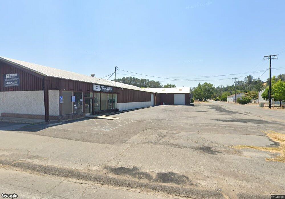
4900 Westside Rd Redding, CA 96001
Branstetter NeighborhoodEstimated Value: $627,570
Studio
--
Bath
10,000
Sq Ft
$63/Sq Ft
Est. Value
About This Home
This home is located at 4900 Westside Rd, Redding, CA 96001 and is currently estimated at $627,570, approximately $62 per square foot. 4900 Westside Rd is a home located in Shasta County with nearby schools including Sycamore Elementary School, Sequoia Middle School, and Shasta High School.
Ownership History
Date
Name
Owned For
Owner Type
Purchase Details
Closed on
Jul 30, 2015
Sold by
Buchanan Toni D and Briggs Patrick M
Bought by
Tatom 2001 Trust and Tatom Deena C
Current Estimated Value
Purchase Details
Closed on
Dec 22, 1999
Sold by
North Valley Bank
Bought by
Buchanan L J and Buchanan Toni D
Home Financials for this Owner
Home Financials are based on the most recent Mortgage that was taken out on this home.
Original Mortgage
$220,000
Interest Rate
7.69%
Mortgage Type
Commercial
Create a Home Valuation Report for This Property
The Home Valuation Report is an in-depth analysis detailing your home's value as well as a comparison with similar homes in the area
Home Values in the Area
Average Home Value in this Area
Purchase History
| Date | Buyer | Sale Price | Title Company |
|---|---|---|---|
| Tatom 2001 Trust | $350,000 | Fidelity Natl Title Co Of Ca | |
| Buchanan L J | $211,090 | Chicago Title Co |
Source: Public Records
Mortgage History
| Date | Status | Borrower | Loan Amount |
|---|---|---|---|
| Previous Owner | Buchanan L J | $220,000 |
Source: Public Records
Tax History
| Year | Tax Paid | Tax Assessment Tax Assessment Total Assessment is a certain percentage of the fair market value that is determined by local assessors to be the total taxable value of land and additions on the property. | Land | Improvement |
|---|---|---|---|---|
| 2025 | $4,395 | $414,322 | $112,457 | $301,865 |
| 2024 | $4,330 | $406,199 | $110,252 | $295,947 |
| 2023 | $4,330 | $398,236 | $108,091 | $290,145 |
| 2022 | $4,258 | $390,428 | $105,972 | $284,456 |
| 2021 | $4,239 | $382,774 | $103,895 | $278,879 |
| 2020 | $4,294 | $378,850 | $102,830 | $276,020 |
| 2019 | $4,081 | $371,422 | $100,814 | $270,608 |
| 2018 | $4,117 | $364,140 | $98,838 | $265,302 |
| 2017 | $4,096 | $357,000 | $96,900 | $260,100 |
| 2016 | $3,969 | $350,000 | $95,000 | $255,000 |
| 2015 | $3,105 | $271,102 | $121,483 | $149,619 |
| 2014 | $3,101 | $265,793 | $119,104 | $146,689 |
Source: Public Records
Map
Nearby Homes
- 2340 Wilsey Dr
- 4920 Bonnyview Ave
- 4549 Harrison Ave
- 2521 Radio Ln
- 2230 El Reno Ln
- 4410 Westside Rd
- 2415 Marion Ct
- 0 Lot4 Unit 2 Ph 2 Stillwater Unit 25-4962
- 0 Lot3 Unit 2 Ph 2 Stillwater Unit 25-4961
- 0 Lot6 Unit 2 Ph 2 Stillwater Unit 25-4964
- 0 Lot5 Unit 2 Ph 2 Stillwater Unit 25-4963
- 0 Lot16 Unit 2 Ph 2 Stillwater Unit 25-4958
- 0 Lot9 Unit 2 Ph 2 Stillwater Unit 25-4967
- 0 Lot2 Unit 2 Ph 2 Stillwater Unit 25-4960
- 0 Lot11 Unit 2 Ph 2 Stillwater Unit 25-4953
- 0 Lot10 Unit 2 Ph 2 Stillwater Unit 25-4952
- 0 Lot7 Unit 2 Ph 2 Stillwater Unit 25-4965
- 3232 Nicolet Ln
- 0000 Wyndham Pointe Subdivision
- 1400 Riviera Dr
- 4890 Westside Rd
- 2211 Kenyon Dr
- 4920 Westside Rd
- 4870 Westside Rd
- 2195 Kenyon Dr
- 2184 Kenyon Dr
- 2175 Kenyon Dr
- 4970-4972 Westside Rd
- 2180 Kenyon Dr
- 4970 Westside Rd
- 2185 Kenyon Dr
- 4980 Westside Rd
- 2178 Kenyon Dr
- 2176-2184 Kenyon Dr
- 4925 Cedars Rd
- 2151 Kenyon Dr
- 4935 Cedars Rd
- 2160 Kenyon Dr
- 4945 Cedars Rd
- 4991 Cedars Rd
Your Personal Tour Guide
Ask me questions while you tour the home.