Estimated Value: $142,554 - $174,000
2
Beds
1
Bath
1,036
Sq Ft
$153/Sq Ft
Est. Value
About This Home
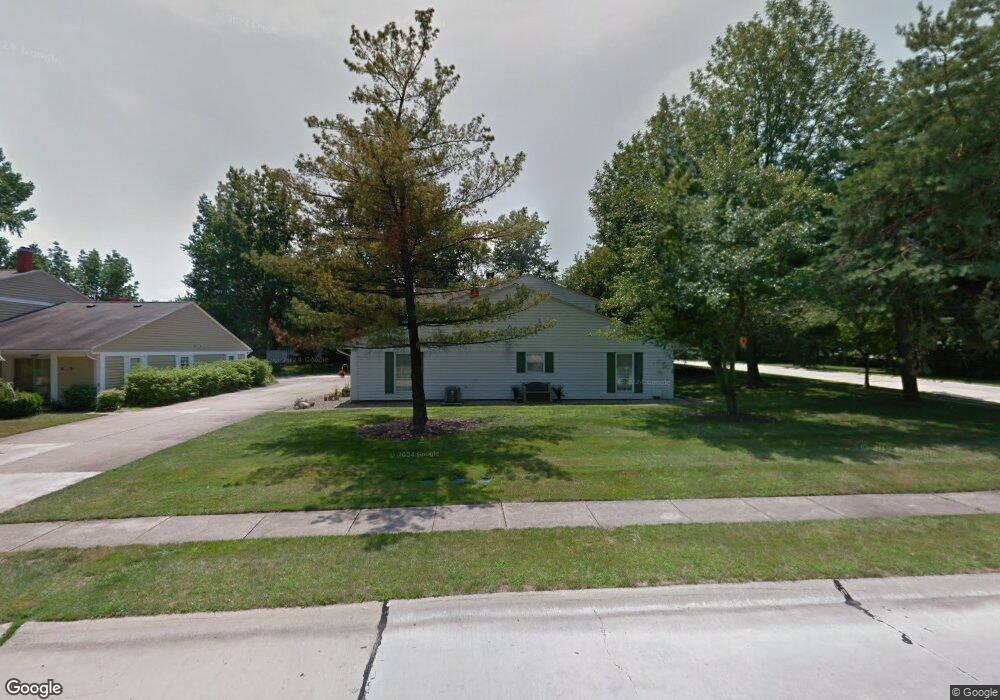
This home is located at 4901 Independence Cir, Stow, OH 44224 and is currently estimated at $158,389, approximately $152 per square foot. 4901 Independence Cir is a home located in Summit County with nearby schools including Stow-Munroe Falls High School, Primrose School of Hudson, and Holy Family Elementary School.
Ownership History
Date
Name
Owned For
Owner Type
Purchase Details
Closed on
Feb 22, 2002
Sold by
Herr Susan K
Bought by
Schiavoni Sheryle Jo
Current Estimated Value
Home Financials for this Owner
Home Financials are based on the most recent Mortgage that was taken out on this home.
Original Mortgage
$75,000
Outstanding Balance
$30,705
Interest Rate
6.92%
Estimated Equity
$127,684
Purchase Details
Closed on
Oct 21, 1997
Sold by
Knight Jack D
Bought by
Herr Susan K and Jack D Knight Intervivos Trust
Create a Home Valuation Report for This Property
The Home Valuation Report is an in-depth analysis detailing your home's value as well as a comparison with similar homes in the area
Home Values in the Area
Average Home Value in this Area
Purchase History
| Date | Buyer | Sale Price | Title Company |
|---|---|---|---|
| Schiavoni Sheryle Jo | $81,000 | Midland Commerce Group | |
| Herr Susan K | -- | -- |
Source: Public Records
Mortgage History
| Date | Status | Borrower | Loan Amount |
|---|---|---|---|
| Open | Schiavoni Sheryle Jo | $75,000 |
Source: Public Records
Tax History
| Year | Tax Paid | Tax Assessment Tax Assessment Total Assessment is a certain percentage of the fair market value that is determined by local assessors to be the total taxable value of land and additions on the property. | Land | Improvement |
|---|---|---|---|---|
| 2024 | $1,620 | $37,156 | $3,850 | $33,306 |
| 2023 | $1,620 | $37,156 | $3,850 | $33,306 |
| 2022 | $1,219 | $27,122 | $2,811 | $24,311 |
| 2021 | $1,096 | $27,122 | $2,811 | $24,311 |
| 2020 | $1,078 | $27,120 | $2,810 | $24,310 |
| 2019 | $776 | $20,830 | $2,780 | $18,050 |
| 2018 | $764 | $20,830 | $2,790 | $18,040 |
| 2017 | $641 | $20,830 | $2,790 | $18,040 |
| 2016 | $658 | $18,440 | $2,790 | $15,650 |
| 2015 | $641 | $18,440 | $2,790 | $15,650 |
| 2014 | $642 | $18,440 | $2,790 | $15,650 |
| 2013 | $967 | $23,960 | $2,790 | $21,170 |
Source: Public Records
Map
Nearby Homes
- 4916 Friar Rd Unit B
- 4932 Friar Rd Unit A
- 4638 Dresher Trail
- 4909 Fishcreek Rd
- 4399-4403 Cherryhurst Dr
- 4556 Fishcreek Rd
- 4846 Garnet Cir
- 2221 Crockett Cir
- 2188 Duxbury
- 2365 Norman Dr
- 2908 Wexford Blvd
- 4155 Burton Dr
- 4424 Timberdale Dr Unit 4428
- 2279 Becket Cir
- 2260 E Gilwood Dr
- 4138 Genevieve Blvd
- 2072 White Oak Dr Unit 2076
- 4078 Pardee Rd
- 2054 Maplewood Rd
- 4040 Burton Dr
- 4901 Independence Cir Unit 23B
- 4901 Independence Cir Unit 23D
- 4901 Independence Cir
- 4901 Independence Cir Unit C
- 0 Friar Rd Unit 4915D
- 4905 Independence Cir Unit D
- 4905 Independence Cir Unit 22B
- 4905 Independence Cir Unit 22C
- 4905 Independence Cir
- 4905 Independence Cir
- 4905 Independence Cir Unit A
- 4905 Independence Cir Unit B
- 2599 Valleydale Rd
- 2591 Valleydale Rd
- 2601 Valleydale Rd
- 3044 Westview Ln
- 4915 Friar Rd Unit 24D
- 4915 Friar Rd Unit 24B
- 4915 Friar Rd Unit 24A
- 4915 Friar Rd
Your Personal Tour Guide
Ask me questions while you tour the home.