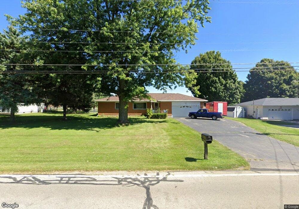
4906 Bosart Rd Springfield, OH 45503
Estimated Value: $241,502 - $261,000
2
Beds
2
Baths
1,646
Sq Ft
$151/Sq Ft
Est. Value
About This Home
This home is located at 4906 Bosart Rd, Springfield, OH 45503 and is currently estimated at $248,376, approximately $150 per square foot. 4906 Bosart Rd is a home located in Clark County with nearby schools including Northridge Elementary School, Kenton Ridge Middle & High School, and Emmanuel Christian Academy.
Ownership History
Date
Name
Owned For
Owner Type
Purchase Details
Closed on
Oct 5, 2001
Sold by
Baker Donald G and Baker Nancy M
Bought by
Crosier Craig R and Crosier Bonnie C
Current Estimated Value
Home Financials for this Owner
Home Financials are based on the most recent Mortgage that was taken out on this home.
Original Mortgage
$125,628
Outstanding Balance
$46,945
Interest Rate
6.88%
Mortgage Type
FHA
Estimated Equity
$201,431
Create a Home Valuation Report for This Property
The Home Valuation Report is an in-depth analysis detailing your home's value as well as a comparison with similar homes in the area
Home Values in the Area
Average Home Value in this Area
Purchase History
| Date | Buyer | Sale Price | Title Company |
|---|---|---|---|
| Crosier Craig R | $127,600 | -- |
Source: Public Records
Mortgage History
| Date | Status | Borrower | Loan Amount |
|---|---|---|---|
| Open | Crosier Craig R | $125,628 |
Source: Public Records
Tax History
| Year | Tax Paid | Tax Assessment Tax Assessment Total Assessment is a certain percentage of the fair market value that is determined by local assessors to be the total taxable value of land and additions on the property. | Land | Improvement |
|---|---|---|---|---|
| 2025 | $2,447 | $75,520 | $15,540 | $59,980 |
| 2024 | $2,366 | $55,950 | $12,920 | $43,030 |
| 2023 | $2,366 | $55,950 | $12,920 | $43,030 |
| 2022 | $2,375 | $55,950 | $12,920 | $43,030 |
| 2021 | $2,378 | $47,470 | $10,680 | $36,790 |
| 2020 | $2,380 | $47,470 | $10,680 | $36,790 |
| 2019 | $2,425 | $47,470 | $10,680 | $36,790 |
| 2018 | $2,229 | $41,890 | $9,820 | $32,070 |
| 2017 | $1,910 | $47,835 | $9,821 | $38,014 |
| 2016 | $1,897 | $47,835 | $9,821 | $38,014 |
| 2015 | $2,018 | $48,689 | $10,675 | $38,014 |
| 2014 | $2,017 | $48,689 | $10,675 | $38,014 |
| 2013 | $1,971 | $48,689 | $10,675 | $38,014 |
Source: Public Records
Map
Nearby Homes
- 4500 Bosart Rd
- 4890 Brannan Dr W Unit 4890
- 4732 Lehigh Dr
- 4652 Reno Ln Unit 15
- 4577 Reno Ln Unit 2
- 1977 Willoughby Ave
- 1521 Erika Dr
- 4028 Ryland Dr Unit 4028
- 4446 Ridgewood Rd E Unit 3
- 5060 Morris Rd
- 4322 Midfield St Unit 15
- 1644 Delmar Dr
- 4256 Midfield St Unit 9
- 1309 Richmoor Rd
- 5235 W Ridgewood Rd
- 1341 Student Ave
- 4802 Willowbrook Dr
- 1398 Elizabeth Ct Unit 66
- 4741 Cullen Ave
- 1470 Oldham Dr Unit 12
- 4880 Bosart Rd
- 4914 Bosart Rd
- 4922 Bosart Rd
- 4830 Bosart Rd
- 4885 Bosart Rd
- 4911 Bosart Rd
- 4928 Bosart Rd
- 4931 Bosart Rd
- 4820 Bosart Rd
- 4845 Bosart Rd
- 4953 Bosart Rd
- 4810 Bosart Rd
- 4960 Bosart Rd
- 2497 Moorefield Rd
- 4801 Bosart Rd
- 4754 Bosart Rd
- 4725 Bosart Rd
- 4732 Bosart Rd
- 2536 Moorefield Rd
- 2433 Moorefield Rd
Your Personal Tour Guide
Ask me questions while you tour the home.