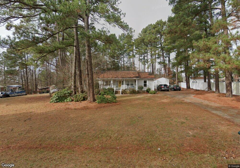
4906 Simpson Dr Sanford, NC 27330
Estimated Value: $286,734 - $301,000
3
Beds
2
Baths
1,562
Sq Ft
$189/Sq Ft
Est. Value
About This Home
This home is located at 4906 Simpson Dr, Sanford, NC 27330 and is currently estimated at $295,184, approximately $188 per square foot. 4906 Simpson Dr is a home located in Lee County with nearby schools including J.R. Ingram Jr. Elementary School, West Lee Middle School, and Southern Lee High School.
Ownership History
Date
Name
Owned For
Owner Type
Purchase Details
Closed on
Mar 12, 2025
Sold by
Valentine Frances Campbell and Valentine Michael Lee
Bought by
Tatone Angela
Current Estimated Value
Purchase Details
Closed on
Mar 14, 2014
Sold by
Sikinger William C and Sikinger Eileen B
Bought by
Valentine Frances
Purchase Details
Closed on
Oct 8, 2002
Sold by
Mosley Ricky E
Bought by
Valentine Frances
Create a Home Valuation Report for This Property
The Home Valuation Report is an in-depth analysis detailing your home's value as well as a comparison with similar homes in the area
Home Values in the Area
Average Home Value in this Area
Purchase History
| Date | Buyer | Sale Price | Title Company |
|---|---|---|---|
| Tatone Angela | -- | None Listed On Document | |
| Tatone Angela | -- | None Listed On Document | |
| Valentine Frances | $111,500 | None Available | |
| Valentine Frances | $123,500 | -- |
Source: Public Records
Tax History Compared to Growth
Tax History
| Year | Tax Paid | Tax Assessment Tax Assessment Total Assessment is a certain percentage of the fair market value that is determined by local assessors to be the total taxable value of land and additions on the property. | Land | Improvement |
|---|---|---|---|---|
| 2025 | $1,594 | $207,500 | $35,000 | $172,500 |
| 2024 | $1,594 | $207,500 | $35,000 | $172,500 |
| 2023 | $1,580 | $207,500 | $35,000 | $172,500 |
| 2022 | $1,066 | $120,400 | $30,000 | $90,400 |
| 2021 | $1,096 | $120,400 | $30,000 | $90,400 |
| 2020 | $1,102 | $120,400 | $30,000 | $90,400 |
| 2019 | $1,102 | $120,400 | $30,000 | $90,400 |
| 2018 | $1,081 | $115,300 | $25,000 | $90,300 |
| 2017 | $1,075 | $115,300 | $25,000 | $90,300 |
| 2016 | $1,067 | $115,300 | $25,000 | $90,300 |
| 2014 | $1,023 | $115,300 | $25,000 | $90,300 |
Source: Public Records
Map
Nearby Homes
- 0 Pendergrass Rd Unit 701808
- 2017 Owls Nest Rd
- 1700 Phillips Dr
- 0 Phillips Dr Unit 10088155
- 1508 Westfall Cir
- 2101 Wimberly Woods Dr
- 3309 Westcott Cir
- 729 Richardson Dr
- 5224 Tyndall Dr
- 5228 Tyndall Dr
- 5232 Tyndall Dr
- 5220 Tyndall Dr
- 737 Richardson Dr
- 5054 Tyndall Dr
- 5058 Tyndall Dr
- 5216 Tyndall Dr
- 5212 Tyndall Dr
- 5208 Tyndall Dr
- Prelude Plan at Brantley Place
- Intrigue Plan at Brantley Place
- 4912 Simpson Dr
- 4902 Simpson Dr
- 1420 Pendergrass Rd
- 1416 Pendergrass Rd
- 5124 Simpson Dr
- 4905 Simpson Dr
- 5012 Simpson Dr
- 4901 Simpson Dr
- 5000 Simpson Dr
- 4911 Simpson Dr
- 5020 Simpson Dr
- 1410 Pendergrass Rd
- 4915 Simpson Dr
- 4812 Simpson Dr
- 1415 Pendergrass Rd
- 4919 Simpson Dr
- 1402 Pendergrass Rd
- 5117 Simpson Dr
- 5113 Simpson Dr
- 4923 Simpson Dr