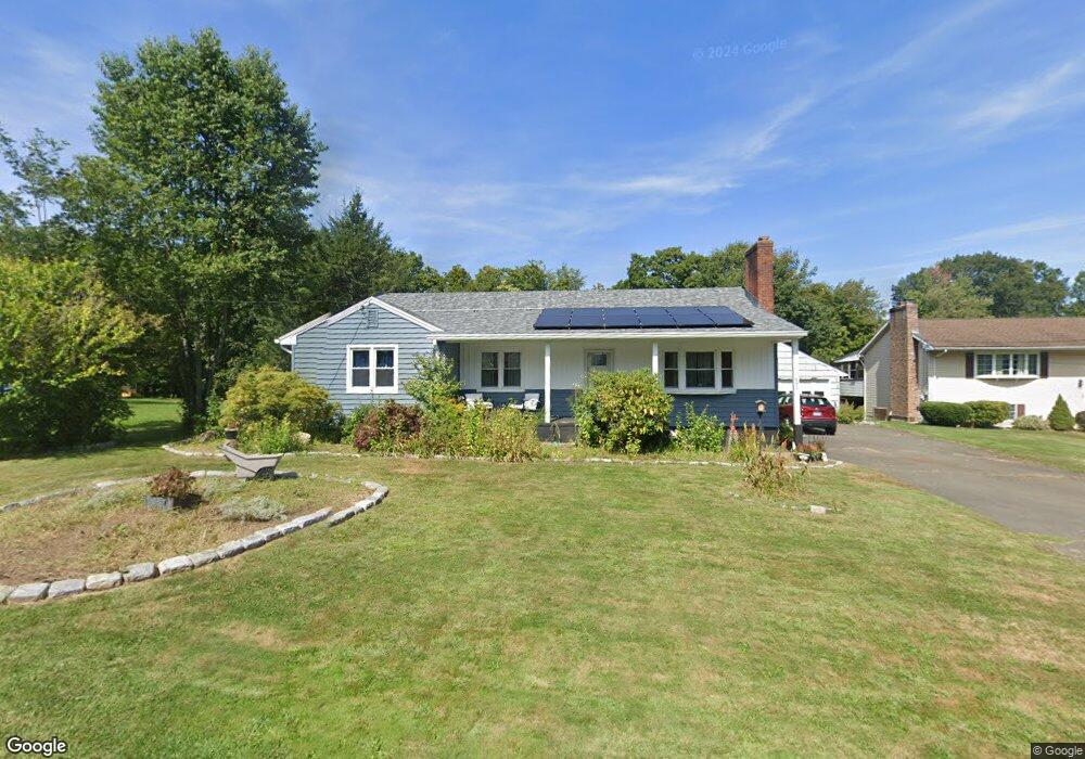
491 Butternut St Middletown, CT 06457
Westfield NeighborhoodEstimated Value: $337,000 - $361,624
2
Beds
3
Baths
1,428
Sq Ft
$246/Sq Ft
Est. Value
About This Home
This home is located at 491 Butternut St, Middletown, CT 06457 and is currently estimated at $350,906, approximately $245 per square foot. 491 Butternut St is a home located in Middlesex County with nearby schools including Wilbert Snow Elementary School, St John Paul II School, and Mercy High School.
Ownership History
Date
Name
Owned For
Owner Type
Purchase Details
Closed on
Jul 2, 2003
Sold by
Dreaher Martin A and Dreaher Patricia A
Bought by
Gabriel Wayne and Gabriel Betsy
Current Estimated Value
Home Financials for this Owner
Home Financials are based on the most recent Mortgage that was taken out on this home.
Original Mortgage
$179,900
Outstanding Balance
$76,973
Interest Rate
5.46%
Estimated Equity
$273,933
Create a Home Valuation Report for This Property
The Home Valuation Report is an in-depth analysis detailing your home's value as well as a comparison with similar homes in the area
Home Values in the Area
Average Home Value in this Area
Purchase History
| Date | Buyer | Sale Price | Title Company |
|---|---|---|---|
| Gabriel Wayne | $310,000 | -- |
Source: Public Records
Mortgage History
| Date | Status | Borrower | Loan Amount |
|---|---|---|---|
| Open | Gabriel Wayne | $179,900 | |
| Previous Owner | Gabriel Wayne | $16,000 | |
| Previous Owner | Gabriel Wayne | $117,000 |
Source: Public Records
Tax History Compared to Growth
Tax History
| Year | Tax Paid | Tax Assessment Tax Assessment Total Assessment is a certain percentage of the fair market value that is determined by local assessors to be the total taxable value of land and additions on the property. | Land | Improvement |
|---|---|---|---|---|
| 2025 | $6,252 | $160,710 | $63,620 | $97,090 |
| 2024 | $5,914 | $160,710 | $63,620 | $97,090 |
| 2023 | $5,641 | $160,710 | $63,620 | $97,090 |
| 2022 | $4,942 | $112,320 | $40,190 | $72,130 |
| 2021 | $4,942 | $112,320 | $40,190 | $72,130 |
| 2020 | $7,894 | $112,320 | $40,190 | $72,130 |
| 2019 | $7,941 | $112,320 | $40,190 | $72,130 |
| 2018 | $4,908 | $112,320 | $40,190 | $72,130 |
| 2017 | $5,685 | $134,070 | $48,510 | $85,560 |
| 2016 | $5,524 | $134,070 | $48,510 | $85,560 |
| 2015 | $5,309 | $134,070 | $48,510 | $85,560 |
| 2014 | $5,363 | $134,070 | $48,510 | $85,560 |
Source: Public Records
Map
Nearby Homes
- 81 Aresco Dr
- 574 Butternut St
- 160 Boston Rd
- 237 Boston Rd
- 40 Batt St
- 27 Barbara Rd
- 17 Mckenna Dr
- 60 Old Mill Rd
- 18 Phedon Pkwy
- 31 Broadview Pkwy
- 1 Nathan Hale Rd
- 2 Nathan Hale Rd
- 4 Nathan Hale Rd
- 3 Nathan Hale Rd
- 84 Camp St
- 1271 Washington St Unit 7
- 498 Pine St
- 10 Lorelei Cir
- 55 Lorelei Cir
- 82 Westfield Terrace
- 481 Butternut St
- 509 Butternut St
- 496 Butternut St
- 475 Butternut St
- 463 Butternut St
- 510 Butternut St
- 470 Butternut St
- 22 Markham St
- 520 Butternut St
- 455 Butternut St
- 539 Butternut St
- 460 Butternut St
- 146 Middlefield St
- 121 Middlefield St
- 128 Middlefield St
- 147 Middlefield St
- 530 Butternut St
- 35 Markham St
- 124 Middlefield St
- 40 Markham St