491 Joe Sizemore Rd Forsyth, GA 31029
Estimated Value: $662,000 - $1,218,160
3
Beds
5
Baths
2,722
Sq Ft
$345/Sq Ft
Est. Value
About This Home
This home is located at 491 Joe Sizemore Rd, Forsyth, GA 31029 and is currently estimated at $940,080, approximately $345 per square foot. 491 Joe Sizemore Rd is a home with nearby schools including Samuel E. Hubbard Elementary School and Mary Persons High School.
Ownership History
Date
Name
Owned For
Owner Type
Purchase Details
Closed on
Jun 15, 2021
Sold by
Scarpinato Dennis D
Bought by
Rising Sons Estate Llc
Current Estimated Value
Purchase Details
Closed on
May 19, 2021
Sold by
Shurling Properties Limited Liability
Bought by
Scarpinato Dennis D and Scarpinato Sheryl
Purchase Details
Closed on
Dec 17, 2003
Sold by
Wilson Wilson W and Wilson Martin A
Bought by
Shurling F Tredway
Purchase Details
Closed on
Jan 29, 1997
Sold by
Georgia Timberlands Inc
Bought by
Wilson Wilson W and Wilson Martin A
Create a Home Valuation Report for This Property
The Home Valuation Report is an in-depth analysis detailing your home's value as well as a comparison with similar homes in the area
Home Values in the Area
Average Home Value in this Area
Purchase History
| Date | Buyer | Sale Price | Title Company |
|---|---|---|---|
| Rising Sons Estate Llc | -- | -- | |
| Scarpinato Dennis D | $928,400 | -- | |
| Shurling F Tredway | $852,000 | -- | |
| Wilson Wilson W | $85,000 | -- | |
| Wilson Wilson W | $361,600 | -- |
Source: Public Records
Tax History Compared to Growth
Tax History
| Year | Tax Paid | Tax Assessment Tax Assessment Total Assessment is a certain percentage of the fair market value that is determined by local assessors to be the total taxable value of land and additions on the property. | Land | Improvement |
|---|---|---|---|---|
| 2024 | $6,901 | $364,320 | $182,640 | $181,680 |
| 2023 | $2,100 | $197,080 | $182,640 | $14,440 |
| 2022 | $1,968 | $197,080 | $182,640 | $14,440 |
| 2021 | $3,698 | $131,928 | $129,360 | $2,568 |
| 2020 | $3,791 | $131,928 | $129,360 | $2,568 |
| 2019 | $3,821 | $131,928 | $129,360 | $2,568 |
| 2018 | $3,832 | $131,928 | $129,360 | $2,568 |
| 2017 | $3,834 | $131,928 | $129,360 | $2,568 |
| 2016 | $3,645 | $131,928 | $129,360 | $2,568 |
| 2015 | $3,456 | $131,928 | $129,360 | $2,568 |
| 2014 | $3,334 | $131,928 | $129,360 | $2,568 |
Source: Public Records
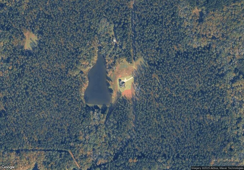
Map
Nearby Homes
- 3319 Highway 42 S
- 0 S Tingle Rd
- 0 Old Zebulon Rd Unit 25091896
- 0 Old Zebulon Rd Unit 25062362
- 0 Old Zebulon Rd Unit 25091897
- 1774 Maynards Mill Rd
- 293 AC Hopewell Rd
- 0 Hopewell Rd Unit 24477788
- 1395 Josey Rd
- 2088 Georgia 42
- 4866 Hwy 42 S
- 1721 Old Zebulon Rd
- 519 Barbara Ct
- 271 Presidents Way
- 266 Presidents Way
- 106 Creekside Ct
- 14 Creekside Ct
- 14 Creekside Ct
- 0 Montpelier Springs Rd Unit 13 M162038
- 0 Montpelier Springs Rd Unit 10 M162036
- 0 Maynards Mill Rd Unit Parcel 8-C 169792
- 0 Maynards Mill Rd Unit Parcel 7 169791
- 0 Maynards Mill Rd Unit Parcel 8-B 169790
- 0 Maynards Mill Rd Unit Parcel 8-C M169792
- 0 Maynards Mill Rd Unit Parcel 7 M169791
- 0 Maynards Mill Rd Unit Parcel 8-B M169790
- 0 Maynards Mill Rd Unit M169014
- 0 Maynards Mill Rd Unit 20062650
- 0 Maynards Mill Rd Unit 80 7417794
- 0 Maynards Mill Rd Unit 7106558
- 0 Maynards Mill Rd Unit 7123106
- 0 Maynards Mill Rd Unit 7147018
- 3265 Georgia 42 Unit Parcel 5
- 3229 Georgia 42 Unit Parcel 4
- 3353 Ga Highway 42 S Unit PARCEL 7
- 3353 Ga Highway 42 S
- 1045 Maynards Mill Rd S
- 3131 Highway 42 S
- 3445 Ga Highway 42 S Unit Parcel 9
- 3177 Georgia 42 Unit Parcel 3