S
Seller's Agent in 2025
Suzy Appel
Real Broker, LLC
(435) 229-8378
76 Total Sales
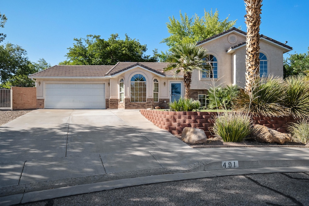
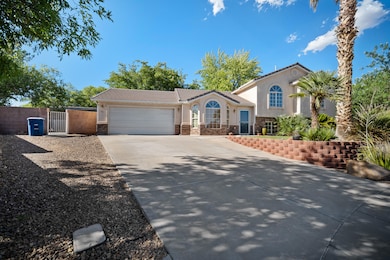
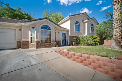
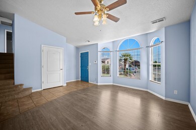
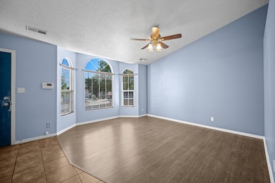
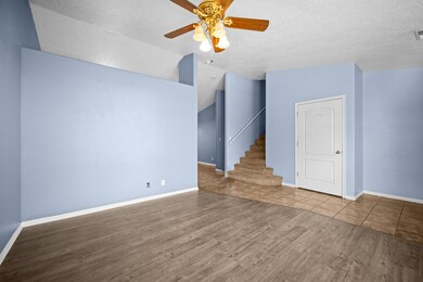
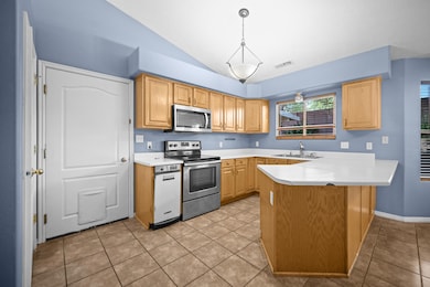
Tucked away in a private cul-de-sac, this tri-level St. George home offers 5 bedrooms and 3 bathrooms in a smart, functional layout. Enjoy warm days in the spacious backyard featuring a sparkling pool with an electric cover for easy maintenance and added safety. Ideally located near shopping, dining, and everyday conveniences, this home combines comfort, privacy, and prime location—perfect for relaxed living and entertaining.
Last Agent to Sell the Property
Real Broker, LLC License #5476006-SA Listed on: 08/02/2025

| Date | Type | Sale Price | Title Company |
|---|---|---|---|
| Warranty Deed | -- | Eagle Gate Title Insurance Agc | |
| Warranty Deed | -- | -- | |
| Interfamily Deed Transfer | -- | First American Title Ins Co | |
| Warranty Deed | -- | Southern Utah Title |
| Date | Status | Loan Amount | Loan Type |
|---|---|---|---|
| Open | $484,070 | FHA | |
| Previous Owner | $158,000 | New Conventional | |
| Previous Owner | $139,500 | New Conventional |
| Date | Event | Price | List to Sale | Price per Sq Ft |
|---|---|---|---|---|
| 11/24/2025 11/24/25 | Sold | -- | -- | -- |
| 10/24/2025 10/24/25 | Pending | -- | -- | -- |
| 10/17/2025 10/17/25 | Price Changed | $495,000 | -2.0% | $252 / Sq Ft |
| 09/05/2025 09/05/25 | Price Changed | $505,000 | -3.8% | $258 / Sq Ft |
| 08/23/2025 08/23/25 | Price Changed | $525,000 | -1.9% | $268 / Sq Ft |
| 08/02/2025 08/02/25 | For Sale | $535,000 | -- | $273 / Sq Ft |
| Year | Tax Paid | Tax Assessment Tax Assessment Total Assessment is a certain percentage of the fair market value that is determined by local assessors to be the total taxable value of land and additions on the property. | Land | Improvement |
|---|---|---|---|---|
| 2025 | $1,762 | $268,015 | $74,250 | $193,765 |
| 2023 | $1,844 | $275,440 | $52,250 | $223,190 |
| 2022 | $2,432 | $280,225 | $52,250 | $227,975 |
| 2021 | $1,708 | $357,800 | $80,000 | $277,800 |
| 2020 | $1,563 | $308,500 | $75,000 | $233,500 |
| 2019 | $1,512 | $291,500 | $60,000 | $231,500 |
| 2018 | $1,456 | $144,925 | $0 | $0 |
| 2017 | $1,454 | $140,525 | $0 | $0 |
| 2016 | $1,501 | $134,200 | $0 | $0 |
| 2015 | $1,404 | $120,395 | $0 | $0 |
| 2014 | $1,366 | $117,865 | $0 | $0 |
S
Seller's Agent in 2025
Suzy Appel
Real Broker, LLC
(435) 229-8378
76 Total Sales
D
Buyer's Agent in 2025
David Araque
RED ROCK REAL ESTATE
(435) 313-5708
89 Total Sales
Source: Washington County Board of REALTORS®
MLS Number: 25-263674
APN: 0620065
Disclaimer: Certain information contained herein is derived from information provided by parties other than Homes.com. All information provided is deemed reliable, but is not guaranteed to be accurate and should be independently verified.
![]() All information should be verified by the recipient and none is guaranteed as accurate by ARMLS
All information should be verified by the recipient and none is guaranteed as accurate by ARMLS
Listing Information presented by local MLS brokerage: Ten-X, local REALTOR®- Arlene Richardson - (888)-952-6393