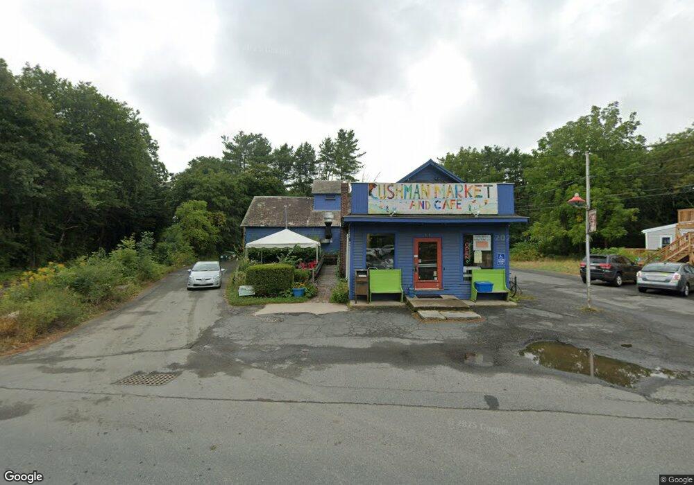
491 Pine St Amherst, MA 01002
Estimated Value: $601,175
Studio
2
Baths
3,136
Sq Ft
$192/Sq Ft
Est. Value
About This Home
This home is located at 491 Pine St, Amherst, MA 01002 and is currently estimated at $601,175, approximately $191 per square foot. 491 Pine St is a home located in Hampshire County with nearby schools including Wildwood Elementary School, Amherst Regional Middle School, and Amherst Regional High School.
Ownership History
Date
Name
Owned For
Owner Type
Purchase Details
Closed on
Jun 29, 2005
Sold by
Latorre Steven E
Bought by
Eddie Haskell Llc
Current Estimated Value
Home Financials for this Owner
Home Financials are based on the most recent Mortgage that was taken out on this home.
Original Mortgage
$280,000
Outstanding Balance
$144,961
Interest Rate
5.73%
Mortgage Type
Commercial
Estimated Equity
$456,214
Purchase Details
Closed on
Jan 11, 2000
Sold by
491 Pine St Assoc
Bought by
Latorre Steven E
Home Financials for this Owner
Home Financials are based on the most recent Mortgage that was taken out on this home.
Original Mortgage
$155,000
Interest Rate
7.73%
Mortgage Type
Commercial
Purchase Details
Closed on
Jun 23, 1994
Sold by
Cushman Vlg Gen Store
Bought by
Ev Rt
Create a Home Valuation Report for This Property
The Home Valuation Report is an in-depth analysis detailing your home's value as well as a comparison with similar homes in the area
Home Values in the Area
Average Home Value in this Area
Purchase History
| Date | Buyer | Sale Price | Title Company |
|---|---|---|---|
| Eddie Haskell Llc | $200,000 | -- | |
| Eddie Haskell Llc | $200,000 | -- | |
| Latorre Steven E | $150,000 | -- | |
| Latorre Steven E | $150,000 | -- | |
| Ev Rt | $80,000 | -- | |
| Ev Rt | $80,000 | -- |
Source: Public Records
Mortgage History
| Date | Status | Borrower | Loan Amount |
|---|---|---|---|
| Open | Eddie Haskell Llc | $280,000 | |
| Closed | Ev Rt | $280,000 | |
| Previous Owner | Ev Rt | $155,000 |
Source: Public Records
Tax History Compared to Growth
Tax History
| Year | Tax Paid | Tax Assessment Tax Assessment Total Assessment is a certain percentage of the fair market value that is determined by local assessors to be the total taxable value of land and additions on the property. | Land | Improvement |
|---|---|---|---|---|
| 2025 | $98 | $545,100 | $111,700 | $433,400 |
| 2024 | $9,547 | $515,800 | $105,400 | $410,400 |
| 2023 | $9,407 | $468,000 | $95,800 | $372,200 |
| 2022 | $9,448 | $444,200 | $91,200 | $353,000 |
| 2021 | $9,692 | $444,200 | $91,200 | $353,000 |
| 2020 | $9,470 | $444,200 | $91,200 | $353,000 |
| 2019 | $9,016 | $413,600 | $91,200 | $322,400 |
| 2018 | $8,744 | $413,600 | $91,200 | $322,400 |
| 2017 | $8,529 | $390,700 | $91,200 | $299,500 |
| 2016 | $8,291 | $390,700 | $91,200 | $299,500 |
| 2015 | $7,711 | $375,400 | $91,200 | $284,200 |
Source: Public Records
Map
Nearby Homes
- 0 Henry St
- 110 Grantwood Dr
- Lot A Kingman Rd
- 185 Cherry Ln
- Lot 3A-3 Leverett Rd
- 11 Overlook Dr
- 60 Overlook Dr
- 39 Valley Ln
- 113 Juggler Meadow Rd
- Lot A January Hills Rd
- Lot 2, January Hills Rd
- 270 N East St
- 0 Red Gate Ln Unit 73348273
- 48 Gray St
- Lot 3 Roosevelt St
- 38 S Plain Rd
- 6 Shattuck Rd
- 18 N Prospect St
- 15 S Plain Rd
- 75 Amity Place Unit 75