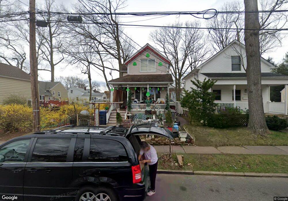
491 W Anderson St Hackensack, NJ 07601
Estimated Value: $371,898 - $510,000
--
Bed
--
Bath
549
Sq Ft
$785/Sq Ft
Est. Value
About This Home
This home is located at 491 W Anderson St, Hackensack, NJ 07601 and is currently estimated at $430,725, approximately $784 per square foot. 491 W Anderson St is a home located in Bergen County with nearby schools including Hackensack High School and Bergen County Christian Academy.
Ownership History
Date
Name
Owned For
Owner Type
Purchase Details
Closed on
Apr 2, 2007
Sold by
Esawy Nasser
Bought by
Esawy Nasser and Toh Choon Y
Current Estimated Value
Purchase Details
Closed on
Apr 19, 2001
Sold by
Archer Richard
Bought by
Esawy Nasser
Home Financials for this Owner
Home Financials are based on the most recent Mortgage that was taken out on this home.
Original Mortgage
$113,715
Interest Rate
6.88%
Mortgage Type
FHA
Create a Home Valuation Report for This Property
The Home Valuation Report is an in-depth analysis detailing your home's value as well as a comparison with similar homes in the area
Home Values in the Area
Average Home Value in this Area
Purchase History
| Date | Buyer | Sale Price | Title Company |
|---|---|---|---|
| Esawy Nasser | -- | -- | |
| Esawy Nasser | $115,500 | -- |
Source: Public Records
Mortgage History
| Date | Status | Borrower | Loan Amount |
|---|---|---|---|
| Previous Owner | Esawy Nasser | $113,715 |
Source: Public Records
Tax History Compared to Growth
Tax History
| Year | Tax Paid | Tax Assessment Tax Assessment Total Assessment is a certain percentage of the fair market value that is determined by local assessors to be the total taxable value of land and additions on the property. | Land | Improvement |
|---|---|---|---|---|
| 2025 | $7,035 | $230,200 | $175,600 | $54,600 |
| 2024 | $6,627 | $230,200 | $175,600 | $54,600 |
| 2023 | $6,355 | $230,200 | $175,600 | $54,600 |
| 2022 | $6,355 | $226,800 | $172,500 | $54,300 |
| 2021 | $5,218 | $183,700 | $157,000 | $26,700 |
| 2020 | $6,079 | $183,700 | $157,000 | $26,700 |
| 2019 | $6,593 | $196,400 | $154,000 | $42,400 |
| 2018 | $6,556 | $192,100 | $150,000 | $42,100 |
| 2017 | $6,451 | $188,900 | $147,500 | $41,400 |
| 2016 | $5,851 | $173,200 | $132,500 | $40,700 |
| 2015 | $5,303 | $151,500 | $118,200 | $33,300 |
| 2014 | $5,033 | $151,500 | $118,200 | $33,300 |
Source: Public Records
Map
Nearby Homes
- 420 Passaic St Unit 2G
- 409 W Anderson St
- 137 Hartwich St
- 378 Lookout Ave
- 403 Summit Ave
- 471 Crestwood Ave Unit 49
- 486 Blanchard Terrace Unit 70
- 290 Clinton Place
- 246 Ross Ave
- 461 Heath Place Unit 23
- 303 Hamilton Place Unit D4
- 357 Maywood Ave
- 344 Prospect Ave Unit 4C
- 178 Fairmount Ave
- 316 Prospect Ave Unit 3C
- 316 Prospect Ave Unit 8D
- 307 Prospect Ave Unit 16A
- 307 Prospect Ave Unit 9a
- 30 Clarendon Place
- 326 Prospect Ave Unit 6J
- 43 Byrne St
- 47 Byrne St
- 497 W Anderson St
- 37 Byrne St
- 492 Hamilton Place
- 496 Hamilton Place
- 499 W Anderson St
- 33 Byrne St
- 496 W Anderson St
- 500 Hamilton Place
- 29 Byrne St
- 511 W Anderson St
- 492 W Anderson St
- 478 W Anderson St Unit 478A
- 57 Byrne St Unit FL 1
- 57 Byrne St
- 498 W Anderson St
- 63 Byrne St
- 506 W Anderson St
- 513 W Anderson St