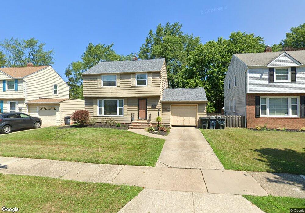
4911 Edsal Dr Cleveland, OH 44124
Estimated Value: $172,565 - $194,000
3
Beds
1
Bath
1,150
Sq Ft
$161/Sq Ft
Est. Value
About This Home
This home is located at 4911 Edsal Dr, Cleveland, OH 44124 and is currently estimated at $185,641, approximately $161 per square foot. 4911 Edsal Dr is a home located in Cuyahoga County with nearby schools including Sunview Elementary School, Greenview Upper Elementary School, and Memorial Junior High School.
Ownership History
Date
Name
Owned For
Owner Type
Purchase Details
Closed on
May 13, 1994
Sold by
Simon Michael Joel and Simon Barbara
Bought by
Kilroy Maurita A
Current Estimated Value
Purchase Details
Closed on
Jul 3, 1984
Sold by
Nagel Barbara
Bought by
Simon Michael Joel and Simon Barbara
Purchase Details
Closed on
Sep 18, 1979
Sold by
Ketchum Jane B
Bought by
Nagel Barbara
Purchase Details
Closed on
Jan 1, 1975
Bought by
Ketchum Jane B
Create a Home Valuation Report for This Property
The Home Valuation Report is an in-depth analysis detailing your home's value as well as a comparison with similar homes in the area
Home Values in the Area
Average Home Value in this Area
Purchase History
| Date | Buyer | Sale Price | Title Company |
|---|---|---|---|
| Kilroy Maurita A | $97,000 | -- | |
| Simon Michael Joel | $67,000 | -- | |
| Nagel Barbara | $64,900 | -- | |
| Ketchum Jane B | -- | -- |
Source: Public Records
Tax History Compared to Growth
Tax History
| Year | Tax Paid | Tax Assessment Tax Assessment Total Assessment is a certain percentage of the fair market value that is determined by local assessors to be the total taxable value of land and additions on the property. | Land | Improvement |
|---|---|---|---|---|
| 2024 | $3,558 | $50,435 | $10,360 | $40,075 |
| 2023 | $3,621 | $41,510 | $8,120 | $33,390 |
| 2022 | $3,601 | $41,510 | $8,120 | $33,390 |
| 2021 | $3,570 | $41,510 | $8,120 | $33,390 |
| 2020 | $3,348 | $34,020 | $6,650 | $27,370 |
| 2019 | $3,019 | $97,200 | $19,000 | $78,200 |
| 2018 | $3,003 | $34,020 | $6,650 | $27,370 |
| 2017 | $3,617 | $37,980 | $6,620 | $31,360 |
| 2016 | $3,590 | $37,980 | $6,620 | $31,360 |
| 2015 | $3,633 | $37,980 | $6,620 | $31,360 |
| 2014 | $3,633 | $38,750 | $6,760 | $31,990 |
Source: Public Records
Map
Nearby Homes
- 1333 Clearview Rd
- 4866 Fairlawn Rd
- 4800 Farnhurst Rd
- 1271 Dorsh Rd
- 4781 Dorshwood Rd
- 5103 Eastover Rd
- 4769 Edenwood Rd
- 4669 Liberty Rd
- 1512 Parkside Cir
- 4650 Liberty Rd
- 4695 Mayfield Rd Unit A
- 4685 Mayfield Rd Unit F
- 981 Hanley Rd
- 5227 E Farnhurst Rd
- 5079 Haverford Dr
- 5027 Bristol Ct
- 5268 Edenhurst Rd
- 4880 Anderson Rd
- 5144 Oakmont Dr
- 4742 Anderson Rd
- 4907 Edsal Dr
- 4919 Edsal Dr
- 4923 Edsal Dr
- 4903 Edsal Dr
- 4908 S Sedgewick Rd
- 4918 S Sedgewick Rd
- 4895 Edsal Dr
- 4927 Edsal Dr
- 4912 Edsal Dr
- 4904 S Sedgewick Rd
- 4916 Edsal Dr
- 4908 Edsal Dr
- 4924 S Sedgewick Rd
- 4924 Edsal Dr
- 4904 Edsal Dr
- 4898 S Sedgewick Rd
- 4891 Edsal Dr
- 4931 Edsal Dr
- 4928 S Sedgewick Rd
- 4928 Edsal Dr