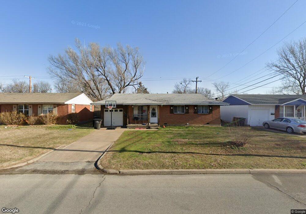
4912 E Frank Phillips Blvd Bartlesville, OK 74006
Estimated Value: $110,000 - $122,337
3
Beds
1
Bath
1,001
Sq Ft
$116/Sq Ft
Est. Value
About This Home
This home is located at 4912 E Frank Phillips Blvd, Bartlesville, OK 74006 and is currently estimated at $116,334, approximately $116 per square foot. 4912 E Frank Phillips Blvd is a home located in Washington County with nearby schools including Hoover Elementary School, Madison Middle School, and Bartlesville High School.
Ownership History
Date
Name
Owned For
Owner Type
Purchase Details
Closed on
Apr 14, 2008
Sold by
Gaspard Louis and Gaspard Sheila
Bought by
Cornsilk Shannon
Current Estimated Value
Home Financials for this Owner
Home Financials are based on the most recent Mortgage that was taken out on this home.
Original Mortgage
$46,182
Outstanding Balance
$29,337
Interest Rate
6.11%
Mortgage Type
FHA
Estimated Equity
$86,997
Purchase Details
Closed on
Aug 16, 2002
Sold by
Cabanaw Reba W Trust
Create a Home Valuation Report for This Property
The Home Valuation Report is an in-depth analysis detailing your home's value as well as a comparison with similar homes in the area
Home Values in the Area
Average Home Value in this Area
Purchase History
| Date | Buyer | Sale Price | Title Company |
|---|---|---|---|
| Cornsilk Shannon | $59,500 | None Available | |
| -- | $34,000 | -- |
Source: Public Records
Mortgage History
| Date | Status | Borrower | Loan Amount |
|---|---|---|---|
| Open | Cornsilk Shannon | $46,182 |
Source: Public Records
Tax History Compared to Growth
Tax History
| Year | Tax Paid | Tax Assessment Tax Assessment Total Assessment is a certain percentage of the fair market value that is determined by local assessors to be the total taxable value of land and additions on the property. | Land | Improvement |
|---|---|---|---|---|
| 2025 | $1,152 | $10,069 | $1,020 | $9,049 |
| 2024 | $1,152 | $9,590 | $1,020 | $8,570 |
| 2023 | $1,152 | $9,133 | $1,020 | $8,113 |
| 2022 | $1,094 | $9,133 | $1,020 | $8,113 |
| 2021 | $1,039 | $8,852 | $1,020 | $7,832 |
| 2020 | $1,012 | $8,431 | $1,020 | $7,411 |
| 2019 | $965 | $8,029 | $1,020 | $7,009 |
| 2018 | $960 | $8,029 | $1,020 | $7,009 |
| 2017 | $982 | $8,029 | $1,020 | $7,009 |
| 2016 | $922 | $8,029 | $1,020 | $7,009 |
| 2015 | $916 | $7,860 | $385 | $7,475 |
| 2014 | $870 | $7,485 | $385 | $7,100 |
Source: Public Records
Map
Nearby Homes
- 4900 E Frank Phillips Blvd
- 4800 E Frank Phillips Blvd
- 4732 Cornell Dr
- 332 Brookline Place
- 4709 Amherst Dr
- 4917 Amherst Dr
- 4944 Cornell Dr
- 4701 Dartmouth Dr
- 953 Yale Dr
- 644 SE Elmhurst Ave
- 5608 Harvard Dr
- 4512 E Frank Phillips Blvd
- 4507 E Frank Phillips Blvd
- 5610 Baylor Dr
- 397 Fleetwood Dr
- 616 SE Greystone Ave
- 4816 Carole Ct
- 5012 Allen Ct
- 1058 Renick Ln
- 348 SE Elmhurst Ave
- 4908 E Frank Phillips Blvd
- 4916 E Frank Phillips Blvd
- 4904 E Frank Phillips Blvd
- 4920 E Frank Phillips Blvd
- 5129 Harvard Dr
- 5133 Harvard Dr
- 5125 Harvard Dr
- 4913 E Frank Phillips Blvd
- 4924 E Frank Phillips Blvd
- 4768 Cornell Dr
- 4905 E Frank Phillips Blvd
- 5137 Harvard Dr
- 4909 E Frank Phillips Blvd
- 5121 Harvard Dr
- 4808 E Frank Phillips Blvd
- 4764 Cornell Dr
- 5000 E Frank Phillips Blvd
- 5141 Harvard Dr
- 4760 Cornell Dr
- 4804 E Frank Phillips Blvd