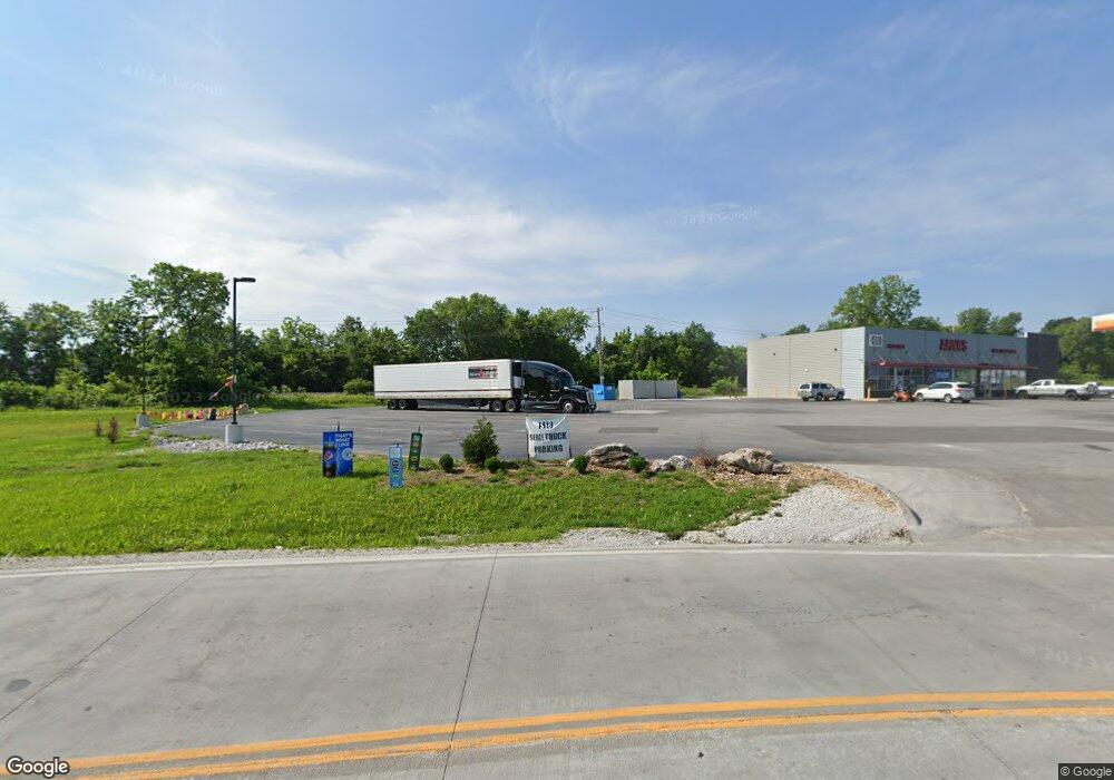
4912 W State Highway 266 Springfield, MO 65802
Young-Lilly Neighborhood
--
Bed
2
Baths
5,500
Sq Ft
2.5
Acres
About This Home
This home is located at 4912 W State Highway 266, Springfield, MO 65802. 4912 W State Highway 266 is a home located in Greene County with nearby schools including Willard Intermediate-South and Willard High School.
Ownership History
Date
Name
Owned For
Owner Type
Purchase Details
Closed on
Sep 3, 2021
Sold by
Patel Harshad Thakorlal and Patel Indiraben H
Bought by
Patel Harshad Thakorlal and Patel Indiraben H
Home Financials for this Owner
Home Financials are based on the most recent Mortgage that was taken out on this home.
Original Mortgage
$1,752,295
Outstanding Balance
$1,588,553
Interest Rate
2.7%
Mortgage Type
New Conventional
Create a Home Valuation Report for This Property
The Home Valuation Report is an in-depth analysis detailing your home's value as well as a comparison with similar homes in the area
Home Values in the Area
Average Home Value in this Area
Purchase History
| Date | Buyer | Sale Price | Title Company |
|---|---|---|---|
| Patel Harshad Thakorlal | -- | None Listed On Document |
Source: Public Records
Mortgage History
| Date | Status | Borrower | Loan Amount |
|---|---|---|---|
| Open | Patel Harshad Thakorlal | $1,752,295 | |
| Closed | Patel Harshad Thakorlal | $1,752,295 |
Source: Public Records
Tax History Compared to Growth
Tax History
| Year | Tax Paid | Tax Assessment Tax Assessment Total Assessment is a certain percentage of the fair market value that is determined by local assessors to be the total taxable value of land and additions on the property. | Land | Improvement |
|---|---|---|---|---|
| 2025 | $26,753 | $419,810 | $41,220 | $378,590 |
| 2024 | $26,753 | $402,470 | $36,100 | $366,370 |
| 2023 | $26,648 | $402,470 | $36,100 | $366,370 |
| 2022 | $23,419 | $350,950 | $36,100 | $314,850 |
| 2021 | $23,428 | $350,950 | $36,100 | $314,850 |
| 2020 | $2,248 | $36,100 | $36,100 | $0 |
| 2019 | $2,242 | $36,100 | $36,100 | $0 |
| 2018 | $2,252 | $36,100 | $36,100 | $0 |
| 2017 | $2,236 | $36,100 | $36,100 | $0 |
| 2016 | $2,226 | $36,100 | $36,100 | $0 |
| 2015 | $2,213 | $36,100 | $36,100 | $0 |
| 2014 | $2,226 | $36,100 | $36,100 | $0 |
Source: Public Records
Map
Nearby Homes
- 209 N Miller Ave
- 452 S Dove Valley Ave
- 516 S Bernier Ave
- 438 S Lulwood Ave
- 4803 W Tilden Ct
- 4553 W La Siesta St
- 4800 W Mount Vernon St
- 4533 W Tarkio St
- 4426 W Billings St
- 602 S Casa Grande Ave
- 4360 W Mount Vernon St
- 4247 W La Siesta Place
- 5175 W Sunstruck St
- 709 S Mahn Ave
- 5163 W Sunstruck St
- 5331 W Harrison St
- 5131 W Sunstruck St
- 5182 W Sunstruck St
- 5145 W Sunstruck St
- 4211 W Tarkio St
- 4857 W Burbank St
- 4851 W Burbank St
- 4843 W Burbank St
- 4852 W Burbank St
- 4837 W Burbank St
- 4846 W Burbank St
- 4875 W La Siesta St
- 4885 W La Siesta St
- 4838 W Burbank St
- 235 N Foster Ave
- 4855 W La Siesta St
- 229 N Foster Ave
- 241 N Foster Ave
- 4830 W Burbank St
- 4845 W La Siesta St
- 203 S Dove Valley Ave
- 4824 W Burbank St
- 4835 W La Siesta St
- 213 S Dove Valley Ave
- 246 N Foster Ave
