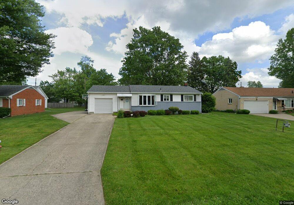
4914 Cedarhurst Rd Toledo, OH 43613
DeVeaux NeighborhoodEstimated Value: $168,000 - $190,000
3
Beds
1
Bath
1,028
Sq Ft
$173/Sq Ft
Est. Value
About This Home
This home is located at 4914 Cedarhurst Rd, Toledo, OH 43613 and is currently estimated at $178,159, approximately $173 per square foot. 4914 Cedarhurst Rd is a home located in Lucas County with nearby schools including Hiawatha Elementary School, Jefferson Junior High School, and Washington Junior High School.
Ownership History
Date
Name
Owned For
Owner Type
Purchase Details
Closed on
Apr 20, 2004
Sold by
Ritson Michael W and Ritson Deanna M
Bought by
Bundren Richard T and Bundren Candace E
Current Estimated Value
Purchase Details
Closed on
Jun 13, 2001
Sold by
Ritson Michael W
Bought by
Ritson Michael W and Ritson Deanna M
Purchase Details
Closed on
Nov 29, 1988
Sold by
Iserman C B and E B
Create a Home Valuation Report for This Property
The Home Valuation Report is an in-depth analysis detailing your home's value as well as a comparison with similar homes in the area
Home Values in the Area
Average Home Value in this Area
Purchase History
| Date | Buyer | Sale Price | Title Company |
|---|---|---|---|
| Bundren Richard T | $127,000 | -- | |
| Ritson Michael W | -- | -- | |
| -- | $62,500 | -- |
Source: Public Records
Tax History Compared to Growth
Tax History
| Year | Tax Paid | Tax Assessment Tax Assessment Total Assessment is a certain percentage of the fair market value that is determined by local assessors to be the total taxable value of land and additions on the property. | Land | Improvement |
|---|---|---|---|---|
| 2024 | $1,419 | $44,695 | $10,290 | $34,405 |
| 2023 | $2,920 | $39,550 | $9,170 | $30,380 |
| 2022 | $2,891 | $39,550 | $9,170 | $30,380 |
| 2021 | $2,973 | $39,550 | $9,170 | $30,380 |
| 2020 | $2,898 | $32,900 | $7,630 | $25,270 |
| 2019 | $2,800 | $32,900 | $7,630 | $25,270 |
| 2018 | $2,453 | $32,900 | $7,630 | $25,270 |
| 2017 | $2,284 | $27,545 | $7,805 | $19,740 |
| 2016 | $2,301 | $78,700 | $22,300 | $56,400 |
| 2015 | $2,335 | $78,700 | $22,300 | $56,400 |
| 2014 | $1,877 | $27,550 | $7,810 | $19,740 |
| 2013 | $1,877 | $27,550 | $7,810 | $19,740 |
Source: Public Records
Map
Nearby Homes
- 4823 Cedarhurst Rd
- 4807 Brott Rd
- 2849 W Laskey Rd
- 3065 Reen Dr
- 5111 Elaine Dr
- 5117 Fern Dr
- 2820 Claredale Rd
- 5201 Elaine Dr
- 4812 Secor Rd
- 5044 Secor Rd
- 2842 Oak Grove Place
- 5238 Sheila Dr
- 2855 Castleton Ave
- 2623 W Laskey Rd
- 5213 Fairgreen Dr
- 2728 Castleton Ave
- 5264 Fairgreen Dr
- 2605 Wyndale Rd
- 2659 Oak Grove Place
- 5215 Secor Rd
- 4906 Cedarhurst Rd
- 4922 Cedarhurst Rd
- 4862 Cedarhurst Rd
- 4930 Cedarhurst Rd
- 4917 Bowser Dr
- 4921 Bowser Dr
- 4911 Bowser Dr
- 4925 Bowser Dr
- 4905 Bowser Dr
- 4929 Bowser Dr
- 4915 Cedarhurst Rd
- 4907 Cedarhurst Rd
- 4923 Cedarhurst Rd
- 4859 Bowser Dr
- 4854 Cedarhurst Rd
- 4861 Cedarhurst Rd
- 3025 W Laskey Rd
- 3029 W Laskey Rd
- 4931 Cedarhurst Rd
- 4857 Bowser Dr