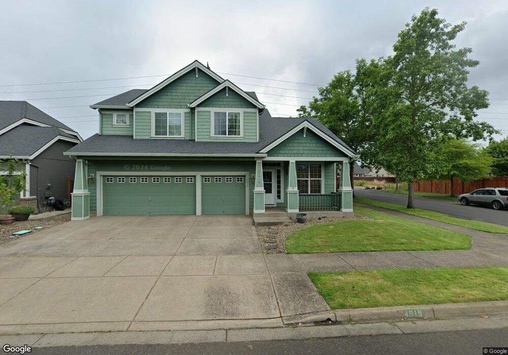
4919 Stagecoach Rd Eugene, OR 97402
Bethel NeighborhoodEstimated Value: $520,963 - $556,000
3
Beds
3
Baths
2,280
Sq Ft
$237/Sq Ft
Est. Value
About This Home
This home is located at 4919 Stagecoach Rd, Eugene, OR 97402 and is currently estimated at $540,991, approximately $237 per square foot. 4919 Stagecoach Rd is a home located in Lane County with nearby schools including Danebo Elementary School, Shasta Middle School, and Willamette High School.
Ownership History
Date
Name
Owned For
Owner Type
Purchase Details
Closed on
Mar 30, 2007
Sold by
Portland D R Horton Inc
Bought by
Foust David A and Foust Krista Joy
Current Estimated Value
Home Financials for this Owner
Home Financials are based on the most recent Mortgage that was taken out on this home.
Original Mortgage
$308,500
Outstanding Balance
$186,110
Interest Rate
6.29%
Mortgage Type
Purchase Money Mortgage
Estimated Equity
$354,881
Create a Home Valuation Report for This Property
The Home Valuation Report is an in-depth analysis detailing your home's value as well as a comparison with similar homes in the area
Home Values in the Area
Average Home Value in this Area
Purchase History
| Date | Buyer | Sale Price | Title Company |
|---|---|---|---|
| Foust David A | $308,500 | First American Title |
Source: Public Records
Mortgage History
| Date | Status | Borrower | Loan Amount |
|---|---|---|---|
| Open | Foust David A | $308,500 |
Source: Public Records
Tax History
| Year | Tax Paid | Tax Assessment Tax Assessment Total Assessment is a certain percentage of the fair market value that is determined by local assessors to be the total taxable value of land and additions on the property. | Land | Improvement |
|---|---|---|---|---|
| 2025 | $4,654 | $267,561 | -- | -- |
| 2024 | $4,537 | $259,768 | -- | -- |
| 2023 | $4,537 | $252,202 | -- | -- |
| 2022 | $4,223 | $244,857 | $0 | $0 |
| 2021 | $4,134 | $237,726 | $0 | $0 |
| 2020 | $4,013 | $230,802 | $0 | $0 |
| 2019 | $3,816 | $224,080 | $0 | $0 |
| 2018 | $3,709 | $211,217 | $0 | $0 |
| 2017 | $3,545 | $211,217 | $0 | $0 |
| 2016 | $3,455 | $205,065 | $0 | $0 |
| 2015 | $3,387 | $199,092 | $0 | $0 |
| 2014 | $3,335 | $193,293 | $0 | $0 |
Source: Public Records
Map
Nearby Homes
- 4941 Stagecoach Rd
- 1159 Throne Dr
- 1145 Ludgate Dr
- 1199 N Terry St
- 1199 N Terry St Unit 248
- 1199 N Terry St Unit 259
- 1199 N Terry St Unit 139
- 1199 N Terry St Unit 258
- 1199 N Terry St Unit SP113
- 1199 N Terry St Unit 309
- 1199 N Terry St Unit SP282
- 1199 N Terry St Unit 128
- 1199 N Terry St Unit 366
- 1199 N Terry St Unit 404
- 4749 Royal Ave
- 1400 Candlelight Dr Unit 162
- 1400 Candlelight Dr Unit 208
- 1400 Candlelight Dr
- 1400 Candlelight Dr Unit 226
- 4548 Cambon St
- 4925 Stagecoach Rd
- 4891 Stagecoach Rd
- 1096 Throne Dr
- 1099 Heathrow Dr
- 4953 Stagecoach Rd
- 1093 Throne Dr
- 4920 Chancellor Ln
- 4936 Chancellor Ln
- 1087 Heathrow Dr
- 4882 Chancellor Ln
- 4942 Chancellor Ln
- 4863 Stagecoach Rd
- 4867 Stagecoach Rd
- 1081 Throne Dr
- 4965 Stagecoach Rd
- 1078 Throne Dr
- 1092 Hollow Way
- 1075 Heathrow Dr
- 4956 Chancellor Ln
- 4876 Chancellor Ln
Your Personal Tour Guide
Ask me questions while you tour the home.