Estimated Value: $317,000 - $427,000
4
Beds
4
Baths
2,728
Sq Ft
$139/Sq Ft
Est. Value
About This Home
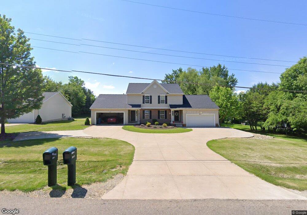
This home is located at 492 Jarvis Rd, Akron, OH 44319 and is currently estimated at $378,018, approximately $138 per square foot. 492 Jarvis Rd is a home located in Summit County with nearby schools including Greenwood Elementary School, Green Intermediate Elementary School, and Green Primary School.
Ownership History
Date
Name
Owned For
Owner Type
Purchase Details
Closed on
Jun 15, 2022
Sold by
Shultz Family Investments Llc
Bought by
Shultz Andrew R
Current Estimated Value
Home Financials for this Owner
Home Financials are based on the most recent Mortgage that was taken out on this home.
Original Mortgage
$225,000
Outstanding Balance
$211,078
Interest Rate
4.13%
Mortgage Type
New Conventional
Estimated Equity
$166,940
Purchase Details
Closed on
Aug 31, 2020
Sold by
Dcs Properties Inc
Bought by
Shultz Family Investments Llc
Home Financials for this Owner
Home Financials are based on the most recent Mortgage that was taken out on this home.
Original Mortgage
$1,400,000
Interest Rate
2.8%
Mortgage Type
Commercial
Purchase Details
Closed on
Oct 26, 1998
Sold by
Robinhood Development Llc
Bought by
Robinhood Development Llc
Create a Home Valuation Report for This Property
The Home Valuation Report is an in-depth analysis detailing your home's value as well as a comparison with similar homes in the area
Home Values in the Area
Average Home Value in this Area
Purchase History
| Date | Buyer | Sale Price | Title Company |
|---|---|---|---|
| Shultz Andrew R | $250,000 | New Title Company Name | |
| Shultz Family Investments Llc | -- | None Available | |
| Robinhood Development Llc | -- | Bond & Associates Title Agen | |
| Robinhood Development Llc | -- | Bond & Associates Title Agen |
Source: Public Records
Mortgage History
| Date | Status | Borrower | Loan Amount |
|---|---|---|---|
| Open | Shultz Andrew R | $225,000 | |
| Previous Owner | Shultz Family Investments Llc | $1,400,000 |
Source: Public Records
Tax History Compared to Growth
Tax History
| Year | Tax Paid | Tax Assessment Tax Assessment Total Assessment is a certain percentage of the fair market value that is determined by local assessors to be the total taxable value of land and additions on the property. | Land | Improvement |
|---|---|---|---|---|
| 2025 | $7,397 | $96,251 | $27,388 | $68,863 |
| 2024 | $7,397 | $150,091 | $27,388 | $122,703 |
| 2023 | $7,397 | $150,091 | $27,388 | $122,703 |
| 2022 | $5,887 | $108,759 | $19,845 | $88,914 |
| 2021 | $5,533 | $108,759 | $19,845 | $88,914 |
| 2020 | $5,429 | $108,760 | $19,850 | $88,910 |
| 2019 | $4,877 | $91,280 | $22,100 | $69,180 |
| 2018 | $4,987 | $91,280 | $22,100 | $69,180 |
| 2017 | $4,621 | $91,280 | $22,100 | $69,180 |
| 2016 | $4,597 | $79,220 | $22,100 | $57,120 |
| 2015 | $4,621 | $79,220 | $22,100 | $57,120 |
| 2014 | $4,590 | $79,220 | $22,100 | $57,120 |
| 2013 | $4,339 | $74,400 | $22,100 | $52,300 |
Source: Public Records
Map
Nearby Homes
- 3272 Doubler Dr
- 3273 S Jasmine Ave
- 399 Abbyshire Rd
- 435 Bonshire Rd
- 213 Klinger St
- 111 Magua Dr
- 3785 S Main St
- 0 Fortuna Dr Unit 5005346
- TBD Heron Watch Dr
- 0 Sandy Beach Dr
- 3917 Cayugas Dr
- 0 S Main St
- 2872 Ironwood Dr
- 3809 Butterfield Dr
- 63 Starboard Cir Unit 64
- 68 Starboard Cir
- 221 Lake Front Dr
- 265 E Pace Ave
- 1254 Maxfli Dr
- 4138 S Main St
- 508 Jarvis Rd
- 470 Jarvis Rd
- 2962 Quail Ridge
- 524 Jarvis Rd
- 2961 Quail Ridge
- 489 Jarvis Rd
- 2970 Quail Ridge
- 3163 Doves Crossing
- 509 Jarvis Rd
- 696 Jarvis Rd
- 695 Jarvis Rd
- 3060 Sparrows Crest
- 2969 Quail Ridge
- 452 Jarvis Rd
- 3068 Sparrows Crest
- 3154 Doves Crossing
- 2978 Quail Ridge
- 3076 Sparrows Crest
- 3171 Doves Crossing
- 2977 Quail Ridge