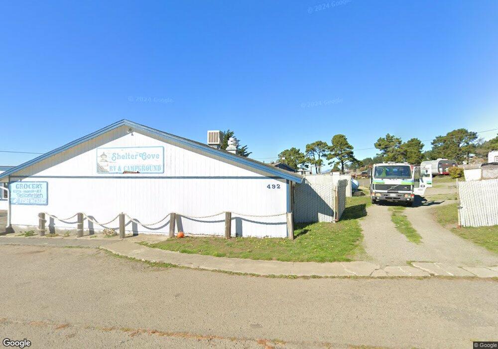
492 MacHi Rd Whitethorn, CA 95589
Studio
--
Bath
2,208
Sq Ft
436
Sq Ft
About This Home
This home is located at 492 MacHi Rd, Whitethorn, CA 95589. 492 MacHi Rd is a home located in Humboldt County.
Ownership History
Date
Name
Owned For
Owner Type
Purchase Details
Closed on
Dec 21, 2023
Sold by
Sanford Jack and Picton Bruce
Bought by
Shelter Cove Campground Llc
Home Financials for this Owner
Home Financials are based on the most recent Mortgage that was taken out on this home.
Original Mortgage
$2,000,000
Interest Rate
7.44%
Mortgage Type
Seller Take Back
Purchase Details
Closed on
Sep 13, 2007
Sold by
Picton Bruce
Bought by
Sanford Jack and Picton Bruce
Purchase Details
Closed on
Dec 15, 2003
Sold by
Picton Bruce
Bought by
Picton Bruce
Home Financials for this Owner
Home Financials are based on the most recent Mortgage that was taken out on this home.
Original Mortgage
$206,000
Interest Rate
5.97%
Mortgage Type
Commercial
Create a Home Valuation Report for This Property
The Home Valuation Report is an in-depth analysis detailing your home's value as well as a comparison with similar homes in the area
Home Values in the Area
Average Home Value in this Area
Purchase History
| Date | Buyer | Sale Price | Title Company |
|---|---|---|---|
| Shelter Cove Campground Llc | $3,350,000 | Humboldt Land Title | |
| Sanford Jack | $186,500 | None Available | |
| Picton Bruce | -- | Fidelity National |
Source: Public Records
Mortgage History
| Date | Status | Borrower | Loan Amount |
|---|---|---|---|
| Previous Owner | Shelter Cove Campground Llc | $2,000,000 | |
| Previous Owner | Picton Bruce | $206,000 |
Source: Public Records
Tax History
| Year | Tax Paid | Tax Assessment Tax Assessment Total Assessment is a certain percentage of the fair market value that is determined by local assessors to be the total taxable value of land and additions on the property. | Land | Improvement |
|---|---|---|---|---|
| 2025 | $10,198 | $3,381,650 | $1,677,900 | $1,703,750 |
| 2024 | $10,198 | $910,569 | $410,236 | $500,333 |
| 2023 | $10,244 | $893,169 | $402,193 | $490,976 |
| 2022 | $10,095 | $876,384 | $394,307 | $482,077 |
| 2021 | $9,672 | $854,984 | $386,576 | $468,408 |
| 2020 | $9,732 | $846,410 | $382,613 | $463,797 |
| 2019 | $9,496 | $830,181 | $375,111 | $455,070 |
| 2018 | $9,327 | $813,170 | $367,756 | $445,414 |
| 2017 | $8,932 | $797,572 | $360,546 | $437,026 |
| 2016 | $8,859 | $780,234 | $353,477 | $426,757 |
| 2015 | $8,817 | $768,749 | $348,168 | $420,581 |
| 2014 | $9,045 | $753,996 | $341,348 | $412,648 |
Source: Public Records
Map
Nearby Homes
- 1630 Upper Pacific Dr
- 15 Seal Ct
- 6 Coral Point
- 142 Oceanview Rd
- 82 Fawn Dr
- 23 Steelhead Ct
- 126 Neptune Dr
- 36 Bambi Dr
- 81 Neptune Rd
- 75 Neptune Rd
- 794 & 806 Lower Pacific Dr
- 9350 Shelter Cove Rd
- 16 Bambi Dr
- 1325&1335 Upper Pacific Dr
- 8 Buckhorn Ct
- 5 Antler Ct
- 27 Buckhorn Ct
- 454 Lower Pacific Dr
- 806 Lower Pacific Dr
- 112 Seafoam Rd
- 1164 Lower Pacific Dr
- 1140 Lower Pacific Dr
- 1661 Upper Pacific Dr
- 1518 Upper Pacific
- 461 MacHi Rd
- 1566 Upper Pacific Dr
- 1176 Lower Pacific Dr
- 1638 Upper Pacific Dr
- 17 View Cir
- 1130 Lower Pacific Dr
- 1120 Lower Pacific Dr
- 1120 Lower Pacific Rd
- 1110 Lower Pacific Dr
- 48 Ocean View Rd
- 1090 Lower Pacific Dr
- 533 MacHi Rd
- 1149 Lower Pacific Dr
- 60 Ocean View Rd
- 1594 Upper Pacific Dr
- 1076 Lower Pacific Dr
Your Personal Tour Guide
Ask me questions while you tour the home.