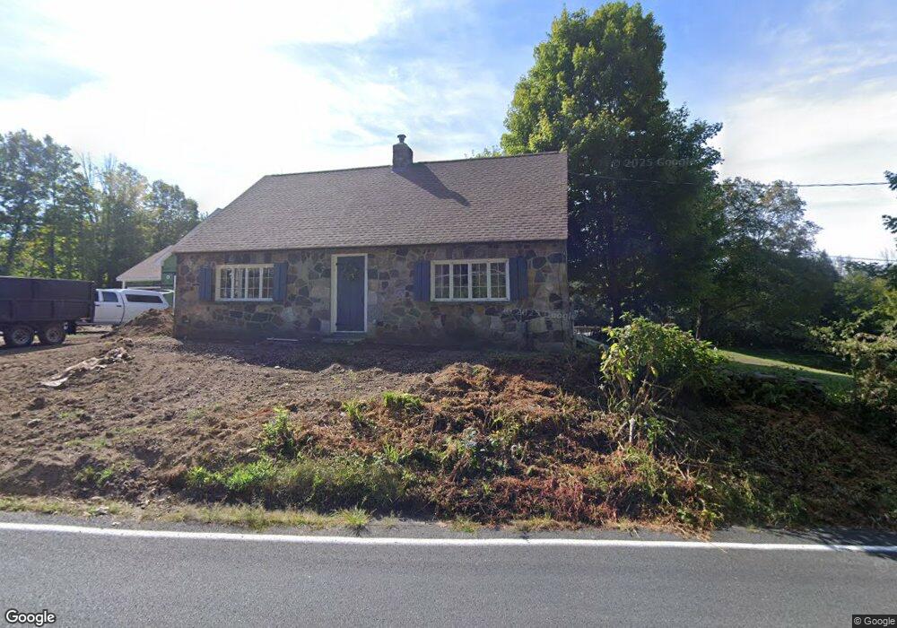
492 Mountain Rd Somers, CT 06071
Estimated Value: $401,000 - $467,000
2
Beds
2
Baths
1,905
Sq Ft
$222/Sq Ft
Est. Value
About This Home
This home is located at 492 Mountain Rd, Somers, CT 06071 and is currently estimated at $422,500, approximately $221 per square foot. 492 Mountain Rd is a home located in Tolland County with nearby schools including Somers Elementary School, Mabelle B. Avery Middle School, and Somers High School.
Ownership History
Date
Name
Owned For
Owner Type
Purchase Details
Closed on
Aug 3, 2009
Sold by
Smith Thomas
Bought by
Smith Amy
Current Estimated Value
Purchase Details
Closed on
Oct 29, 2003
Sold by
Ford Richard and Ford Constance
Bought by
Smith Thomas and Smith Amy
Home Financials for this Owner
Home Financials are based on the most recent Mortgage that was taken out on this home.
Original Mortgage
$213,750
Interest Rate
4.62%
Create a Home Valuation Report for This Property
The Home Valuation Report is an in-depth analysis detailing your home's value as well as a comparison with similar homes in the area
Home Values in the Area
Average Home Value in this Area
Purchase History
| Date | Buyer | Sale Price | Title Company |
|---|---|---|---|
| Smith Amy | -- | -- | |
| Smith Amy | -- | -- | |
| Smith Thomas | $225,000 | -- | |
| Smith Thomas | $225,000 | -- |
Source: Public Records
Mortgage History
| Date | Status | Borrower | Loan Amount |
|---|---|---|---|
| Previous Owner | Smith Thomas | $45,018 | |
| Previous Owner | Smith Thomas | $213,750 |
Source: Public Records
Tax History
| Year | Tax Paid | Tax Assessment Tax Assessment Total Assessment is a certain percentage of the fair market value that is determined by local assessors to be the total taxable value of land and additions on the property. | Land | Improvement |
|---|---|---|---|---|
| 2025 | $4,831 | $159,900 | $76,600 | $83,300 |
| 2024 | $4,631 | $159,900 | $76,600 | $83,300 |
| 2023 | $4,527 | $159,900 | $76,600 | $83,300 |
| 2022 | $4,407 | $159,900 | $76,600 | $83,300 |
| 2021 | $4,263 | $159,900 | $76,600 | $83,300 |
| 2020 | $4,491 | $164,100 | $76,600 | $87,500 |
| 2019 | $4,316 | $157,700 | $83,000 | $74,700 |
| 2018 | $4,316 | $157,700 | $83,000 | $74,700 |
| 2017 | $4,017 | $157,700 | $83,000 | $74,700 |
| 2016 | $3,819 | $157,700 | $83,000 | $74,700 |
| 2015 | $4,041 | $172,900 | $90,000 | $82,900 |
| 2014 | $4,041 | $172,900 | $90,000 | $82,900 |
Source: Public Records
Map
Nearby Homes
- 64 Somerset Ln
- 8 S Ridge Rd
- 142 Turnpike Rd
- 369 Turnpike Rd
- Lot D South Rd
- 261 Chapin Rd
- Lot 2R &3 Chapin Rd
- 169 Stafford Rd
- 200 Hampden Rd
- 175 Stafford Rd
- 1040 Main St
- 11 King Rd
- 994 Main St
- 179 Chapin Rd
- 201 Diamond Ledge Rd
- 175 Scantic Rd
- 41 Martin Farms Rd
- 63 Maple Ridge Dr
- 42 Schneider Rd
- 283 Mountain View Rd
- 472 Mountain Rd
- 432 Old Springfield Rd
- 9 Dillenback Rd
- 425 Old Springfield Rd
- 459 Mountain Rd
- 27 Dillenback Rd
- 740 Stafford Rd
- 42 Dillenback Rd
- 453 Mountain Rd
- 736 Stafford Rd
- 447 Mountain Rd
- 41 Dillenback Rd
- 413 Old Springfield Rd
- 728 Stafford Rd
- 759 Stafford Rd
- 743 Stafford Rd
- 727 Stafford Rd
- 715 Stafford Rd
- 46 Dillenback Rd
- 415 Old Springfield Rd
Your Personal Tour Guide
Ask me questions while you tour the home.