Estimated Value: $273,897 - $295,000
3
Beds
2
Baths
1,270
Sq Ft
$227/Sq Ft
Est. Value
About This Home
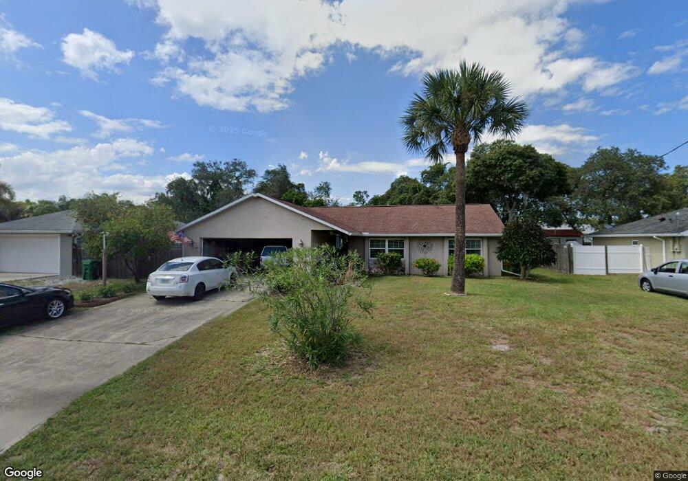
This home is located at 4920 Brookhaven St, Cocoa, FL 32927 and is currently estimated at $287,724, approximately $226 per square foot. 4920 Brookhaven St is a home located in Brevard County with nearby schools including Atlantis Elementary School, Space Coast Junior/Senior High School, and Sculptor Charter School.
Ownership History
Date
Name
Owned For
Owner Type
Purchase Details
Closed on
Sep 9, 1996
Sold by
Ng Howard H
Bought by
Cook R David and Lund Deborah C
Current Estimated Value
Home Financials for this Owner
Home Financials are based on the most recent Mortgage that was taken out on this home.
Original Mortgage
$59,400
Interest Rate
7.69%
Create a Home Valuation Report for This Property
The Home Valuation Report is an in-depth analysis detailing your home's value as well as a comparison with similar homes in the area
Home Values in the Area
Average Home Value in this Area
Purchase History
| Date | Buyer | Sale Price | Title Company |
|---|---|---|---|
| Cook R David | $69,300 | -- |
Source: Public Records
Mortgage History
| Date | Status | Borrower | Loan Amount |
|---|---|---|---|
| Previous Owner | Cook R David | $59,400 |
Source: Public Records
Tax History Compared to Growth
Tax History
| Year | Tax Paid | Tax Assessment Tax Assessment Total Assessment is a certain percentage of the fair market value that is determined by local assessors to be the total taxable value of land and additions on the property. | Land | Improvement |
|---|---|---|---|---|
| 2025 | $1,152 | $86,250 | -- | -- |
| 2024 | $1,118 | $84,000 | -- | -- |
| 2023 | $1,118 | $81,560 | $0 | $0 |
| 2022 | $1,037 | $79,190 | $0 | $0 |
| 2021 | $1,026 | $76,890 | $0 | $0 |
| 2020 | $973 | $75,830 | $0 | $0 |
| 2019 | $914 | $74,130 | $0 | $0 |
| 2018 | $916 | $72,750 | $0 | $0 |
| 2017 | $918 | $71,260 | $0 | $0 |
| 2016 | $927 | $69,800 | $18,000 | $51,800 |
| 2015 | $936 | $69,320 | $15,000 | $54,320 |
| 2014 | $941 | $68,770 | $11,000 | $57,770 |
Source: Public Records
Map
Nearby Homes
- 6735 Grissom Pkwy
- 6840 Anecia Ave
- 4760 Ivan St
- 0000 Grissom Pkwy
- 6390 Depot Ave
- 4635 Alfred St
- 5090 Market St
- 6499 Pleasant Ave
- 5149 Arlington Rd Unit 104
- 7035 Jasmine Ave
- 6375 Cable Ave
- 00 Unknown
- 5155 Mayflower St
- 7155 Export Ave
- 5265 Fay Blvd
- 4975 Fay Blvd
- 4859 Horton St
- 6240 Grissom Pkwy
- 5145 Fay Blvd
- 4560 Fay Blvd
- 4910 Brookhaven St
- 4930 Brookhaven St
- 4863 Hawley Rd
- 4857 Hawley Rd
- 4900 Brookhaven St
- 4940 Brookhaven St
- 4915 Brookhaven St
- 4925 Brookhaven St
- 4845 Hawley Rd
- 4905 Brookhaven St
- 4935 Brookhaven St
- 4890 Brookhaven St
- 4950 Brookhaven St
- 4895 Brookhaven St
- 4867 Hawley Rd
- 4833 Hawley Rd
- 4945 Brookhaven St
- 4860 Hawley Rd
- 4850 Hawley Rd
- 4885 Brookhaven St