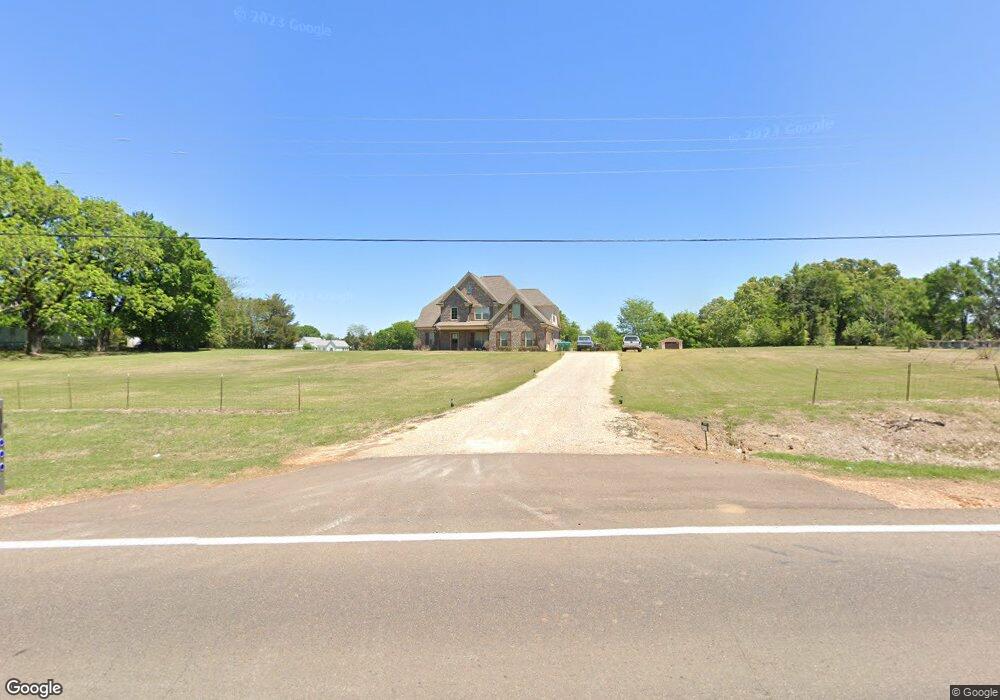
4920 Highway 305 S Hernando, MS 38632
Lewisburg NeighborhoodEstimated Value: $427,000 - $507,000
4
Beds
--
Bath
2,822
Sq Ft
$159/Sq Ft
Est. Value
About This Home
This home is located at 4920 Highway 305 S, Hernando, MS 38632 and is currently estimated at $449,323, approximately $159 per square foot. 4920 Highway 305 S is a home with nearby schools including Lewisburg Primary School, Lewisburg Elementary School, and Lewisburg Middle School.
Ownership History
Date
Name
Owned For
Owner Type
Purchase Details
Closed on
Jul 30, 2021
Sold by
Logan James Sinjin and Logan Olivia A
Bought by
Brooks John R
Current Estimated Value
Home Financials for this Owner
Home Financials are based on the most recent Mortgage that was taken out on this home.
Original Mortgage
$250,000
Outstanding Balance
$225,958
Interest Rate
2.93%
Mortgage Type
New Conventional
Estimated Equity
$223,365
Purchase Details
Closed on
Sep 13, 2017
Sold by
Distinctive Properties By Trent Ross Llc
Bought by
Logan James Sinjin and Logan Olivia A
Home Financials for this Owner
Home Financials are based on the most recent Mortgage that was taken out on this home.
Original Mortgage
$245,900
Interest Rate
3.89%
Mortgage Type
New Conventional
Create a Home Valuation Report for This Property
The Home Valuation Report is an in-depth analysis detailing your home's value as well as a comparison with similar homes in the area
Home Values in the Area
Average Home Value in this Area
Purchase History
| Date | Buyer | Sale Price | Title Company |
|---|---|---|---|
| Brooks John R | -- | None Available | |
| Logan James Sinjin | -- | None Available |
Source: Public Records
Mortgage History
| Date | Status | Borrower | Loan Amount |
|---|---|---|---|
| Open | Brooks John R | $250,000 | |
| Previous Owner | Logan James Sinjin | $245,900 |
Source: Public Records
Tax History Compared to Growth
Tax History
| Year | Tax Paid | Tax Assessment Tax Assessment Total Assessment is a certain percentage of the fair market value that is determined by local assessors to be the total taxable value of land and additions on the property. | Land | Improvement |
|---|---|---|---|---|
| 2025 | $2,664 | $26,648 | $1,778 | $24,870 |
| 2024 | $1,596 | $18,962 | $1,778 | $17,184 |
| 2023 | $1,596 | $18,962 | $0 | $0 |
| 2022 | $1,596 | $18,962 | $1,778 | $17,184 |
| 2021 | $1,596 | $18,962 | $1,778 | $17,184 |
| 2020 | $1,455 | $17,557 | $1,778 | $15,779 |
| 2019 | $1,455 | $17,557 | $1,778 | $15,779 |
| 2017 | $179 | $1,778 | $1,778 | $0 |
| 2016 | $179 | $1,778 | $1,778 | $0 |
| 2015 | $179 | $1,778 | $1,778 | $0 |
| 2014 | $179 | $1,778 | $0 | $0 |
| 2013 | $179 | $1,778 | $0 | $0 |
Source: Public Records
Map
Nearby Homes
- 5000 Allen Rd
- 5199 Dixie Creek Dr
- 0 Hunters Walk Unit 4124365
- 0 Allen Rd
- 4348 Mississippi 305
- 10756 Honey Ridge Dr
- 5629 Trinity Dr
- 10131 Sunset Creek Dr
- 10094 Sunset Creek Dr
- 9567 Holly Springs Rd
- 4644 Taylor Trail
- 9094 Treadway Creek
- 9092 Bennett Trail
- 9069 Bennett Trail
- 9072 Treadway Creek
- 9065 Bennett Trail
- 4121 Jenny Ln
- 9002 Lot 3 Hudson Rd
- 9002 Lot 2 Hudson Rd
- 10562 N Cockrum Dr
- 4872 Highway 305 S
- 4872 Hwy 305 S
- 4872 Ms-305
- 5002 Allen Rd
- 4865 Hwy 305 Hwy
- 5004 Allen Rd
- 32 acres Hwy 305
- 10055 Cedar Grove
- 5072 Highway 305 S
- No Cedar Grove Cove
- 5006 Allen Rd
- 10007 Cedar Grove
- 5007 Allen Rd
- 10083 Cedar Grove
- 5102 Highway 305 S
- 5102 Highway 305 S Unit 305
- 5102 Highway 305 S
- 5009 Allen Rd
- 5008 Allen Rd
- 10121 Cedar Grove