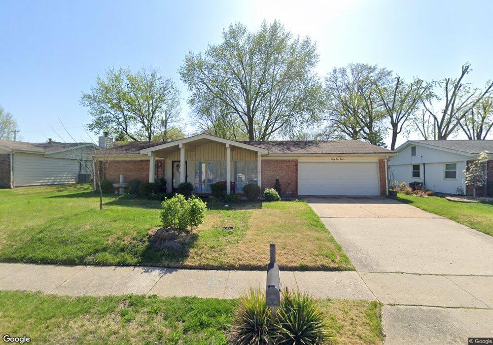
4920 Mattis Rd Saint Louis, MO 63128
Estimated Value: $294,593 - $364,000
3
Beds
2
Baths
1,619
Sq Ft
$203/Sq Ft
Est. Value
About This Home
This home is located at 4920 Mattis Rd, Saint Louis, MO 63128 and is currently estimated at $328,898, approximately $203 per square foot. 4920 Mattis Rd is a home located in St. Louis County with nearby schools including Kennerly Elementary School, Sperreng Middle School, and Lindbergh High School.
Ownership History
Date
Name
Owned For
Owner Type
Purchase Details
Closed on
Mar 19, 2004
Sold by
Farmer Shirley
Bought by
Kubasta Katherine C
Current Estimated Value
Purchase Details
Closed on
Mar 21, 2003
Sold by
Morefield James A and Borgerson Lynne E
Bought by
Farmer Shirley
Home Financials for this Owner
Home Financials are based on the most recent Mortgage that was taken out on this home.
Original Mortgage
$125,500
Interest Rate
5.77%
Mortgage Type
Purchase Money Mortgage
Purchase Details
Closed on
Dec 24, 1997
Sold by
Morefield James A and Morefield Lynne E
Bought by
Morefield James A and Borgerson Lynne E
Home Financials for this Owner
Home Financials are based on the most recent Mortgage that was taken out on this home.
Original Mortgage
$110,839
Interest Rate
7.14%
Mortgage Type
FHA
Create a Home Valuation Report for This Property
The Home Valuation Report is an in-depth analysis detailing your home's value as well as a comparison with similar homes in the area
Home Values in the Area
Average Home Value in this Area
Purchase History
| Date | Buyer | Sale Price | Title Company |
|---|---|---|---|
| Kubasta Katherine C | $166,900 | Capital Title | |
| Farmer Shirley | $163,000 | -- | |
| Morefield James A | -- | -- |
Source: Public Records
Mortgage History
| Date | Status | Borrower | Loan Amount |
|---|---|---|---|
| Previous Owner | Farmer Shirley | $125,500 | |
| Previous Owner | Morefield James A | $110,839 |
Source: Public Records
Tax History
| Year | Tax Paid | Tax Assessment Tax Assessment Total Assessment is a certain percentage of the fair market value that is determined by local assessors to be the total taxable value of land and additions on the property. | Land | Improvement |
|---|---|---|---|---|
| 2025 | $2,979 | $47,740 | $13,030 | $34,710 |
| 2024 | $2,979 | $45,690 | $13,030 | $32,660 |
| 2023 | $2,972 | $45,690 | $13,030 | $32,660 |
| 2022 | $2,164 | $31,820 | $13,030 | $18,790 |
| 2021 | $2,088 | $31,820 | $13,030 | $18,790 |
| 2020 | $1,953 | $28,690 | $13,030 | $15,660 |
| 2019 | $1,948 | $28,690 | $13,030 | $15,660 |
| 2018 | $2,182 | $29,280 | $7,960 | $21,320 |
| 2017 | $2,158 | $29,280 | $7,960 | $21,320 |
| 2016 | $2,002 | $25,770 | $7,240 | $18,530 |
Source: Public Records
Map
Nearby Homes
- 4767 Towne South Rd
- 4839 Hursley Dr
- 105 Worthington Cir Unit 34
- 5108 Kennerly Place Dr Unit 7A
- 12430 Somerset Place Dr
- 4930 Mount Royal Rd
- 12568 Chardin Place Unit 1
- 12586 Chardin Place Unit 4
- 4988 Sefton Dr
- 4931 Theiss Rd
- 12055 Charwick Dr
- 4931 Butler Hill Rd
- 16 Bayswater Rd
- 4829 Gatesbury Dr
- 10008 Meadowfield Ln
- 5019 Valley Crest Ct
- 4525 Eli Dr Unit F
- 4525 Eli Dr Unit D
- 11951 Tesson Ferry Rd Unit D
- 4501 Eli Dr Unit K
- 4928 Mattis Rd
- 4912 Mattis Rd
- 4723 Morestead Dr
- 4729 Morestead Dr
- 4717 Morestead Dr
- 4911 Mattis Rd
- 4919 Mattis Rd
- 4927 Mattis Rd
- 4735 Morestead Dr
- 4907 Mattis Rd
- 4939 Mattis Rd
- 4705 Morestead Dr
- 4736 Morestead Dr
- 4701 Towne South Rd
- 4901 Mattis Rd
- 4945 Mattis Rd
- 4741 Morestead Dr
- 4737 Towne S
- 4742 Morestead Dr
- 4737 Towne South Rd
Your Personal Tour Guide
Ask me questions while you tour the home.