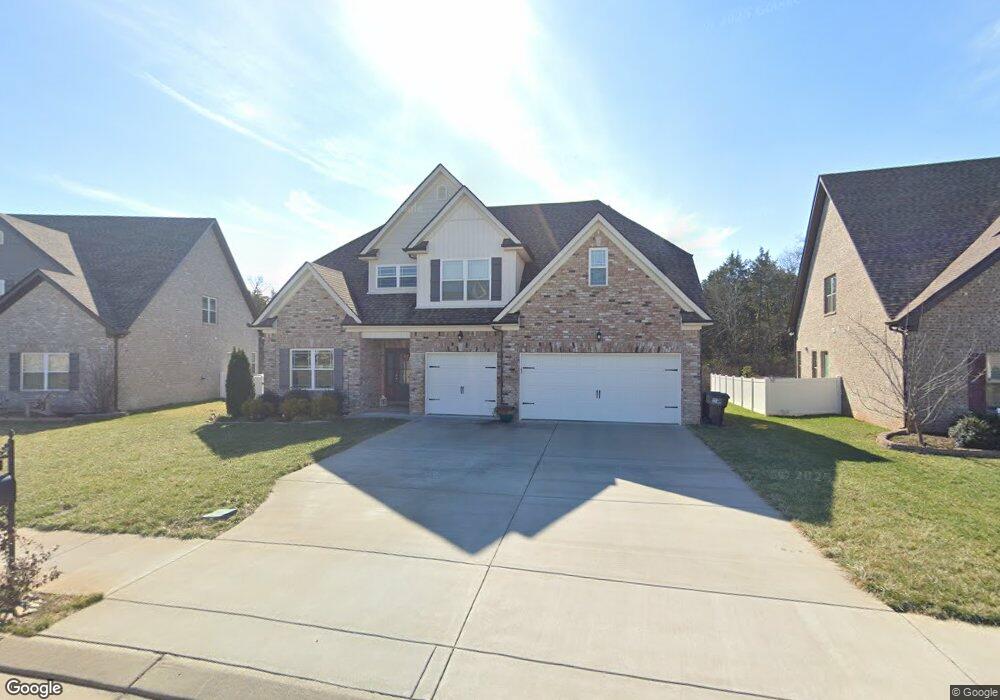
4920 Saint Ives Dr Murfreesboro, TN 37128
Estimated Value: $573,110 - $617,000
--
Bed
--
Bath
2,756
Sq Ft
$216/Sq Ft
Est. Value
About This Home
This home is located at 4920 Saint Ives Dr, Murfreesboro, TN 37128 and is currently estimated at $594,028, approximately $215 per square foot. 4920 Saint Ives Dr is a home with nearby schools including Blackman Elementary School, Blackman Middle School, and Blackman High School.
Ownership History
Date
Name
Owned For
Owner Type
Purchase Details
Closed on
May 31, 2018
Sold by
Harney Homes Llc
Bought by
Brown Joe Michael and Brown Jeanette Danielle
Current Estimated Value
Home Financials for this Owner
Home Financials are based on the most recent Mortgage that was taken out on this home.
Original Mortgage
$403,390
Outstanding Balance
$348,076
Interest Rate
4.4%
Mortgage Type
VA
Estimated Equity
$245,952
Purchase Details
Closed on
Mar 9, 2017
Sold by
Parles Llc
Bought by
Harney Homes Llc
Create a Home Valuation Report for This Property
The Home Valuation Report is an in-depth analysis detailing your home's value as well as a comparison with similar homes in the area
Home Values in the Area
Average Home Value in this Area
Purchase History
| Date | Buyer | Sale Price | Title Company |
|---|---|---|---|
| Brown Joe Michael | $394,900 | Laweyrs Title | |
| Harney Homes Llc | $480,000 | Solomon Parks Title & Escrow |
Source: Public Records
Mortgage History
| Date | Status | Borrower | Loan Amount |
|---|---|---|---|
| Open | Brown Joe Michael | $403,390 |
Source: Public Records
Tax History Compared to Growth
Tax History
| Year | Tax Paid | Tax Assessment Tax Assessment Total Assessment is a certain percentage of the fair market value that is determined by local assessors to be the total taxable value of land and additions on the property. | Land | Improvement |
|---|---|---|---|---|
| 2025 | $3,432 | $121,325 | $13,750 | $107,575 |
| 2024 | $3,432 | $121,325 | $13,750 | $107,575 |
| 2023 | $2,276 | $121,325 | $13,750 | $107,575 |
| 2022 | $1,961 | $121,325 | $13,750 | $107,575 |
| 2021 | $1,943 | $87,550 | $13,750 | $73,800 |
| 2020 | $1,943 | $87,550 | $13,750 | $73,800 |
| 2019 | $1,943 | $87,550 | $13,750 | $73,800 |
Source: Public Records
Map
Nearby Homes
- 4814 Saint Ives Dr
- 5227 Starnes Dr
- 1235 Timber Creek Dr
- 629 Brinkley Rd
- 1232 Stockwell Dr
- 548 Brinkley Rd
- 5309 Perlou Ln
- 4826 Trevino Ct
- 5350 Tony Lama Ln
- 5108 Saint Ives Dr
- 628 Evergreen Dr
- 5313 Eiffel Ct
- 2108 Olmstead Ct
- 827 Stovers Glen Dr
- 814 Stovers Glen
- 5050 Creekside Dr
- 802 Licinius Ln
- 400 Brinkley Rd
- 390 Meadow Ln
- 4670 Forsman Ct
- 4916 Saint Ives Dr
- 4924 Saint Ives Dr
- 4912 Saint Ives Dr Unit 256
- 4912 Saint Ives Dr
- 4928 St Ives Dr
- 4928 Saint Ives Dr
- 4933 Saint Ives Dr
- 4933 Saint Ives Dr Unit 249
- 4933 Saint Ives Dr
- 4929 Saint Ives Dr
- 4908 Saint Ives Dr
- 4932 Saint Ives Dr
- 4937 Saint Ives Dr
- 1108 Timber Creek Dr
- 4904 Saint Ives Dr
- 4936 St Ives Dr
- 4941 Saint Ives Dr
- 1112 Timber Creek Dr Unit 213
- 1112 Timber Creek Dr Unit DRIVE
- 1112 Timber Creek Dr