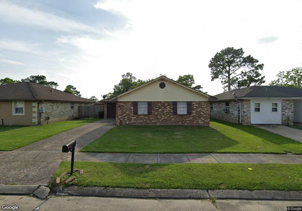
4920 Tynecastle Dr New Orleans, LA 70128
Read Boulevard East NeighborhoodEstimated Value: $107,048 - $184,000
3
Beds
2
Baths
1,378
Sq Ft
$106/Sq Ft
Est. Value
About This Home
This home is located at 4920 Tynecastle Dr, New Orleans, LA 70128 and is currently estimated at $146,012, approximately $105 per square foot. 4920 Tynecastle Dr is a home located in Orleans Parish with nearby schools including Fannie C. Williams Charter School, Einstein Charter at Sherwood Forest, and Einstein Charter School - Village De L'est Elementary.
Ownership History
Date
Name
Owned For
Owner Type
Purchase Details
Closed on
Jun 17, 2008
Sold by
Unlimited Ventures
Bought by
Guesnon Elaine M
Current Estimated Value
Home Financials for this Owner
Home Financials are based on the most recent Mortgage that was taken out on this home.
Original Mortgage
$112,000
Outstanding Balance
$71,980
Interest Rate
6.08%
Estimated Equity
$74,032
Create a Home Valuation Report for This Property
The Home Valuation Report is an in-depth analysis detailing your home's value as well as a comparison with similar homes in the area
Home Values in the Area
Average Home Value in this Area
Purchase History
| Date | Buyer | Sale Price | Title Company |
|---|---|---|---|
| Guesnon Elaine M | $14,490 | -- |
Source: Public Records
Mortgage History
| Date | Status | Borrower | Loan Amount |
|---|---|---|---|
| Open | Guesnon Elaine M | $112,000 | |
| Closed | Guesnon Elaine M | $112,000 |
Source: Public Records
Tax History Compared to Growth
Tax History
| Year | Tax Paid | Tax Assessment Tax Assessment Total Assessment is a certain percentage of the fair market value that is determined by local assessors to be the total taxable value of land and additions on the property. | Land | Improvement |
|---|---|---|---|---|
| 2025 | $571 | $11,170 | $2,200 | $8,970 |
| 2024 | $578 | $11,170 | $2,200 | $8,970 |
| 2023 | $367 | $9,860 | $1,100 | $8,760 |
| 2022 | $367 | $9,420 | $1,100 | $8,320 |
| 2021 | $437 | $9,860 | $1,100 | $8,760 |
| 2020 | $440 | $9,860 | $1,100 | $8,760 |
| 2019 | $454 | $9,860 | $1,100 | $8,760 |
| 2018 | $461 | $9,860 | $1,100 | $8,760 |
| 2017 | $426 | $9,860 | $1,100 | $8,760 |
| 2016 | $437 | $9,860 | $1,100 | $8,760 |
| 2015 | $593 | $10,960 | $1,100 | $9,860 |
| 2014 | -- | $10,960 | $1,100 | $9,860 |
| 2013 | -- | $10,960 | $1,100 | $9,860 |
Source: Public Records
Map
Nearby Homes
- 11611 N Adams Ct
- 4901 Friar Tuck Dr
- 4920 Robin Hood Dr
- 4928 Robin Hood Dr
- 11358 Will Stutley Dr
- 11839 Chef Menteur Hwy
- 57002 Chef Menteur Hwy
- 11327 Will Stutley Dr
- 11268 Notaway Ln
- 11303 Midpoint Dr
- 5042 W Saint Andrews Cir
- 5083 W St Andrews Cir
- 5050 Par 4 Dr
- 4921 Nighthart St
- 11276 Fernley Dr
- 4819 Nighthart St
- 4624 Wright Rd
- 4926 Tynecastle Dr
- 4914 Tynecastle Dr
- 4932 Tynecastle Dr
- 4908 Tynecastle Dr
- 4921 Major Dr
- 4927 Major Dr
- 4915 Major Dr
- 4915 Tynecastle Dr
- 4938 Tynecastle Dr
- 4900 Tynecastle Dr
- 4933 Major Dr
- 4921 Tynecastle Dr
- 4907 Major Dr
- 4907 Tynecastle Dr
- 4927 Tynecastle Dr
- 11555 Pressburg St
- 4939 Major Dr
- 4901 Tynecastle Dr
- 4944 Tynecastle Dr
- 4933 Tynecastle Dr