Estimated Value: $458,446 - $495,000
4
Beds
4
Baths
2,750
Sq Ft
$172/Sq Ft
Est. Value
About This Home
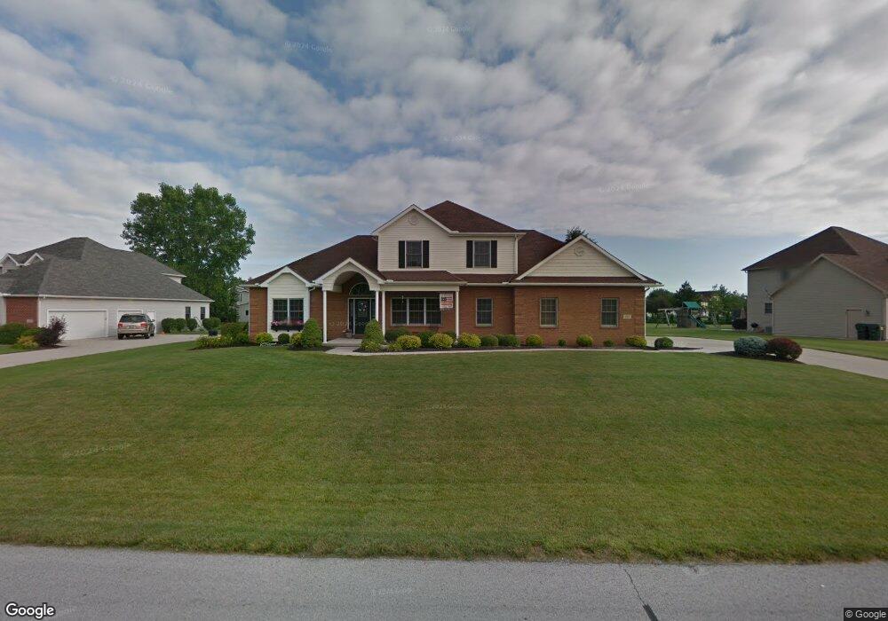
This home is located at 4924 Shoshone Trail, Lima, OH 45805 and is currently estimated at $473,612, approximately $172 per square foot. 4924 Shoshone Trail is a home located in Allen County with nearby schools including Maplewood Elementary School, Elmwood Elementary School, and Shawnee Middle School.
Ownership History
Date
Name
Owned For
Owner Type
Purchase Details
Closed on
Dec 21, 2010
Sold by
National Residential Nominee Services In
Bought by
Myers Jeremy D and Myers Elizabeth A
Current Estimated Value
Purchase Details
Closed on
Jul 10, 2010
Sold by
Pankow Dale R and Pankow Juli L
Bought by
National Residential Nominee Services In
Purchase Details
Closed on
Jan 29, 2007
Sold by
Chudzik John A
Bought by
Pankow Dale R and Pankow Juli L
Home Financials for this Owner
Home Financials are based on the most recent Mortgage that was taken out on this home.
Original Mortgage
$175,000
Interest Rate
6.19%
Mortgage Type
New Conventional
Create a Home Valuation Report for This Property
The Home Valuation Report is an in-depth analysis detailing your home's value as well as a comparison with similar homes in the area
Purchase History
| Date | Buyer | Sale Price | Title Company |
|---|---|---|---|
| Myers Jeremy D | $262,500 | Attorney | |
| National Residential Nominee Services In | $278,500 | Attorney | |
| Pankow Dale R | $352,000 | None Available |
Source: Public Records
Mortgage History
| Date | Status | Borrower | Loan Amount |
|---|---|---|---|
| Previous Owner | Pankow Dale R | $175,000 |
Source: Public Records
Tax History
| Year | Tax Paid | Tax Assessment Tax Assessment Total Assessment is a certain percentage of the fair market value that is determined by local assessors to be the total taxable value of land and additions on the property. | Land | Improvement |
|---|---|---|---|---|
| 2024 | $6,731 | $137,030 | $12,740 | $124,290 |
| 2023 | $6,285 | $112,320 | $10,430 | $101,890 |
| 2022 | $6,298 | $112,320 | $10,430 | $101,890 |
| 2021 | $6,337 | $112,320 | $10,430 | $101,890 |
| 2020 | $4,865 | $99,440 | $10,010 | $89,430 |
| 2019 | $4,865 | $99,440 | $10,010 | $89,430 |
| 2018 | $4,816 | $99,440 | $10,010 | $89,430 |
| 2017 | $4,787 | $95,170 | $10,010 | $85,160 |
| 2016 | $4,679 | $95,170 | $10,010 | $85,160 |
| 2015 | $4,537 | $95,170 | $10,010 | $85,160 |
| 2014 | $4,537 | $91,110 | $9,210 | $81,900 |
| 2013 | $4,450 | $91,110 | $9,210 | $81,900 |
Source: Public Records
Map
Nearby Homes
- 4906 Shoshone Trail
- 845 Atalan Trail
- 4875 Wenatchi Trail
- 616 Wildbrook Ln
- 1602 Wonderlick Rd
- 2340 S Wapak Rd
- 123 Eagles Point W
- 3390 Spencerville Rd
- 1540 Adak Ave
- 0 Springview Dr
- 206 Eagles Point St E
- 2970 Sands Rd
- 1453 W Shore Dr
- 4211 Fort Amanda Rd
- 000 N Stevick Rd
- 0000 N Stevick Rd
- 1408 Winghaven Dr
- 2940 Koop Rd
- 145 N Concept Dr
- 115 Lanes End
Your Personal Tour Guide
Ask me questions while you tour the home.