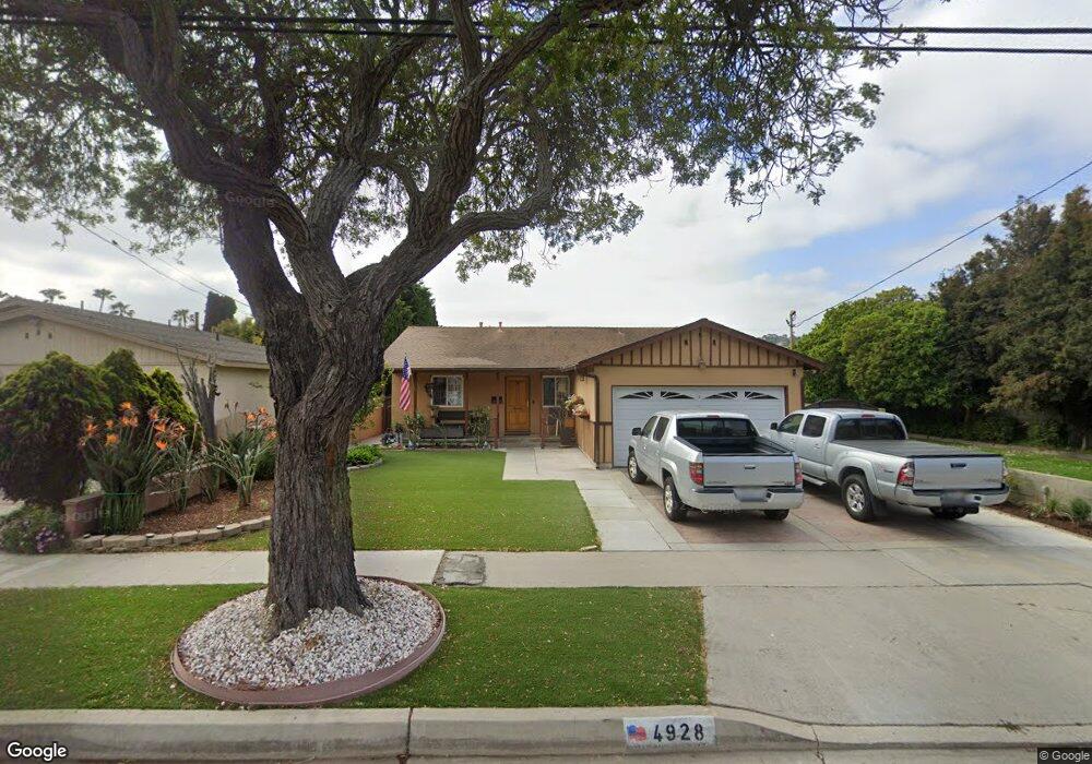
4928 Macafee Rd Torrance, CA 90505
Seaside NeighborhoodEstimated Value: $1,364,390 - $1,573,000
4
Beds
2
Baths
1,653
Sq Ft
$907/Sq Ft
Est. Value
About This Home
This home is located at 4928 Macafee Rd, Torrance, CA 90505 and is currently estimated at $1,499,598, approximately $907 per square foot. 4928 Macafee Rd is a home located in Los Angeles County with nearby schools including Seaside Elementary School, Calle Mayor Middle School, and South High School.
Ownership History
Date
Name
Owned For
Owner Type
Purchase Details
Closed on
Aug 24, 2004
Sold by
Kawa Zbigniew
Bought by
Kawa Zbigniew L and Kawa Stella G
Current Estimated Value
Home Financials for this Owner
Home Financials are based on the most recent Mortgage that was taken out on this home.
Original Mortgage
$400,000
Interest Rate
5.92%
Mortgage Type
New Conventional
Purchase Details
Closed on
Oct 19, 2000
Sold by
Liu Vivian
Bought by
Kawa Zbigniew and Kawa Stella
Home Financials for this Owner
Home Financials are based on the most recent Mortgage that was taken out on this home.
Original Mortgage
$380,000
Interest Rate
7.9%
Mortgage Type
Stand Alone First
Create a Home Valuation Report for This Property
The Home Valuation Report is an in-depth analysis detailing your home's value as well as a comparison with similar homes in the area
Home Values in the Area
Average Home Value in this Area
Purchase History
| Date | Buyer | Sale Price | Title Company |
|---|---|---|---|
| Kawa Zbigniew L | -- | Landsafe Title | |
| Kawa Zbigniew | $380,000 | South Coast Title |
Source: Public Records
Mortgage History
| Date | Status | Borrower | Loan Amount |
|---|---|---|---|
| Previous Owner | Kawa Zbigniew L | $400,000 | |
| Previous Owner | Kawa Zbigniew | $380,000 |
Source: Public Records
Tax History
| Year | Tax Paid | Tax Assessment Tax Assessment Total Assessment is a certain percentage of the fair market value that is determined by local assessors to be the total taxable value of land and additions on the property. | Land | Improvement |
|---|---|---|---|---|
| 2025 | $6,664 | $572,583 | $441,949 | $130,634 |
| 2024 | $6,664 | $561,357 | $433,284 | $128,073 |
| 2023 | $6,544 | $550,351 | $424,789 | $125,562 |
| 2022 | $6,457 | $539,560 | $416,460 | $123,100 |
| 2021 | $6,337 | $528,982 | $408,295 | $120,687 |
| 2020 | $6,243 | $523,559 | $404,109 | $119,450 |
| 2019 | $6,156 | $513,294 | $396,186 | $117,108 |
| 2018 | $5,944 | $503,230 | $388,418 | $114,812 |
| 2016 | $5,676 | $483,690 | $373,336 | $110,354 |
| 2015 | $5,554 | $476,426 | $367,729 | $108,697 |
| 2014 | $5,413 | $467,094 | $360,526 | $106,568 |
Source: Public Records
Map
Nearby Homes
- 4817 Macafee Rd
- 5013 Macafee Rd
- 23333 Anza Ave
- 4922 Reynolds Rd
- 22631 Kathryn Ave
- 23505 Ladeene Ave
- 425 Via el Chico
- 4509 Vista Largo
- 5519 Calle de Ricardo
- 523 Avenue G
- 22508 Shadycroft Ave
- 5407 Via Del Valle
- 23108 Los Codona Ave
- 4321 Paseo de Las Tortugas
- 3822 Jason Cir
- 1800 S Pacific Coast Hwy Unit 21
- 1800 S Pacific Coast Hwy
- 1041 Avenue D
- 845 Calle Miramar
- 3649 Navajo Place
- 4924 Macafee Rd
- 5004 Macafee Rd
- 4920 Macafee Rd
- 5008 Macafee Rd
- 4916 Macafee Rd
- 4929 Macafee Rd
- 4925 Macafee Rd
- 4908 Calle Mayor
- 5012 Macafee Rd
- 5005 Macafee Rd
- 4912 Macafee Rd
- 4921 Macafee Rd
- 4919 Louise Ave
- 4917 Macafee Rd
- 5009 Macafee Rd
- 4842 Theo Ave
- 4913 Louise Ave
- 5016 Macafee Rd
- 4908 Macafee Rd
- 4841 Theo Ave
Your Personal Tour Guide
Ask me questions while you tour the home.