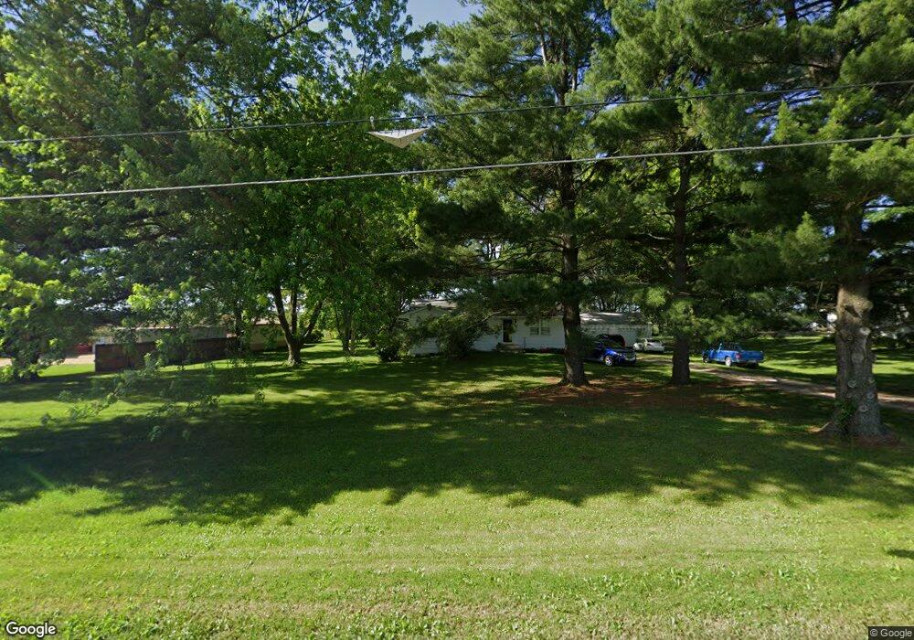
4929 SE 72nd Ave Carlisle, IA 50047
Avon Lake NeighborhoodEstimated Value: $218,000 - $275,000
3
Beds
1
Bath
1,028
Sq Ft
$229/Sq Ft
Est. Value
About This Home
This home is located at 4929 SE 72nd Ave, Carlisle, IA 50047 and is currently estimated at $235,706, approximately $229 per square foot. 4929 SE 72nd Ave is a home located in Polk County with nearby schools including Carlisle Elementary School, Hartford Upper Elementary School, and Carlisle Middle School.
Ownership History
Date
Name
Owned For
Owner Type
Purchase Details
Closed on
Dec 17, 1998
Sold by
Bankers Trust Company
Bought by
Bartholomew Ralph and Bartholomew Patricia
Current Estimated Value
Home Financials for this Owner
Home Financials are based on the most recent Mortgage that was taken out on this home.
Original Mortgage
$68,850
Interest Rate
6.93%
Purchase Details
Closed on
Nov 5, 1998
Sold by
Bartholomew Patricia L
Bought by
Bales Brad L and Bales Sandra K
Home Financials for this Owner
Home Financials are based on the most recent Mortgage that was taken out on this home.
Original Mortgage
$68,850
Interest Rate
6.93%
Create a Home Valuation Report for This Property
The Home Valuation Report is an in-depth analysis detailing your home's value as well as a comparison with similar homes in the area
Home Values in the Area
Average Home Value in this Area
Purchase History
| Date | Buyer | Sale Price | Title Company |
|---|---|---|---|
| Bartholomew Ralph | $46,000 | -- | |
| Bales Brad L | $43,000 | -- |
Source: Public Records
Mortgage History
| Date | Status | Borrower | Loan Amount |
|---|---|---|---|
| Previous Owner | Bales Brad L | $68,850 |
Source: Public Records
Tax History Compared to Growth
Tax History
| Year | Tax Paid | Tax Assessment Tax Assessment Total Assessment is a certain percentage of the fair market value that is determined by local assessors to be the total taxable value of land and additions on the property. | Land | Improvement |
|---|---|---|---|---|
| 2024 | $3,576 | $190,300 | $50,000 | $140,300 |
| 2023 | $3,512 | $190,300 | $50,000 | $140,300 |
| 2022 | $3,462 | $157,000 | $42,600 | $114,400 |
| 2021 | $3,384 | $157,000 | $42,600 | $114,400 |
| 2020 | $3,322 | $147,100 | $39,800 | $107,300 |
| 2019 | $3,070 | $147,100 | $39,800 | $107,300 |
| 2018 | $3,022 | $131,700 | $34,800 | $96,900 |
| 2017 | $2,848 | $131,700 | $34,800 | $96,900 |
| 2016 | $2,770 | $121,100 | $31,600 | $89,500 |
| 2015 | $2,770 | $121,100 | $31,600 | $89,500 |
| 2014 | $2,816 | $121,800 | $31,100 | $90,700 |
Source: Public Records
Map
Nearby Homes
- 2820 Gateway Dr
- 5756 SE 66th Place
- 4695 E Spring St
- 340 Crescent Dr
- 1115 Pleasant St
- 1588 Highway 5
- 6416 SE 36th St
- 325 Pennsylvania St
- 1000 Commons Ct
- Lot 13 152nd Ln
- Lot 2 152nd Ln
- Lot 17 152nd Ln
- Lot 16 152nd Ln
- Lot 10 152nd Ln
- Lot 9 152nd Ln
- Lot 6 152nd Ln
- Lot 3 152nd Ln
- 535 N 4th St
- 415 Commons Dr
- 390 Commons Dr
- 4949 SE 72nd Ave
- 4959 SE 72nd Ave
- 00 SE 72nd Ave
- 4865 SE 72nd Ave
- 4969 SE 72nd Ave
- 4989 SE 72nd Ave
- 5021 SE 72nd Ave
- 5069 SE 72nd Ave
- 5093 SE 72nd Ave
- 5115 SE 72nd Ave
- 5137 SE 72nd Ave
- 5165 SE 72nd Ave
- 7278 SE 52nd St
- 7366 SE 52nd St
- 7414 SE 52nd St
- 4515 E Pine Ave
- 7646 SE 52nd St
- 7460 SE 52nd St
- 7261 SE 45th St
- 7105 SE 52nd St