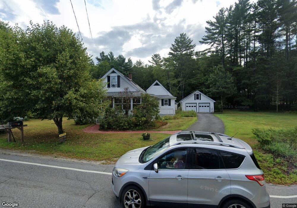
493 Clinton St Concord, NH 03301
South End NeighborhoodEstimated Value: $480,237 - $628,000
2
Beds
2
Baths
1,654
Sq Ft
$326/Sq Ft
Est. Value
About This Home
This home is located at 493 Clinton St, Concord, NH 03301 and is currently estimated at $539,059, approximately $325 per square foot. 493 Clinton St is a home located in Merrimack County with nearby schools including Abbot-Downing School, Rundlett Middle School, and Concord High School.
Ownership History
Date
Name
Owned For
Owner Type
Purchase Details
Closed on
Sep 6, 2016
Sold by
Lynch Chrisinda M and Lynch Michael E
Bought by
Lynch Ft and Lynch
Current Estimated Value
Purchase Details
Closed on
May 31, 1990
Bought by
Lynch Michael E and Lynch Chrisinda M
Create a Home Valuation Report for This Property
The Home Valuation Report is an in-depth analysis detailing your home's value as well as a comparison with similar homes in the area
Home Values in the Area
Average Home Value in this Area
Purchase History
| Date | Buyer | Sale Price | Title Company |
|---|---|---|---|
| Lynch Ft | -- | -- | |
| Lynch Michael E | $133,000 | -- |
Source: Public Records
Mortgage History
| Date | Status | Borrower | Loan Amount |
|---|---|---|---|
| Previous Owner | Lynch Michael E | $120,000 |
Source: Public Records
Tax History Compared to Growth
Tax History
| Year | Tax Paid | Tax Assessment Tax Assessment Total Assessment is a certain percentage of the fair market value that is determined by local assessors to be the total taxable value of land and additions on the property. | Land | Improvement |
|---|---|---|---|---|
| 2024 | $8,794 | $317,600 | $140,600 | $177,000 |
| 2023 | $8,531 | $317,600 | $140,600 | $177,000 |
| 2022 | $8,223 | $317,600 | $140,600 | $177,000 |
| 2021 | $7,978 | $317,600 | $140,600 | $177,000 |
| 2020 | $7,439 | $278,000 | $111,200 | $166,800 |
| 2019 | $7,053 | $253,900 | $104,200 | $149,700 |
| 2018 | $6,960 | $246,900 | $96,400 | $150,500 |
| 2017 | $6,651 | $235,500 | $96,400 | $139,100 |
| 2016 | $6,472 | $233,900 | $96,400 | $137,500 |
| 2015 | $5,905 | $216,000 | $80,100 | $135,900 |
| 2014 | $5,791 | $216,000 | $80,100 | $135,900 |
| 2013 | $5,689 | $222,400 | $80,100 | $142,300 |
| 2012 | $5,559 | $228,100 | $76,100 | $152,000 |
Source: Public Records
Map
Nearby Homes
- 27 Brushwood Dr
- 167 Branch Londonderry Turnpike
- 490 Page Rd
- I3-03-05 Clinton St
- 8 Longview Dr
- 250 Grapevine Rd
- 5 Longview Dr
- 70 Gile Hill Rd
- 0 Farrington Corner Rd Unit 14
- 0 Brown Hill Rd Unit 5032600
- 40 Sawmill Rd
- 6 Woodland Cir
- 256-0-17 Jewett Rd
- 77 White Rock Hill Rd
- 7 Currier Rd
- 43 Sterling Place
- 0 George Rd Unit 30
- 1 Hop Kiln Rd
- 5 Holly Cir
- 4 Bow Center Rd Unit F2
- 496 Clinton St
- 84 Hooksett Turnpike
- 483 Clinton St
- 494 Clinton St
- 82 Hooksett Turnpike
- 120 Hooksett Turnpike
- 80 Hooksett Turnpike
- 484 Clinton St
- 87 Hooksett Turnpike
- 475 Clinton St
- 488 Clinton St
- 124 Hooksett Turnpike
- 78 Hooksett Turnpike
- 480 Clinton St
- 473 Clinton St
- 83 Hooksett Turnpike
- 128 Hooksett Turnpike
- 474 Clinton St
- 1 Edgewood Dr
- 469 Clinton St