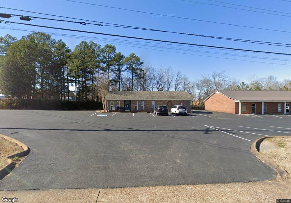
493 E Main St Hohenwald, TN 38462
Estimated Value: $237,386
Studio
2
Baths
1,404
Sq Ft
$169/Sq Ft
Est. Value
About This Home
This home is located at 493 E Main St, Hohenwald, TN 38462 and is currently estimated at $237,386, approximately $169 per square foot. 493 E Main St is a home located in Lewis County with nearby schools including Lewis County Elementary School, Lewis County Intermediate School, and Lewis County Middle School.
Ownership History
Date
Name
Owned For
Owner Type
Purchase Details
Closed on
Mar 18, 2021
Sold by
Davis Audra Kay
Bought by
Skelton Larry
Current Estimated Value
Home Financials for this Owner
Home Financials are based on the most recent Mortgage that was taken out on this home.
Original Mortgage
$133,410
Outstanding Balance
$108,921
Interest Rate
2.73%
Mortgage Type
Commercial
Estimated Equity
$128,465
Purchase Details
Closed on
Nov 21, 2013
Sold by
Garrison Callie M
Bought by
Davis Rodney and Davis Audrey Kay
Home Financials for this Owner
Home Financials are based on the most recent Mortgage that was taken out on this home.
Original Mortgage
$104,000
Interest Rate
4.16%
Mortgage Type
Commercial
Purchase Details
Closed on
Jan 22, 1998
Bought by
Garrison Callie Etuir Dwight G
Create a Home Valuation Report for This Property
The Home Valuation Report is an in-depth analysis detailing your home's value as well as a comparison with similar homes in the area
Home Values in the Area
Average Home Value in this Area
Purchase History
| Date | Buyer | Sale Price | Title Company |
|---|---|---|---|
| Skelton Larry | $170,000 | Assure Title Escrow Llc | |
| Davis Rodney | $130,000 | -- | |
| Garrison Callie Etuir Dwight G | $40,000 | -- |
Source: Public Records
Mortgage History
| Date | Status | Borrower | Loan Amount |
|---|---|---|---|
| Open | Skelton Larry | $133,410 | |
| Previous Owner | Davis Rodney | $104,000 |
Source: Public Records
Tax History
| Year | Tax Paid | Tax Assessment Tax Assessment Total Assessment is a certain percentage of the fair market value that is determined by local assessors to be the total taxable value of land and additions on the property. | Land | Improvement |
|---|---|---|---|---|
| 2025 | -- | $75,400 | $30,200 | $45,200 |
| 2024 | -- | $60,400 | $25,160 | $35,240 |
| 2023 | $1,821 | $60,400 | $25,160 | $35,240 |
| 2022 | $1,821 | $60,400 | $25,160 | $35,240 |
| 2021 | $1,821 | $60,400 | $25,160 | $35,240 |
| 2020 | $1,138 | $60,400 | $25,160 | $35,240 |
| 2019 | $2,226 | $61,080 | $23,400 | $37,680 |
| 2018 | $2,226 | $61,080 | $23,400 | $37,680 |
| 2017 | $2,317 | $61,080 | $23,400 | $37,680 |
| 2016 | $2,317 | $61,080 | $23,400 | $37,680 |
| 2015 | -- | $61,080 | $23,400 | $37,680 |
| 2014 | -- | $61,080 | $23,400 | $37,680 |
| 2013 | -- | $59,600 | $0 | $0 |
Source: Public Records
Map
Nearby Homes
- 118 Joe Ave
- 200 Joe Ave
- 0 Joe Ave
- 0 Joe Ave Unit RTC1910724
- 0 Joe Ave Unit RTC2424474
- 0 Joe Ave Unit RTC2024930
- 0 Joe Ave Unit RTC2102983
- 0 Joe Ave Unit RTC2226849
- 206 Joe Ave
- 118 Joe Ave
- 705 E Main St
- 487 E Main St
- 440 Roney Ave
- 442 Roney Ave
- 218 Joe Ave
- 274 Joe Ave
- 505 E Main St
- 471 E Main St
- 224 Joe Ave
- 464 Roney Ave
Your Personal Tour Guide
Ask me questions while you tour the home.