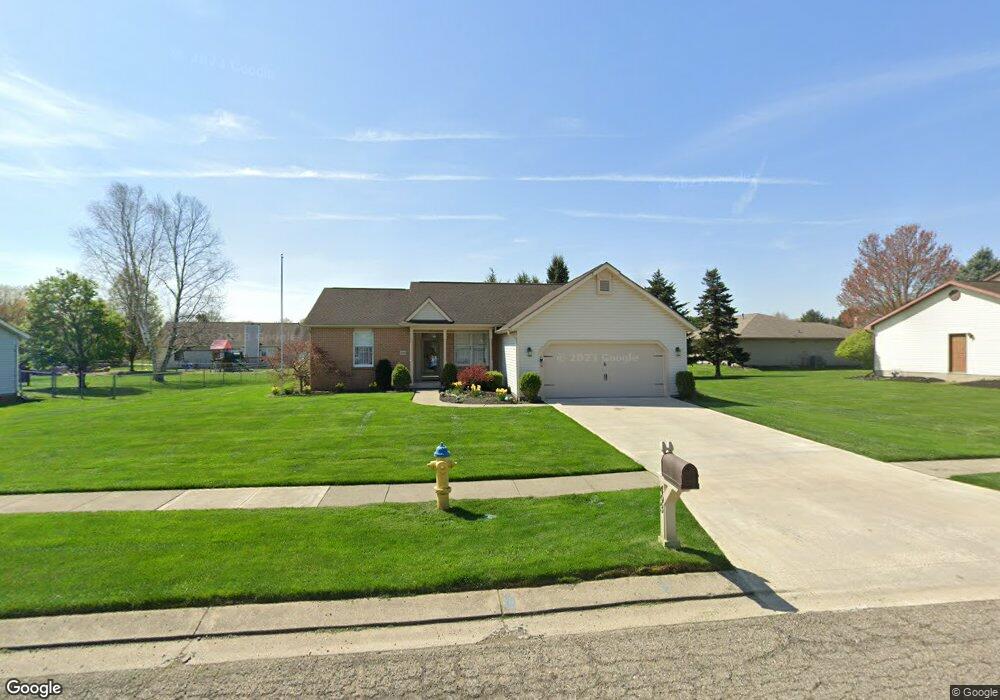
493 Myrtle Ave Newark, OH 43055
Estimated Value: $275,000 - $314,000
3
Beds
2
Baths
1,424
Sq Ft
$209/Sq Ft
Est. Value
About This Home
This home is located at 493 Myrtle Ave, Newark, OH 43055 and is currently estimated at $297,659, approximately $209 per square foot. 493 Myrtle Ave is a home located in Licking County with nearby schools including Legend Elementary School, Liberty Middle School, and Newark High School.
Ownership History
Date
Name
Owned For
Owner Type
Purchase Details
Closed on
Feb 1, 1999
Sold by
Chapman Brian K
Bought by
Westbrook Robert T and Westbrook Connie S
Current Estimated Value
Purchase Details
Closed on
Feb 19, 1998
Sold by
Est E Burdelle Holman
Bought by
Chapman Brian K
Home Financials for this Owner
Home Financials are based on the most recent Mortgage that was taken out on this home.
Original Mortgage
$78,000
Interest Rate
6.99%
Mortgage Type
New Conventional
Create a Home Valuation Report for This Property
The Home Valuation Report is an in-depth analysis detailing your home's value as well as a comparison with similar homes in the area
Home Values in the Area
Average Home Value in this Area
Purchase History
| Date | Buyer | Sale Price | Title Company |
|---|---|---|---|
| Westbrook Robert T | $109,000 | -- | |
| Chapman Brian K | $110,000 | -- |
Source: Public Records
Mortgage History
| Date | Status | Borrower | Loan Amount |
|---|---|---|---|
| Previous Owner | Chapman Brian K | $78,000 |
Source: Public Records
Tax History Compared to Growth
Tax History
| Year | Tax Paid | Tax Assessment Tax Assessment Total Assessment is a certain percentage of the fair market value that is determined by local assessors to be the total taxable value of land and additions on the property. | Land | Improvement |
|---|---|---|---|---|
| 2024 | $2,459 | $78,580 | $22,720 | $55,860 |
| 2023 | $715 | $78,580 | $22,720 | $55,860 |
| 2022 | $1,933 | $56,950 | $13,650 | $43,300 |
| 2021 | $2,027 | $56,950 | $13,650 | $43,300 |
| 2020 | $2,076 | $56,950 | $13,650 | $43,300 |
| 2019 | $1,730 | $47,470 | $11,380 | $36,090 |
| 2018 | $1,731 | $0 | $0 | $0 |
| 2017 | $542 | $0 | $0 | $0 |
| 2016 | $275 | $0 | $0 | $0 |
| 2015 | $468 | $0 | $0 | $0 |
| 2014 | $2,455 | $0 | $0 | $0 |
| 2013 | $2,553 | $0 | $0 | $0 |
Source: Public Records
Map
Nearby Homes
- 1518 Constitution Ct
- 1684 Churchill Downs Rd
- 505 Courtney Dr
- 336 Myrtle Ave
- 1495 Kenarbre Dr
- 1345 Sherwood Downs Rd W
- 139 Aqueduct Ave
- 1831 Churchill Downs Rd
- 267 Goosepond Rd Unit A
- 261 Goosepond Rd Unit D
- 734 Whitetail Loop
- 259 Goosepond Rd Unit C
- 106 Santa Anita Ave Unit 21A
- 763 Whitetail Loop
- 750 Whitetail Loop
- 752 Whitetail Loop
- 105 Pimlico Ave
- 1738 Scioto Way
- 681 Woods Edge Ln
- 47 Northpointe Ln Unit 47
- 485 Myrtle Ave
- 503 Myrtle Ave
- 1593 Paul Revere Dr
- 1602 Independence Dr
- 1585 Paul Revere Dr
- 477 Myrtle Ave
- 1594 Independence Dr
- 488 Myrtle Ave
- 496 Myrtle Ave
- 1590 Paul Revere Dr
- 506 Myrtle Ave
- 480 Myrtle Ave
- 1586 Independence Dr
- 469 Myrtle Ave
- 1577 Paul Revere Dr
- 1609 Independence Dr
- 514 Myrtle Ave
- 472 Myrtle Ave
- 1582 Paul Revere Dr
- 1599 Independence Dr