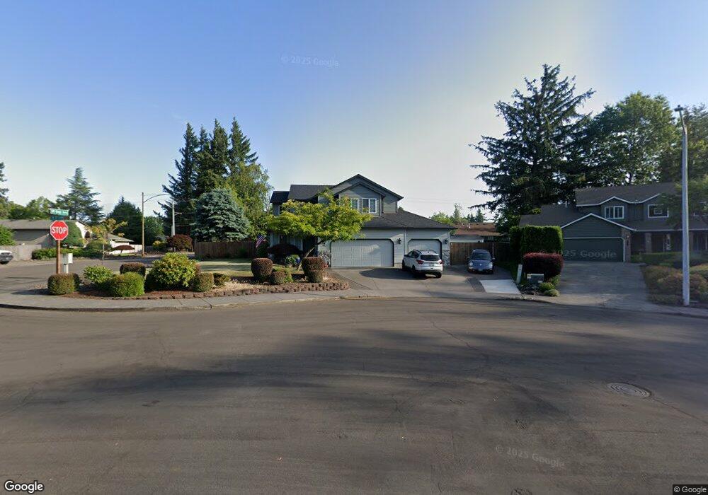
493 SW 10th Cir Troutdale, OR 97060
Town Center NeighborhoodEstimated Value: $504,368 - $543,000
3
Beds
3
Baths
1,624
Sq Ft
$325/Sq Ft
Est. Value
About This Home
This home is located at 493 SW 10th Cir, Troutdale, OR 97060 and is currently estimated at $528,342, approximately $325 per square foot. 493 SW 10th Cir is a home located in Multnomah County with nearby schools including Troutdale Elementary School, Walt Morey Middle School, and Reynolds High School.
Ownership History
Date
Name
Owned For
Owner Type
Purchase Details
Closed on
Jun 21, 2024
Sold by
Williams Darryl W
Bought by
Darryl W Williams Family Trust and Williams
Current Estimated Value
Purchase Details
Closed on
Feb 25, 2008
Sold by
Williams Heather A
Bought by
Williams Darryl W
Purchase Details
Closed on
Aug 26, 1996
Sold by
Lone Oak Construction Inc
Bought by
Williams Darryl W and Williams Heather A
Home Financials for this Owner
Home Financials are based on the most recent Mortgage that was taken out on this home.
Original Mortgage
$140,650
Interest Rate
8.23%
Mortgage Type
Purchase Money Mortgage
Purchase Details
Closed on
Jan 4, 1996
Sold by
Rodgers Lonie
Bought by
Lone Oak Construction Inc
Purchase Details
Closed on
Apr 10, 1995
Sold by
Cascade Development Company
Bought by
Rodgers Lonie and River Valley Construction
Create a Home Valuation Report for This Property
The Home Valuation Report is an in-depth analysis detailing your home's value as well as a comparison with similar homes in the area
Home Values in the Area
Average Home Value in this Area
Purchase History
| Date | Buyer | Sale Price | Title Company |
|---|---|---|---|
| Darryl W Williams Family Trust | -- | None Listed On Document | |
| Williams Darryl W | $85,193 | None Available | |
| Williams Darryl W | $165,500 | Ticor Title Insurance | |
| Lone Oak Construction Inc | $38,000 | Ticor Title Insurance | |
| Rodgers Lonie | $37,500 | -- |
Source: Public Records
Mortgage History
| Date | Status | Borrower | Loan Amount |
|---|---|---|---|
| Previous Owner | Williams Darryl W | $140,650 |
Source: Public Records
Tax History Compared to Growth
Tax History
| Year | Tax Paid | Tax Assessment Tax Assessment Total Assessment is a certain percentage of the fair market value that is determined by local assessors to be the total taxable value of land and additions on the property. | Land | Improvement |
|---|---|---|---|---|
| 2025 | $4,863 | $263,380 | -- | -- |
| 2024 | $4,595 | $255,710 | -- | -- |
| 2023 | $4,595 | $248,270 | $0 | $0 |
| 2022 | $4,368 | $241,040 | $0 | $0 |
| 2021 | $4,266 | $234,020 | $0 | $0 |
| 2020 | $3,989 | $227,210 | $0 | $0 |
| 2019 | $3,830 | $220,600 | $0 | $0 |
| 2018 | $3,804 | $214,180 | $0 | $0 |
| 2017 | $3,796 | $207,950 | $0 | $0 |
Source: Public Records
Map
Nearby Homes
- 1226 SW Hensley Rd
- 809 SW Crestview Way
- 735 SW Sunset Way
- 821 SW 14th St
- 839 SW Grant Way
- 1212 SW Edgefield Ave
- 621 SE 11th Cir
- 1018 SW Halsey St
- 988 SW 2nd Way
- 176 SW Hewitt Ave
- 1106 SW Dottie Ct
- 2020 SW Laura Ct
- 28446 E Historic Columbia River Hwy
- 191 SW Lancaster Ct
- 2154 SE Sandy Ct
- 125 SW Lancaster Ct
- 665 SW 24th St
- 1392 SW Berryessa Place
- 1021 SW 24th St
- 1953 SW Northstar Way
- 477 SW 10th Cir
- 1017 SW Kings Byway
- 1018 SW Kings Bywy
- 1000 SW Kings Byway
- 435 SW Cherry Park Rd
- 459 SW 10th Cir
- 1010 SW Kings Byway
- 411 SW 10th Cir
- 483 SW Cherry Park Rd
- 467 SW Cherry Park Rd
- 960 SW Kings Byway
- 435 SW 10th Cir
- 990 SW Kings Byway
- 337 SW Cherry Park Rd
- 950 SW Kings Byway
- 501 SW Cherry Park Rd
- 980 SW Kings Byway
- 535 SW Cherry Park Rd
- 538 SW Cherry Park Rd
- 420 SW 9th Cir