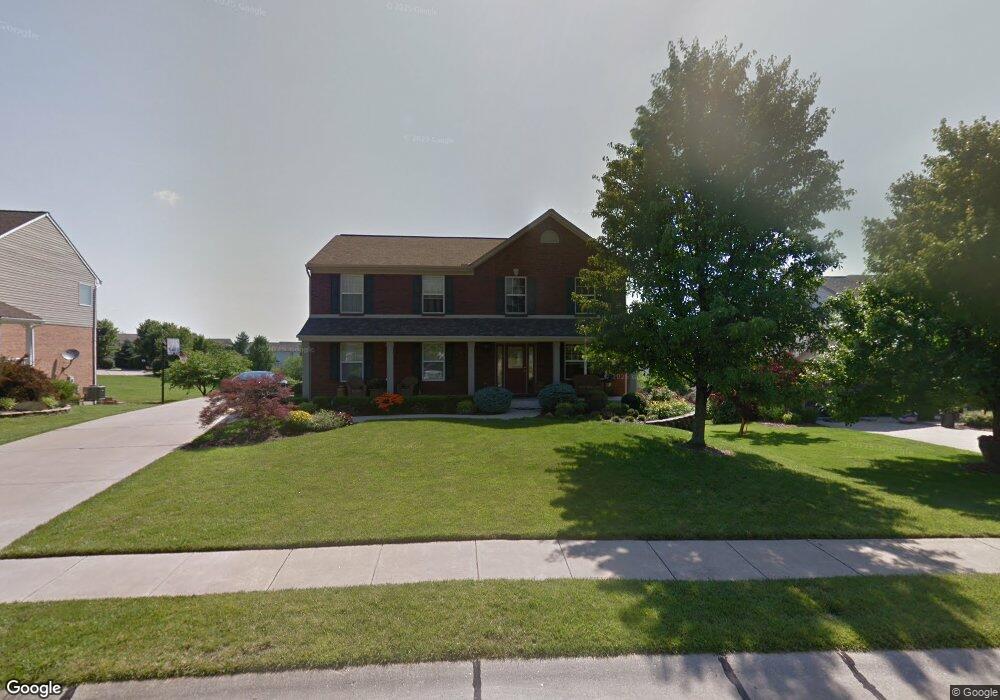
4930 Corn Row Ct Independence, KY 41051
Estimated Value: $384,544 - $435,000
3
Beds
4
Baths
2,466
Sq Ft
$162/Sq Ft
Est. Value
About This Home
This home is located at 4930 Corn Row Ct, Independence, KY 41051 and is currently estimated at $399,136, approximately $161 per square foot. 4930 Corn Row Ct is a home located in Kenton County with nearby schools including Simon Kenton High School, St. Cecilia Catholic School, and Calvary Christian School.
Ownership History
Date
Name
Owned For
Owner Type
Purchase Details
Closed on
Apr 27, 2007
Sold by
Stark James P and Stark Michelle R
Bought by
Stark James P and Stark Michelle R
Current Estimated Value
Home Financials for this Owner
Home Financials are based on the most recent Mortgage that was taken out on this home.
Original Mortgage
$191,250
Outstanding Balance
$113,008
Interest Rate
6.1%
Mortgage Type
Purchase Money Mortgage
Estimated Equity
$286,128
Purchase Details
Closed on
Apr 12, 2007
Sold by
Dowling Earl D and Dowling Mary Frances
Bought by
Stark James P
Home Financials for this Owner
Home Financials are based on the most recent Mortgage that was taken out on this home.
Original Mortgage
$191,250
Outstanding Balance
$113,008
Interest Rate
6.1%
Mortgage Type
Purchase Money Mortgage
Estimated Equity
$286,128
Purchase Details
Closed on
Dec 23, 2003
Sold by
Finke Homes Inc
Bought by
Dowling Earl D and Dowling Mary Frances
Create a Home Valuation Report for This Property
The Home Valuation Report is an in-depth analysis detailing your home's value as well as a comparison with similar homes in the area
Home Values in the Area
Average Home Value in this Area
Purchase History
| Date | Buyer | Sale Price | Title Company |
|---|---|---|---|
| Stark James P | -- | Advanced Land Title Agency | |
| Stark James P | $225,000 | Advanced Land Title Agency | |
| Dowling Earl D | $235,000 | Kentucky Land Title Agency |
Source: Public Records
Mortgage History
| Date | Status | Borrower | Loan Amount |
|---|---|---|---|
| Open | Stark James P | $191,250 |
Source: Public Records
Tax History
| Year | Tax Paid | Tax Assessment Tax Assessment Total Assessment is a certain percentage of the fair market value that is determined by local assessors to be the total taxable value of land and additions on the property. | Land | Improvement |
|---|---|---|---|---|
| 2025 | $3,846 | $330,700 | $45,000 | $285,700 |
| 2024 | $3,238 | $264,300 | $35,000 | $229,300 |
| 2023 | $3,339 | $264,300 | $35,000 | $229,300 |
| 2022 | $3,390 | $264,300 | $35,000 | $229,300 |
| 2021 | $3,441 | $264,300 | $35,000 | $229,300 |
| 2020 | $3,002 | $225,000 | $30,000 | $195,000 |
| 2019 | $3,010 | $225,000 | $30,000 | $195,000 |
| 2018 | $3,027 | $225,000 | $30,000 | $195,000 |
| 2017 | $2,943 | $225,000 | $30,000 | $195,000 |
| 2015 | $2,862 | $225,000 | $30,000 | $195,000 |
| 2014 | $2,821 | $225,000 | $30,000 | $195,000 |
Source: Public Records
Map
Nearby Homes
- 4828 Far Hills Dr
- 1884 Bridle Path
- 1365 Cairns Ct
- 2037 Patriot Way
- 4758 Fowler Creek Rd
- 9964 Meadow Glen Dr
- 9980 Meadow Glen Dr
- 9971 Meadow Glen Dr
- 5220 Cody Rd
- 111 Green Hill Dr
- 10008 Meadow Glen Dr
- 4358 Siffel Ct
- 3852 Sherbourne Dr
- 38 Waterside Way
- 2059 Gribble Dr
- 3981 Sherbourne Dr
- 4394 Boston Ln
- 968 Stablewatch Dr
- 3042 Sugar Camp Rd
- 3828 Sherbourne Dr
- 4934 Corn Row Ct
- 4926 Corn Row Ct
- 2032 Straw Flower Ct
- 4938 Corn Row Ct
- 2036 Straw Flower Ct
- 2028 Straw Flower Ct
- 4925 Corn Row Ct
- 12 Corn Row Ct
- 2033 Straw Flower Ct
- 4929 Corn Row Ct
- 4929 Open Meadow Dr
- 4933 Open Meadow Dr
- 4933 Corn Row Ct
- 4918 Corn Row Ct
- 2040 Straw Flower Ct
- 4919 Corn Row Ct
- 2041 Straw Flower Ct
- 4919 Open Meadow Dr
- 4932 Madison Pike
- 4947 Open Meadow Dr
Your Personal Tour Guide
Ask me questions while you tour the home.