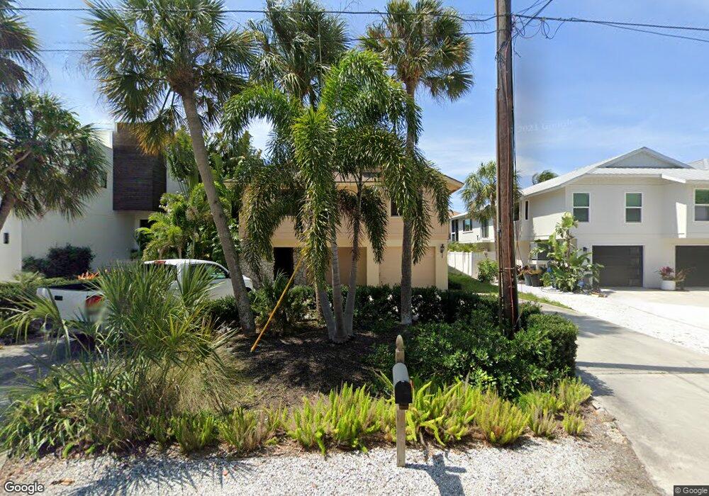
4932 Commonwealth Dr Sarasota, FL 34242
Estimated Value: $1,042,000 - $1,356,000
3
Beds
2
Baths
2,119
Sq Ft
$535/Sq Ft
Est. Value
About This Home
This home is located at 4932 Commonwealth Dr, Sarasota, FL 34242 and is currently estimated at $1,133,541, approximately $534 per square foot. 4932 Commonwealth Dr is a home located in Sarasota County with nearby schools including Phillippi Shores Elementary School, Brookside Middle School, and Sarasota High School.
Ownership History
Date
Name
Owned For
Owner Type
Purchase Details
Closed on
Apr 9, 2021
Sold by
Hurxthal Thomas L
Bought by
Zaletel Patricia A and Zaletel Craig S
Current Estimated Value
Purchase Details
Closed on
Oct 12, 2004
Sold by
Burke John D
Bought by
Hurxthal Thomas Lee
Purchase Details
Closed on
Oct 11, 2002
Sold by
Ward John E and Ward Carol S
Bought by
Hurxthal Thomas Lee
Home Financials for this Owner
Home Financials are based on the most recent Mortgage that was taken out on this home.
Original Mortgage
$150,000
Interest Rate
6.21%
Create a Home Valuation Report for This Property
The Home Valuation Report is an in-depth analysis detailing your home's value as well as a comparison with similar homes in the area
Home Values in the Area
Average Home Value in this Area
Purchase History
| Date | Buyer | Sale Price | Title Company |
|---|---|---|---|
| Zaletel Patricia A | $800,000 | Gulf Breeze Ttl Of Sarasota | |
| Hurxthal Thomas Lee | -- | -- | |
| Hurxthal Thomas Lee | $520,000 | -- |
Source: Public Records
Mortgage History
| Date | Status | Borrower | Loan Amount |
|---|---|---|---|
| Previous Owner | Hurxthal Thomas Lee | $150,000 |
Source: Public Records
Tax History Compared to Growth
Tax History
| Year | Tax Paid | Tax Assessment Tax Assessment Total Assessment is a certain percentage of the fair market value that is determined by local assessors to be the total taxable value of land and additions on the property. | Land | Improvement |
|---|---|---|---|---|
| 2024 | $11,861 | $846,500 | $702,200 | $144,300 |
| 2023 | $11,861 | $955,800 | $692,300 | $263,500 |
| 2022 | $11,934 | $958,200 | $741,200 | $217,000 |
| 2021 | $6,433 | $514,339 | $0 | $0 |
| 2020 | $6,460 | $507,238 | $0 | $0 |
| 2019 | $6,260 | $495,834 | $0 | $0 |
| 2018 | $6,131 | $486,589 | $0 | $0 |
| 2017 | $6,106 | $476,581 | $0 | $0 |
| 2016 | $6,137 | $603,100 | $358,600 | $244,500 |
| 2015 | $6,233 | $546,700 | $346,500 | $200,200 |
| 2014 | $6,211 | $451,896 | $0 | $0 |
Source: Public Records
Map
Nearby Homes
- 4903 Commonwealth Dr
- 4929 Oxford Dr
- 4879 Commonwealth Dr
- 4931 Oxford Dr
- 4894 Oxford Dr
- 4859 Commonwealth Dr
- 717 Treasure Boat Way
- 711 Birdsong Ln
- 4964 Commonwealth Dr
- 782 Birdsong Ln
- 5019 Commonwealth Dr
- 5024 Commonwealth Dr
- 635 Tropical Cir
- 5141 Saint Albans Ave
- 753 Tropical Cir
- 795 Plymouth St
- 568 Venice Ln
- 558 Venice Ln
- 746 Plymouth St
- 5112 Oakmont Place
- 4926 Commonwealth Dr
- 4934 Commonwealth Dr
- 4922 Commonwealth Dr
- 4914 Commonwealth Dr
- 4938 Commonwealth Dr
- 4923 Commonwealth Dr
- 4919 Commonwealth Dr
- 4931 Commonwealth Dr
- 4937 Oxford Dr
- 4907 Commonwealth Dr
- 4910 Commonwealth Dr
- 4959 Oxford Dr
- 4942 Commonwealth Dr
- 4905 Commonwealth Dr
- 4963 Oxford Dr
- 4925 Oxford Dr
- 4903 Oxford Dr
- 4900 Commonwealth Dr
- 718 Birdsong Ln
- 4946 Drive