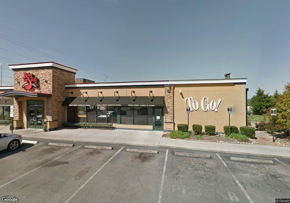
494 Crockett Trace Dr Morristown, TN 37813
--
Bed
2
Baths
4,356
Sq Ft
1.32
Acres
About This Home
This home is located at 494 Crockett Trace Dr, Morristown, TN 37813. 494 Crockett Trace Dr is a home located in Hamblen County with nearby schools including John Hay Elementary School, Meadowview Middle School, and Morristown East High School.
Ownership History
Date
Name
Owned For
Owner Type
Purchase Details
Closed on
Jul 29, 2019
Sold by
Scf Rc Funding Iv Llc
Bought by
Baldi Ron
Purchase Details
Closed on
Dec 18, 2017
Sold by
Ruby Tuesday Inc
Bought by
Scf Rc Funding Iv Llc
Purchase Details
Closed on
Aug 2, 2002
Sold by
Atlantic Financial
Bought by
Ruby Tuesday
Purchase Details
Closed on
Oct 22, 2001
Bought by
Atlantic Financial Group Ltd
Purchase Details
Closed on
Jul 26, 2000
Bought by
Morristown Certified Prop Lp Tax Dept Store #
Purchase Details
Closed on
Sep 7, 1990
Bought by
Thompson J C
Purchase Details
Closed on
Jan 11, 1951
Bought by
Thompson J C
Create a Home Valuation Report for This Property
The Home Valuation Report is an in-depth analysis detailing your home's value as well as a comparison with similar homes in the area
Home Values in the Area
Average Home Value in this Area
Purchase History
| Date | Buyer | Sale Price | Title Company |
|---|---|---|---|
| Baldi Ron | $1,446,000 | First American Title Co | |
| Baldi Ron | $1,446,000 | First American Title Co | |
| Scf Rc Funding Iv Llc | $1,333,000 | None Available | |
| Ruby Tuesday | -- | -- | |
| Atlantic Financial Group Ltd | $545,000 | -- | |
| Morristown Certified Prop Lp Tax Dept Store # | $2,913,200 | -- | |
| Thompson J C | -- | -- | |
| Thompson J C | -- | -- |
Source: Public Records
Tax History Compared to Growth
Tax History
| Year | Tax Paid | Tax Assessment Tax Assessment Total Assessment is a certain percentage of the fair market value that is determined by local assessors to be the total taxable value of land and additions on the property. | Land | Improvement |
|---|---|---|---|---|
| 2024 | $8,178 | $464,640 | $197,280 | $267,360 |
| 2023 | $7,747 | $440,160 | $0 | $0 |
| 2022 | $13,909 | $440,160 | $197,280 | $242,880 |
| 2021 | $13,909 | $440,160 | $197,280 | $242,880 |
| 2020 | $13,891 | $440,160 | $197,280 | $242,880 |
| 2019 | $15,115 | $444,560 | $197,280 | $247,280 |
| 2018 | $14,004 | $444,560 | $197,280 | $247,280 |
| 2017 | $13,782 | $444,560 | $197,280 | $247,280 |
| 2016 | $13,159 | $444,560 | $197,280 | $247,280 |
| 2015 | $12,243 | $444,560 | $197,280 | $247,280 |
| 2014 | -- | $444,560 | $197,280 | $247,280 |
| 2013 | -- | $504,160 | $0 | $0 |
Source: Public Records
Map
Nearby Homes
- 1575 Thompson Creek Rd
- 0 Thompson Creek Rd
- 458 Laurel St
- 1932 Eastern Ave
- 1670 Oak St
- 808 Gaston St
- 460 Ash St
- 216 Laurel St
- 0 Russell Cir
- 411 Ash St
- 1710 Morningside Dr
- 345 Belle Meade Cir
- 3003 Eloise Dr
- 1205 Ledford Ave
- 0 Morelock Rd N
- 518 W Hillcrest Dr
- 1200 Liberty Hall Dr
- 000 Bacon Ln
- 3115 Eloise Dr
- Lot 1 E Andrew Johnson Hwy
- 494 Crockett Trace Dr Unit /2
- 504 Crockett Trace Dr
- Lot 1R Crockett Trace Dr
- 468 Crockett Trace Dr
- 855 Thompson Creek Rd
- 987 Thompson Creek Rd
- 513 Sycamore St
- 541 Sycamore St
- 547 Sycamore St
- 535 Sycamore St
- 521 Sycamore St
- 555 Sycamore St
- 545 Redwood St
- 621 Spruce St
- 623 Spruce St
- 1051 Thompson Creek Rd
- 603 Spruce St
- 449 Wilder St
- 455 Wilder St
- 552 Sycamore St