
494 E 100 S (Address Is Approximate) Unit C Parowan, UT 84761
Estimated Value: $412,000 - $634,000
0.27
Acre
$1,937,037
Price per Acre
11,761
Sq Ft Lot
Highlights
- No HOA
- Brush Vegetation
- Level Lot
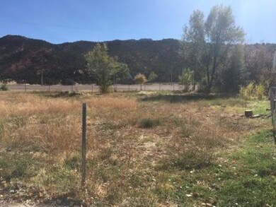
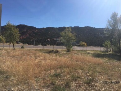
About This Lot
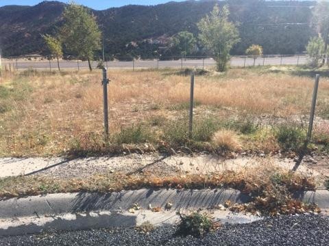
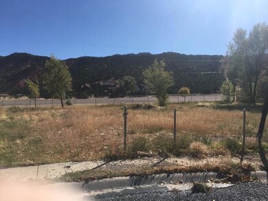
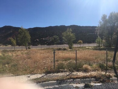
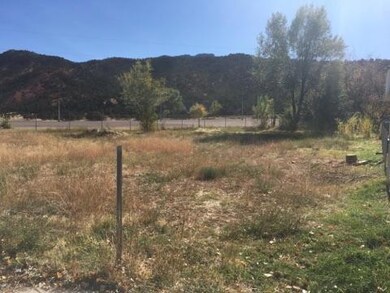
As of December 2018Beautiful lot in Parowan, Utah! Close to Brian Head Ski Resort! Close to Cedar City, Utah! Gorgeous backyard views facing east/facing the mountains! Located in a cul-de-sac! Great location in wonderful neighborhood!
Property Details
Property Type
- Land
Est. Annual Taxes
- $379
Lot Details
- 0.27 Acre Lot
- Brush Vegetation
- Native Plants
- Level Lot
Community Details
- No Home Owners Association
- Red Hills Subdivision
Listing and Financial Details
- Legal Lot and Block 5 / B
- Assessor Parcel Number A-0007-0010-000B-05
Ownership History
Date
Name
Owned For
Owner Type
Purchase Details
Listed on
Apr 10, 2018
Closed on
Dec 7, 2018
Sold by
Jamie O Connell Kenneth P and Connell Jamie O
Bought by
Roberts Scott
List Price
$34,900
Sold Price
$25,000
Premium/Discount to List
-$9,900
-28.37%
Total Days on Market
395
Current Estimated Value
Home Financials for this Owner
Home Financials are based on the most recent Mortgage that was taken out on this home.
Estimated Appreciation
$498,000
Avg. Annual Appreciation
60.82%
Create a Home Valuation Report for This Property
The Home Valuation Report is an in-depth analysis detailing your home's value as well as a comparison with similar homes in the area
Home Values in the Area
Average Home Value in this Area
Purchase History
| Date | Buyer | Sale Price | Title Company |
|---|---|---|---|
| Roberts Scott | -- | Cedar Land Title Inc |
Source: Public Records
Property History
| Date | Event | Price | Change | Sq Ft Price |
|---|---|---|---|---|
| 12/07/2018 12/07/18 | Sold | -- | -- | -- |
| 11/06/2018 11/06/18 | Pending | -- | -- | -- |
| 10/07/2017 10/07/17 | For Sale | $34,900 | -- | -- |
Source: Iron County Board of REALTORS®
Tax History Compared to Growth
Tax History
| Year | Tax Paid | Tax Assessment Tax Assessment Total Assessment is a certain percentage of the fair market value that is determined by local assessors to be the total taxable value of land and additions on the property. | Land | Improvement |
|---|---|---|---|---|
| 2023 | $2,977 | $150,730 | $42,840 | $107,890 |
| 2022 | $678 | $70,805 | $70,805 | $0 |
| 2021 | $424 | $44,250 | $44,250 | $0 |
| 2020 | $376 | $34,725 | $34,725 | $0 |
| 2019 | $394 | $34,725 | $34,725 | $0 |
| 2018 | $350 | $30,195 | $30,195 | $0 |
| 2017 | $379 | $30,195 | $30,195 | $0 |
| 2016 | $379 | $30,195 | $30,195 | $0 |
| 2015 | $153 | $11,525 | $0 | $0 |
| 2014 | $161 | $11,525 | $0 | $0 |
Source: Public Records
Map
Source: Iron County Board of REALTORS®
MLS Number: 80474
APN: A-0007-0010-000B-05
Nearby Homes
- Red Hills E 125 S Lot 14 Unit A
- 161 S Canyon Rd
- Canyon Rd City View Dr
- 471 E 40 S
- .31 ac Canyon Rd
- 280 E 100 S
- 390 E 300 S Unit 10 A
- 290 E 200 S
- 25 S 200 E
- 285 S 200 E
- 46 N 200 E
- 220 N 300 E
- 0 A-0492-0006-0000 Unit 25-257796
- 0 A-0492-0006-0000 Unit 105389
- .6 acres 400 S
- 45 W 100 S
- 289 E 400 N
- 259 W 200 S
- 56 W 500 N
- 11 S 400 W