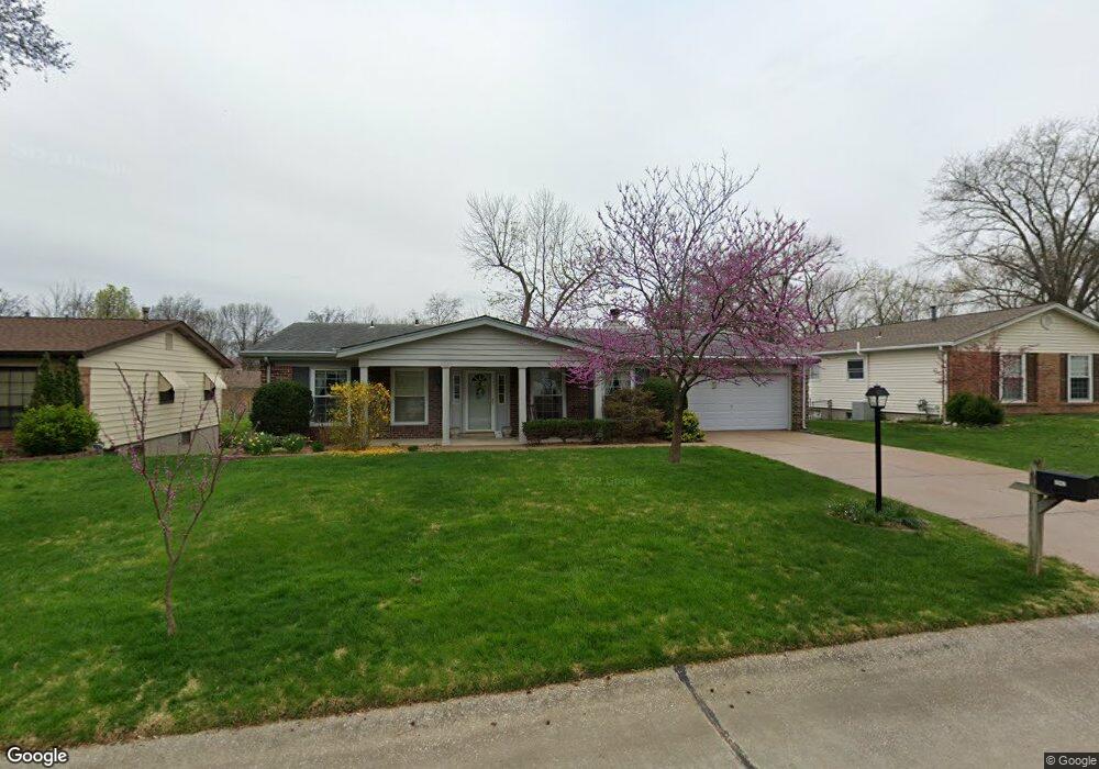
4942 Brockwood Dr Saint Louis, MO 63128
Estimated Value: $342,340 - $386,000
4
Beds
2
Baths
1,765
Sq Ft
$206/Sq Ft
Est. Value
About This Home
This home is located at 4942 Brockwood Dr, Saint Louis, MO 63128 and is currently estimated at $363,835, approximately $206 per square foot. 4942 Brockwood Dr is a home located in St. Louis County with nearby schools including Kennerly Elementary School, Sperreng Middle School, and Lindbergh High School.
Ownership History
Date
Name
Owned For
Owner Type
Purchase Details
Closed on
Jun 2, 2023
Sold by
John K Factor Living Trust and Mary Kaye Factor Living Trust
Bought by
John And Mary Kaye Factor Living Trust and Factor
Current Estimated Value
Purchase Details
Closed on
Sep 1, 2007
Sold by
Factor John Kevin and Factor Mary Kaye
Bought by
Factor Mary Kaye and Mary Kaye Factor Living Trust
Purchase Details
Closed on
Aug 13, 2005
Sold by
Boyd Mark A
Bought by
Boyd Kelly K
Create a Home Valuation Report for This Property
The Home Valuation Report is an in-depth analysis detailing your home's value as well as a comparison with similar homes in the area
Home Values in the Area
Average Home Value in this Area
Purchase History
| Date | Buyer | Sale Price | Title Company |
|---|---|---|---|
| John And Mary Kaye Factor Living Trust | -- | None Listed On Document | |
| Factor Mary Kaye | -- | None Available | |
| Factor John K | -- | None Available | |
| Boyd Kelly K | -- | -- |
Source: Public Records
Tax History Compared to Growth
Tax History
| Year | Tax Paid | Tax Assessment Tax Assessment Total Assessment is a certain percentage of the fair market value that is determined by local assessors to be the total taxable value of land and additions on the property. | Land | Improvement |
|---|---|---|---|---|
| 2025 | $3,565 | $62,720 | $15,770 | $46,950 |
| 2024 | $3,565 | $54,760 | $15,770 | $38,990 |
| 2023 | $3,556 | $54,760 | $15,770 | $38,990 |
| 2022 | $3,064 | $45,220 | $15,770 | $29,450 |
| 2021 | $2,955 | $45,220 | $15,770 | $29,450 |
| 2020 | $2,913 | $43,000 | $15,770 | $27,230 |
| 2019 | $2,905 | $43,000 | $15,770 | $27,230 |
| 2018 | $2,597 | $34,920 | $9,630 | $25,290 |
| 2017 | $2,569 | $34,920 | $9,630 | $25,290 |
| 2016 | $2,477 | $31,960 | $8,760 | $23,200 |
| 2015 | $2,439 | $31,960 | $8,760 | $23,200 |
| 2014 | $2,948 | $38,330 | $7,850 | $30,480 |
Source: Public Records
Map
Nearby Homes
- 4839 Hursley Dr
- 4833 Hursley Dr
- 5135 Towne Centre Dr
- 4801 Langtree Dr
- 4942 Caribee Dr
- 5100 Melitta Dr
- 5057 Peyton Place Ct
- 4645 Tauneybrook Dr
- 4643 Littlebury Dr
- 4915 Butler Hill Rd
- 4818 Chapel Hill Dr
- 4947 Butler Hill Rd
- 5161 Butler Bend Dr
- 5263 Faro Dr
- 10016 Schuessler Rd
- 5317 Hamlin Ct
- 5334 Tesson Ct
- 5325 Tesson Gardens Ct
- 4449 Pinyon Jay Ct
- 4829 Vermilion Dr
- 4936 Brockwood Dr
- 4948 Brockwood Dr
- 5055 Reynosa Dr
- 4930 Brockwood Dr
- 5049 Reynosa Dr
- 5061 Reynosa Dr
- 4939 Brockwood Dr
- 4945 Brockwood Dr
- 5041 Reynosa Dr
- 4933 Brockwood Dr
- 4951 Brockwood Dr
- 4960 Brockwood Dr
- 4924 Brockwood Dr
- 5067 Reynosa Dr
- 4927 Brockwood Dr
- 4957 Brockwood Dr
- 4833 Morestead Dr
- 5037 Reynosa Dr
- 4966 Brockwood Dr
- 4921 Brockwood Dr