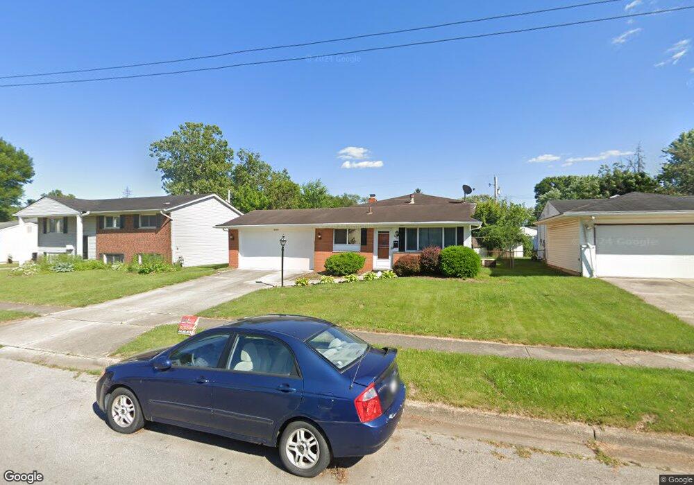
4949 Botsford Dr Columbus, OH 43232
Walnut Heights NeighborhoodEstimated Value: $181,237 - $222,000
3
Beds
2
Baths
960
Sq Ft
$202/Sq Ft
Est. Value
About This Home
This home is located at 4949 Botsford Dr, Columbus, OH 43232 and is currently estimated at $194,059, approximately $202 per square foot. 4949 Botsford Dr is a home located in Franklin County with nearby schools including Liberty Elementary School, Yorktown Middle School, and Independence High School.
Ownership History
Date
Name
Owned For
Owner Type
Purchase Details
Closed on
Feb 3, 1997
Sold by
Knapp Robert V
Bought by
Russell Roderick K
Current Estimated Value
Home Financials for this Owner
Home Financials are based on the most recent Mortgage that was taken out on this home.
Original Mortgage
$85,900
Outstanding Balance
$7,824
Interest Rate
8%
Mortgage Type
VA
Estimated Equity
$186,235
Purchase Details
Closed on
Jul 7, 1994
Sold by
Baird Jane E
Bought by
Knapp Robert V and Knapp Shirley J
Home Financials for this Owner
Home Financials are based on the most recent Mortgage that was taken out on this home.
Original Mortgage
$62,423
Interest Rate
8.61%
Mortgage Type
FHA
Purchase Details
Closed on
Jul 21, 1987
Create a Home Valuation Report for This Property
The Home Valuation Report is an in-depth analysis detailing your home's value as well as a comparison with similar homes in the area
Home Values in the Area
Average Home Value in this Area
Purchase History
| Date | Buyer | Sale Price | Title Company |
|---|---|---|---|
| Russell Roderick K | $85,900 | -- | |
| Knapp Robert V | $66,900 | -- | |
| -- | $58,900 | -- |
Source: Public Records
Mortgage History
| Date | Status | Borrower | Loan Amount |
|---|---|---|---|
| Open | Russell Roderick K | $85,900 | |
| Previous Owner | Knapp Robert V | $62,423 |
Source: Public Records
Tax History
| Year | Tax Paid | Tax Assessment Tax Assessment Total Assessment is a certain percentage of the fair market value that is determined by local assessors to be the total taxable value of land and additions on the property. | Land | Improvement |
|---|---|---|---|---|
| 2025 | $2,911 | $64,860 | $17,820 | $47,040 |
| 2024 | $2,911 | $64,860 | $17,820 | $47,040 |
| 2023 | $2,874 | $64,855 | $17,815 | $47,040 |
| 2022 | $1,913 | $36,890 | $6,300 | $30,590 |
| 2021 | $1,917 | $36,890 | $6,300 | $30,590 |
| 2020 | $1,919 | $36,890 | $6,300 | $30,590 |
| 2019 | $1,879 | $30,980 | $5,250 | $25,730 |
| 2018 | $1,756 | $30,980 | $5,250 | $25,730 |
| 2017 | $1,878 | $30,980 | $5,250 | $25,730 |
| 2016 | $1,802 | $27,200 | $4,340 | $22,860 |
| 2015 | $1,636 | $27,200 | $4,340 | $22,860 |
| 2014 | $1,640 | $27,200 | $4,340 | $22,860 |
| 2013 | $898 | $30,205 | $4,830 | $25,375 |
Source: Public Records
Map
Nearby Homes
- 0 Noe Bixby Rd
- 5123 Jameson Dr
- 5114 Carbondale Dr
- 5144 Botsford Dr
- 2336 Noe Bixby Rd
- 2348 Noe Bixby Rd
- 2342 Noe Bixby Rd
- 2360 Noe Bixby Rd
- 2354 Noe Bixby Rd
- 2608 Hubbell Rd
- 5137 Holbrook Dr
- 2651 Brownfield Rd
- 1945 Riverdale Rd
- 4942 Talbert Dr
- 5278 Glenbriar Ct
- 5207 Kornwal Dr
- 2706 Moundcrest St
- 2932 Renfro Rd
- 5290 Quincy Dr
- 2900 Gentry Ln
- 4955 Botsford Dr
- 4943 Botsford Dr
- 4966 Comstock Dr
- 4965 Botsford Dr
- 4933 Botsford Dr
- 4974 Comstock Dr
- 4960 Comstock Dr
- 4950 Comstock Dr
- 4925 Botsford Dr
- 4971 Botsford Dr
- 4948 Botsford Dr
- 4954 Botsford Dr
- 4940 Botsford Dr
- 4944 Comstock Dr
- 4988 Comstock Dr
- 4962 Botsford Dr
- 4932 Botsford Dr
- 4981 Botsford Dr
- 4921 Botsford Dr
- 4970 Botsford Dr
Your Personal Tour Guide
Ask me questions while you tour the home.