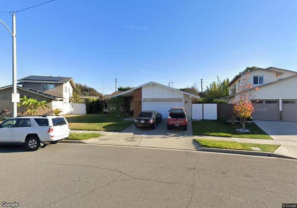
495 Pierpont Dr Costa Mesa, CA 92626
Northside Costa Mesa NeighborhoodEstimated Value: $1,170,000 - $1,477,000
3
Beds
2
Baths
1,296
Sq Ft
$1,001/Sq Ft
Est. Value
About This Home
This home is located at 495 Pierpont Dr, Costa Mesa, CA 92626 and is currently estimated at $1,297,711, approximately $1,001 per square foot. 495 Pierpont Dr is a home located in Orange County with nearby schools including Sonora Elementary School, Costa Mesa High School, and Frontiers Academy.
Ownership History
Date
Name
Owned For
Owner Type
Purchase Details
Closed on
Mar 6, 2000
Sold by
Eustaff Leo J Trust
Bought by
Swartz Karl and Swartz Julie
Current Estimated Value
Home Financials for this Owner
Home Financials are based on the most recent Mortgage that was taken out on this home.
Original Mortgage
$177,600
Outstanding Balance
$60,580
Interest Rate
8.38%
Estimated Equity
$1,237,131
Create a Home Valuation Report for This Property
The Home Valuation Report is an in-depth analysis detailing your home's value as well as a comparison with similar homes in the area
Home Values in the Area
Average Home Value in this Area
Purchase History
| Date | Buyer | Sale Price | Title Company |
|---|---|---|---|
| Swartz Karl | $222,000 | Commonwealth Land Title |
Source: Public Records
Mortgage History
| Date | Status | Borrower | Loan Amount |
|---|---|---|---|
| Open | Swartz Karl | $177,600 | |
| Closed | Swartz Karl | $33,300 |
Source: Public Records
Tax History
| Year | Tax Paid | Tax Assessment Tax Assessment Total Assessment is a certain percentage of the fair market value that is determined by local assessors to be the total taxable value of land and additions on the property. | Land | Improvement |
|---|---|---|---|---|
| 2025 | $4,512 | $346,502 | $246,251 | $100,251 |
| 2024 | $4,512 | $339,708 | $241,422 | $98,286 |
| 2023 | $4,336 | $333,048 | $236,689 | $96,359 |
| 2022 | $4,152 | $326,518 | $232,048 | $94,470 |
| 2021 | $4,007 | $320,116 | $227,498 | $92,618 |
| 2020 | $3,954 | $316,834 | $225,165 | $91,669 |
| 2019 | $3,868 | $310,622 | $220,750 | $89,872 |
| 2018 | $3,789 | $304,532 | $216,422 | $88,110 |
| 2017 | $3,728 | $298,561 | $212,178 | $86,383 |
| 2016 | $3,651 | $292,707 | $208,017 | $84,690 |
| 2015 | $3,615 | $288,311 | $204,893 | $83,418 |
| 2014 | $3,534 | $282,664 | $200,880 | $81,784 |
Source: Public Records
Map
Nearby Homes
- 511 Sturgeon Dr
- 559 Traverse Dr
- 590 Traverse Dr
- 604 Lassen Ln Unit 199
- 1001 W Stevens Ave Unit 328
- 1001 W Stevens Ave Unit 318
- 783 Grayling
- 781 Grayling Bay
- 810 Baker St Unit 112
- 1010 W Macarthur Blvd Unit 16
- 1010 W Macarthur Blvd Unit 55
- 3610 Ramona Dr
- 1030 W Macarthur Blvd Unit 21
- 1030 W Macarthur Blvd Unit 5
- 1030 W Macarthur Blvd Unit 95
- 1030 W Macarthur Blvd Unit 23
- 1030 W Macarthur Blvd Unit 93
- 1000 W Macarthur Blvd Unit 100
- 1000 W Macarthur Blvd Unit 113
- 1000 W Macarthur Blvd Unit 18
- 491 Pierpont Dr
- 499 Pierpont Dr
- 3174 Manistee Dr
- 487 Pierpont Dr
- 3172 Manistee Dr
- 498 Pierpont Dr
- 491 Sturgeon Dr
- 483 Pierpont Dr
- 507 Pierpont Dr
- 506 Pierpont Dr
- 3170 Manistee Dr
- 495 Sturgeon Dr
- 482 Traverse Dr
- 511 Pierpont Dr
- 510 Pierpont Dr
- 3168 Manistee Dr
- 501 Sturgeon Dr
- 3166 Manistee Dr
- 484 Traverse Dr
- 514 Pierpont Dr
Your Personal Tour Guide
Ask me questions while you tour the home.