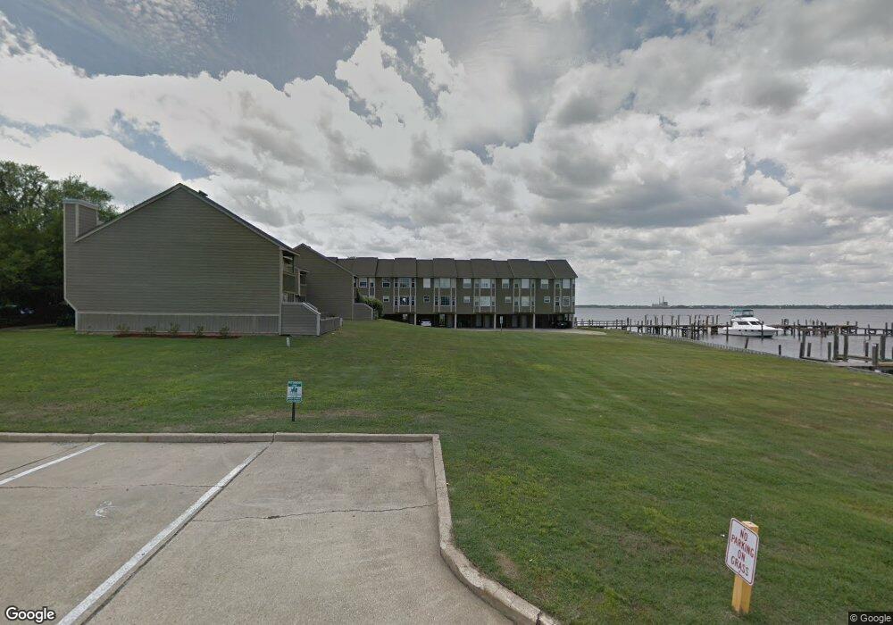
495 Popps Ferry Rd Biloxi, MS 39531
Estimated Value: $250,000 - $362,000
3
Beds
1
Bath
1,524
Sq Ft
$202/Sq Ft
Est. Value
About This Home
This home is located at 495 Popps Ferry Rd, Biloxi, MS 39531 and is currently estimated at $307,759, approximately $201 per square foot. 495 Popps Ferry Rd is a home located in Harrison County with nearby schools including Popps Ferry Elementary School, Biloxi Junior High School, and Biloxi High School.
Ownership History
Date
Name
Owned For
Owner Type
Purchase Details
Closed on
Mar 16, 2022
Sold by
Connley Davis
Bought by
Amos John and Amos Rachel
Current Estimated Value
Home Financials for this Owner
Home Financials are based on the most recent Mortgage that was taken out on this home.
Original Mortgage
$217,053
Outstanding Balance
$204,457
Interest Rate
3.85%
Estimated Equity
$103,303
Purchase Details
Closed on
Dec 22, 2021
Sold by
Renee Ladner
Bought by
Renee Ladner Revocable Trust
Purchase Details
Closed on
Aug 31, 2021
Sold by
Orgler Geraldine K
Bought by
Campbell Jason S and Campbell Aubrey C
Home Financials for this Owner
Home Financials are based on the most recent Mortgage that was taken out on this home.
Original Mortgage
$295,420
Interest Rate
2.7%
Mortgage Type
New Conventional
Create a Home Valuation Report for This Property
The Home Valuation Report is an in-depth analysis detailing your home's value as well as a comparison with similar homes in the area
Home Values in the Area
Average Home Value in this Area
Purchase History
| Date | Buyer | Sale Price | Title Company |
|---|---|---|---|
| Amos John | -- | None Listed On Document | |
| Renee Ladner Revocable Trust | -- | None Listed On Document | |
| Campbell Jason S | -- | None Available |
Source: Public Records
Mortgage History
| Date | Status | Borrower | Loan Amount |
|---|---|---|---|
| Open | Amos John | $217,053 | |
| Previous Owner | Campbell Jason S | $295,420 |
Source: Public Records
Tax History Compared to Growth
Tax History
| Year | Tax Paid | Tax Assessment Tax Assessment Total Assessment is a certain percentage of the fair market value that is determined by local assessors to be the total taxable value of land and additions on the property. | Land | Improvement |
|---|---|---|---|---|
| 2024 | $2,467 | $22,272 | $0 | $0 |
| 2023 | $2,445 | $22,272 | $0 | $0 |
| 2022 | $2,445 | $22,272 | $0 | $0 |
| 2021 | $773 | $14,848 | $0 | $0 |
| 2020 | $774 | $14,543 | $0 | $0 |
| 2019 | $774 | $14,543 | $0 | $0 |
| 2018 | $774 | $14,543 | $0 | $0 |
| 2017 | $774 | $14,543 | $0 | $0 |
| 2015 | $820 | $14,965 | $0 | $0 |
| 2014 | -- | $7,500 | $0 | $0 |
| 2013 | -- | $15,066 | $5,000 | $10,066 |
Source: Public Records
Map
Nearby Homes
- 422 Cachemont Cove
- 426 Carmargue Ln
- 418 Carmargue Ln
- 2509 Provence Place
- 408 Saylor Dr
- 2562 Mercedes Dr
- 0 Melissa Dr Unit 4105330
- 2530 Old Bay Rd
- 446 Melissa Dr
- 441 Linda Dr
- 429 Linda Dr
- 360 Spratley Ave
- 2379 Trafalgar Dr
- 400 Linda Dr
- 416 Woodland Park Dr
- 435 Christi Ln
- 2192 Atkinson Rd
- 0 Harmanson Vue
- 2516 Orleans Rd
- 2281 Stelly Dr
- 495 Popps Ferry Rd Unit 7838
- 495 Popps Ferry Rd
- 495 Popps Ferry Rd
- 495 Popps Ferry Rd
- 495 Popps Ferry Rd
- 495 Popps Ferry Rd
- 495 Popps Ferry Rd
- 495 Popps Ferry Rd
- 495 Popps Ferry Rd
- 495 Popps Ferry Rd
- 495 Popps Ferry Rd
- 495 Popps Ferry Rd
- 495 Popps Ferry Rd
- 495 Popps Ferry Rd
- 495 Popps Ferry Rd
- 495 Popps Ferry Rd
- 495 Popps Ferry Rd
- 495 Popps Ferry Rd
- 495 Popps Ferry Rd
- 495 Popps Ferry Rd