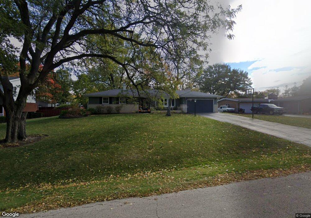
495 Stanford Dr Marengo, IL 60152
Estimated Value: $315,000 - $350,000
3
Beds
3
Baths
2,000
Sq Ft
$166/Sq Ft
Est. Value
About This Home
This home is located at 495 Stanford Dr, Marengo, IL 60152 and is currently estimated at $331,379, approximately $165 per square foot. 495 Stanford Dr is a home located in McHenry County with nearby schools including Locust Elementary School, Marengo Community Middle School, and Marengo Community High School.
Ownership History
Date
Name
Owned For
Owner Type
Purchase Details
Closed on
Nov 29, 2016
Sold by
Mecum Jim A and Mecum Marcia L
Bought by
Galb Rachel C and Galb Ryan J
Current Estimated Value
Home Financials for this Owner
Home Financials are based on the most recent Mortgage that was taken out on this home.
Original Mortgage
$150,000
Outstanding Balance
$121,495
Interest Rate
3.62%
Mortgage Type
New Conventional
Estimated Equity
$209,884
Purchase Details
Closed on
Apr 8, 2009
Sold by
Mecum Jim A and Mecum Marcia L
Bought by
Mecum Jim A and Mecum Marcia L
Create a Home Valuation Report for This Property
The Home Valuation Report is an in-depth analysis detailing your home's value as well as a comparison with similar homes in the area
Home Values in the Area
Average Home Value in this Area
Purchase History
| Date | Buyer | Sale Price | Title Company |
|---|---|---|---|
| Galb Rachel C | $187,500 | Chicago Title | |
| Mecum Jim A | -- | None Available |
Source: Public Records
Mortgage History
| Date | Status | Borrower | Loan Amount |
|---|---|---|---|
| Open | Galb Rachel C | $150,000 |
Source: Public Records
Tax History Compared to Growth
Tax History
| Year | Tax Paid | Tax Assessment Tax Assessment Total Assessment is a certain percentage of the fair market value that is determined by local assessors to be the total taxable value of land and additions on the property. | Land | Improvement |
|---|---|---|---|---|
| 2024 | $6,195 | $89,636 | $20,617 | $69,019 |
| 2023 | $6,006 | $79,016 | $18,174 | $60,842 |
| 2022 | $5,872 | $71,456 | $16,435 | $55,021 |
| 2021 | $5,447 | $65,108 | $14,975 | $50,133 |
| 2020 | $5,344 | $61,960 | $14,251 | $47,709 |
| 2019 | $5,640 | $58,708 | $13,503 | $45,205 |
| 2018 | $5,221 | $54,991 | $12,648 | $42,343 |
| 2017 | $5,041 | $52,090 | $11,981 | $40,109 |
| 2016 | $5,542 | $48,669 | $11,194 | $37,475 |
| 2013 | -- | $47,617 | $10,952 | $36,665 |
Source: Public Records
Map
Nearby Homes
- 704 Echo (Lot 21) Trail
- 806 Echo (Lot 22) Trail
- 7 ACRES Menge Rd
- 802 Echo (Lot 23) Trail
- 832 Oak Manor Dr
- 615 Park Dr
- 455 Park Dr
- 422 Damen St
- 479 Kennedy St
- 459 Kennedy St
- 10 ac U S 20
- 579 Johnson St
- 0 Maple St
- 212 E Van Buren St
- 21820 W Railroad St
- 6211 Maple St Unit 501
- 214 S Prospect St
- 906 N State St
- 830 N Taylor St
- 6212 Meyer Rd