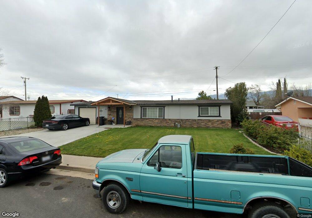
49511 Michael Ave Tehachapi, CA 93561
Estimated Value: $228,000 - $289,000
2
Beds
1
Bath
936
Sq Ft
$283/Sq Ft
Est. Value
About This Home
This home is located at 49511 Michael Ave, Tehachapi, CA 93561 and is currently estimated at $264,629, approximately $282 per square foot. 49511 Michael Ave is a home located in Kern County with nearby schools including Cummings Valley Elementary School, Jacobsen Middle School, and Tehachapi High School.
Ownership History
Date
Name
Owned For
Owner Type
Purchase Details
Closed on
Jan 4, 2007
Sold by
Graham Maria D
Bought by
Graham Scott L
Current Estimated Value
Home Financials for this Owner
Home Financials are based on the most recent Mortgage that was taken out on this home.
Original Mortgage
$170,327
Outstanding Balance
$101,276
Interest Rate
6.12%
Mortgage Type
FHA
Estimated Equity
$163,353
Purchase Details
Closed on
Nov 17, 2006
Sold by
Hampton Gregory L and Hampton Susanne M
Bought by
Graham Scott
Home Financials for this Owner
Home Financials are based on the most recent Mortgage that was taken out on this home.
Original Mortgage
$170,327
Outstanding Balance
$101,276
Interest Rate
6.12%
Mortgage Type
FHA
Estimated Equity
$163,353
Purchase Details
Closed on
Mar 7, 2005
Sold by
Hampton Gregory L and Hampton Susanne M
Bought by
Hampton Gregory L and Hampton Susanne M
Purchase Details
Closed on
Apr 10, 2003
Sold by
Lachica Mario
Bought by
Hampton Gregory L and Hampton Susanne M
Home Financials for this Owner
Home Financials are based on the most recent Mortgage that was taken out on this home.
Original Mortgage
$44,800
Interest Rate
5.75%
Mortgage Type
Purchase Money Mortgage
Purchase Details
Closed on
Aug 25, 1997
Sold by
Lachia Elizabeth
Bought by
Lachica Mario
Home Financials for this Owner
Home Financials are based on the most recent Mortgage that was taken out on this home.
Original Mortgage
$34,000
Interest Rate
7.34%
Purchase Details
Closed on
Oct 30, 1995
Sold by
Tolman Daniel and Rose Marie
Bought by
Lachica Mario and Lachica Elizabeth
Home Financials for this Owner
Home Financials are based on the most recent Mortgage that was taken out on this home.
Original Mortgage
$51,000
Interest Rate
7.67%
Mortgage Type
Seller Take Back
Purchase Details
Closed on
Dec 28, 1994
Sold by
Hud
Bought by
Tolman Daniel and Tolman Rose Marie
Purchase Details
Closed on
May 3, 1994
Sold by
Citicorp Mtg Inc
Bought by
Hud
Create a Home Valuation Report for This Property
The Home Valuation Report is an in-depth analysis detailing your home's value as well as a comparison with similar homes in the area
Home Values in the Area
Average Home Value in this Area
Purchase History
| Date | Buyer | Sale Price | Title Company |
|---|---|---|---|
| Graham Scott L | -- | First American Title Co La | |
| Graham Scott | $173,000 | Fatcola | |
| Hampton Gregory L | -- | -- | |
| Hampton Gregory L | $56,000 | First American Title | |
| Lachica Mario | -- | Fidelity National Title Co | |
| Lachica Mario | $55,000 | Chicago Title Co | |
| Tolman Daniel | $25,500 | Heritage Title Company | |
| Hud | -- | First American Title Company | |
| Citicorp Mtg Inc | $69,067 | First American Title Company |
Source: Public Records
Mortgage History
| Date | Status | Borrower | Loan Amount |
|---|---|---|---|
| Open | Graham Scott L | $170,327 | |
| Previous Owner | Hampton Gregory L | $44,800 | |
| Previous Owner | Lachica Mario | $34,000 | |
| Previous Owner | Lachica Mario | $51,000 |
Source: Public Records
Tax History
| Year | Tax Paid | Tax Assessment Tax Assessment Total Assessment is a certain percentage of the fair market value that is determined by local assessors to be the total taxable value of land and additions on the property. | Land | Improvement |
|---|---|---|---|---|
| 2025 | $2,839 | $231,765 | $53,582 | $178,183 |
| 2024 | $2,738 | $227,222 | $52,532 | $174,690 |
| 2023 | $2,738 | $222,767 | $51,502 | $171,265 |
| 2022 | $2,710 | $218,400 | $50,493 | $167,907 |
| 2021 | $2,290 | $182,000 | $46,000 | $136,000 |
| 2020 | $2,156 | $169,000 | $42,000 | $127,000 |
| 2019 | $1,849 | $141,000 | $35,000 | $106,000 |
| 2018 | $1,673 | $129,000 | $32,000 | $97,000 |
| 2017 | $1,401 | $105,000 | $26,000 | $79,000 |
| 2016 | $1,174 | $87,000 | $22,000 | $65,000 |
| 2015 | $1,300 | $101,000 | $25,000 | $76,000 |
| 2014 | $868 | $64,000 | $16,000 | $48,000 |
Source: Public Records
Map
Nearby Homes
- 49513 Michael Ave
- North N Dennison Rd
- 333 S Dennison Rd Unit 63
- 600 S Dennison Rd Unit 27
- 600 S Dennison Rd Unit 64
- 600 S Dennison Rd Unit Spc 109
- 600 S Dennison Rd Unit 24
- 600 S Dennison Rd Unit 29
- 600 S Dennison Rd Unit 120
- 600 S Dennison Rd Unit 35
- 600 S Dennison Rd Unit 4
- 302 E I St
- 10 Challenger Dr
- 9 Challenger Dr
- 11 Challenger Dr
- 413 Apple Way
- 210 E Tehachapi Blvd
- 211 E Tehachapi Blvd
- 221 E E St
- 321 Holly Dr
- 49509 Michael Ave
- 49515 Michael Ave
- 49507 Michael Ave
- 49510 Michael Ave
- 49508 Michael Ave
- 49512 Michael Ave
- 49514 Michael Ave
- 49505 Michael Ave
- 49506 Michael Ave
- 49516 Michael Ave
- 49504 Michael Ave
- 49511 Brett Ave
- 49519 Michael Ave
- 49509 Brett Ave
- 49513 Brett Ave
- 49503 Michael Ave
- 49507 Brett Ave
- 49515 Brett Ave
- 49502 Michael Ave
- 49517 Brett Ave
Your Personal Tour Guide
Ask me questions while you tour the home.