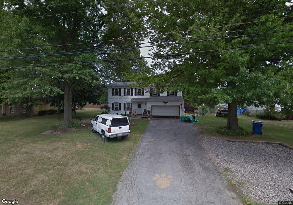
4953 Sampson Dr Youngstown, OH 44505
Estimated Value: $189,000 - $250,000
4
Beds
2
Baths
1,888
Sq Ft
$120/Sq Ft
Est. Value
About This Home
This home is located at 4953 Sampson Dr, Youngstown, OH 44505 and is currently estimated at $226,042, approximately $119 per square foot. 4953 Sampson Dr is a home located in Trumbull County with nearby schools including E.J. Blott Elementary School, William S. Guy Middle School, and Liberty High School.
Ownership History
Date
Name
Owned For
Owner Type
Purchase Details
Closed on
Dec 1, 2015
Sold by
Hull Mark L
Bought by
Mark L Hull J and Debra Hull S
Current Estimated Value
Home Financials for this Owner
Home Financials are based on the most recent Mortgage that was taken out on this home.
Interest Rate
3.95%
Purchase Details
Closed on
Jan 1, 1990
Bought by
Wayne A Rohrbaugh
Create a Home Valuation Report for This Property
The Home Valuation Report is an in-depth analysis detailing your home's value as well as a comparison with similar homes in the area
Home Values in the Area
Average Home Value in this Area
Purchase History
| Date | Buyer | Sale Price | Title Company |
|---|---|---|---|
| Mark L Hull J | -- | -- | |
| Wayne A Rohrbaugh | -- | -- |
Source: Public Records
Mortgage History
| Date | Status | Borrower | Loan Amount |
|---|---|---|---|
| Closed | Mark L Hull J | -- |
Source: Public Records
Tax History Compared to Growth
Tax History
| Year | Tax Paid | Tax Assessment Tax Assessment Total Assessment is a certain percentage of the fair market value that is determined by local assessors to be the total taxable value of land and additions on the property. | Land | Improvement |
|---|---|---|---|---|
| 2024 | $3,047 | $58,770 | $7,950 | $50,820 |
| 2023 | $3,047 | $58,770 | $7,950 | $50,820 |
| 2022 | $2,464 | $38,120 | $6,930 | $31,190 |
| 2021 | $2,469 | $38,120 | $6,930 | $31,190 |
| 2020 | $2,474 | $38,120 | $6,930 | $31,190 |
| 2019 | $2,694 | $35,280 | $6,930 | $28,350 |
| 2018 | $2,579 | $35,280 | $6,930 | $28,350 |
| 2017 | $2,672 | $35,280 | $6,930 | $28,350 |
| 2016 | $2,517 | $34,720 | $6,930 | $27,790 |
| 2015 | $2,513 | $34,720 | $6,930 | $27,790 |
| 2014 | $2,510 | $34,720 | $6,930 | $27,790 |
| 2013 | $2,442 | $34,720 | $6,930 | $27,790 |
Source: Public Records
Map
Nearby Homes
- 4785 Logan Arms Dr
- 4900 5th Ave
- 639 Aurora Dr
- 615 Ventura Dr
- 1120 Timbercrest St
- 1171 Logan Wood Dr
- 5320 Sampson Dr
- 4593 Michigan Blvd
- 0 Churchill Unit 5102145
- 4591 Churchill Hubbard Rd
- 1146 Townsend Ave
- 1185 Townsend Ave
- 4628 Middle Rd
- 1929 Twin Oaks Dr
- 0 Townsend Ave
- 200 Terra Bella Dr Unit 1
- 4810 Logan Way
- 515 Murray Hill Dr
- 5612 Belmont Ave
- 5602 Greenbrier Dr
- 4975 Sampson Dr
- 4933 Sampson Dr
- 4766 Logan Arms Dr
- 4770 Logan Arms Dr
- 4762 Logan Arms Dr
- 4762 Logan Arms Dr
- 4899 Sampson Dr
- 4999 Sampson Dr
- 4950 Sampson Dr
- 4970 Sampson Dr
- 4774 Logan Arms Dr
- 4930 Sampson Dr
- 4758 Logan Arms Dr
- 4998 Sampson Dr
- 5001 Sampson Dr
- 4881 Sampson Dr
- 4900 Sampson Dr
- 4900 Sampson Dr Unit 1
- 4778 Logan Arms Dr
- 5000 Sampson Dr