Estimated Value: $224,000 - $276,000
3
Beds
2
Baths
1,248
Sq Ft
$204/Sq Ft
Est. Value
About This Home
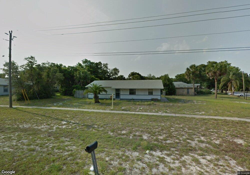
This home is located at 4955 Curtis Blvd Unit 8, Cocoa, FL 32927 and is currently estimated at $254,242, approximately $203 per square foot. 4955 Curtis Blvd Unit 8 is a home located in Brevard County with nearby schools including Atlantis Elementary School, Space Coast Junior/Senior High School, and Sculptor Charter School.
Ownership History
Date
Name
Owned For
Owner Type
Purchase Details
Closed on
Oct 1, 2025
Sold by
Xxv Holdings Llc
Bought by
Llanos Jonatan
Current Estimated Value
Home Financials for this Owner
Home Financials are based on the most recent Mortgage that was taken out on this home.
Original Mortgage
$239,334
Outstanding Balance
$239,334
Interest Rate
6.58%
Mortgage Type
FHA
Estimated Equity
$14,908
Purchase Details
Closed on
Feb 14, 2017
Sold by
Wg Partners Llc
Bought by
Xxv Holdings Llc
Purchase Details
Closed on
Oct 28, 2013
Sold by
Diaz Anthony
Bought by
Wg Partners Llc
Purchase Details
Closed on
May 20, 2011
Sold by
Kaluscak Margaret M
Bought by
Diaz Anthony
Home Financials for this Owner
Home Financials are based on the most recent Mortgage that was taken out on this home.
Original Mortgage
$36,000
Interest Rate
4.79%
Create a Home Valuation Report for This Property
The Home Valuation Report is an in-depth analysis detailing your home's value as well as a comparison with similar homes in the area
Home Values in the Area
Average Home Value in this Area
Purchase History
| Date | Buyer | Sale Price | Title Company |
|---|---|---|---|
| Llanos Jonatan | $243,800 | Title Solutions | |
| Xxv Holdings Llc | -- | Attorney | |
| Wg Partners Llc | $70,000 | Liberty Title Company | |
| Diaz Anthony | $20,000 | Liberty Title |
Source: Public Records
Mortgage History
| Date | Status | Borrower | Loan Amount |
|---|---|---|---|
| Open | Llanos Jonatan | $239,334 | |
| Previous Owner | Diaz Anthony | $36,000 |
Source: Public Records
Tax History Compared to Growth
Tax History
| Year | Tax Paid | Tax Assessment Tax Assessment Total Assessment is a certain percentage of the fair market value that is determined by local assessors to be the total taxable value of land and additions on the property. | Land | Improvement |
|---|---|---|---|---|
| 2025 | $2,887 | $196,380 | -- | -- |
| 2024 | $2,823 | $191,830 | -- | -- |
| 2023 | $2,823 | $191,570 | $0 | $0 |
| 2022 | $2,562 | $182,000 | $0 | $0 |
| 2021 | $1,810 | $135,970 | $42,000 | $93,970 |
| 2020 | $2,147 | $121,880 | $40,000 | $81,880 |
| 2019 | $2,069 | $116,830 | $35,000 | $81,830 |
| 2018 | $1,957 | $105,690 | $27,000 | $78,690 |
| 2017 | $1,705 | $93,920 | $24,000 | $69,920 |
| 2016 | $1,595 | $79,570 | $18,000 | $61,570 |
| 2015 | $1,515 | $65,140 | $15,000 | $50,140 |
| 2014 | $1,388 | $59,220 | $11,000 | $48,220 |
Source: Public Records
Map
Nearby Homes
- 6735 Grissom Pkwy
- 6840 Anecia Ave
- 0000 Grissom Pkwy
- 5090 Market St
- 4760 Ivan St
- 6390 Depot Ave
- 4635 Alfred St
- 5149 Arlington Rd Unit 104
- 5155 Mayflower St
- 7035 Jasmine Ave
- 00 Unknown
- 6499 Pleasant Ave
- 6375 Cable Ave
- 7155 Export Ave
- 4859 Horton St
- 5265 Fay Blvd
- 4975 Fay Blvd
- 6240 Grissom Pkwy
- 5145 Fay Blvd
- 6615 Dock Ave
- 4955 Curtis Blvd
- 6765 Anecia Ave
- 4871 Hawley Rd
- 4867 Hawley Rd
- 6745 Anecia Ave
- 6780 Anecia Ave
- 6760 Anecia Ave
- 6800 Anecia Ave
- 6805 Anecia Ave
- 4970 Curtis Blvd
- 6725 Anecia Ave
- 4863 Hawley Rd
- 4950 Brookhaven St
- 4940 Brookhaven St
- 4860 Hawley Rd
- 6815 Anecia Ave
- 6720 Anecia Ave
- 6810 Anecia Ave
- 4930 Brookhaven St
- 6795 Grissom Pkwy