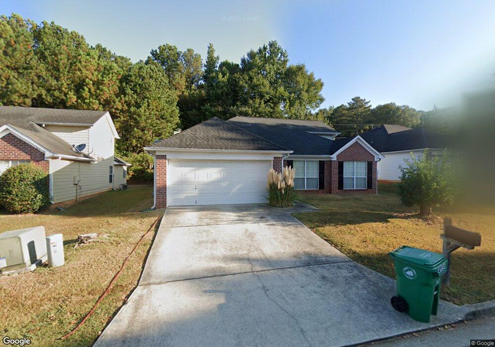
4956 Wilkins Station Dr Unit 1 Decatur, GA 30035
Southwest DeKalb NeighborhoodEstimated Value: $293,000 - $347,000
4
Beds
3
Baths
2,299
Sq Ft
$137/Sq Ft
Est. Value
About This Home
This home is located at 4956 Wilkins Station Dr Unit 1, Decatur, GA 30035 and is currently estimated at $314,874, approximately $136 per square foot. 4956 Wilkins Station Dr Unit 1 is a home located in DeKalb County with nearby schools including Flat Rock Elementary School, Miller Grove Middle School, and Miller Grove High School.
Ownership History
Date
Name
Owned For
Owner Type
Purchase Details
Closed on
Mar 31, 2005
Sold by
Young Marie
Bought by
Smith Margaret L
Current Estimated Value
Home Financials for this Owner
Home Financials are based on the most recent Mortgage that was taken out on this home.
Original Mortgage
$159,500
Outstanding Balance
$84,806
Interest Rate
6.25%
Mortgage Type
New Conventional
Estimated Equity
$230,068
Create a Home Valuation Report for This Property
The Home Valuation Report is an in-depth analysis detailing your home's value as well as a comparison with similar homes in the area
Home Values in the Area
Average Home Value in this Area
Purchase History
| Date | Buyer | Sale Price | Title Company |
|---|---|---|---|
| Smith Margaret L | $159,500 | -- |
Source: Public Records
Mortgage History
| Date | Status | Borrower | Loan Amount |
|---|---|---|---|
| Open | Smith Margaret L | $159,500 |
Source: Public Records
Tax History Compared to Growth
Tax History
| Year | Tax Paid | Tax Assessment Tax Assessment Total Assessment is a certain percentage of the fair market value that is determined by local assessors to be the total taxable value of land and additions on the property. | Land | Improvement |
|---|---|---|---|---|
| 2024 | $965 | $113,720 | $16,000 | $97,720 |
| 2023 | $965 | $114,480 | $12,000 | $102,480 |
| 2022 | $882 | $95,360 | $5,320 | $90,040 |
| 2021 | $2,346 | $75,920 | $5,320 | $70,600 |
| 2020 | $2,063 | $63,440 | $5,320 | $58,120 |
| 2019 | $2,036 | $63,160 | $5,320 | $57,840 |
| 2018 | $1,489 | $50,920 | $5,320 | $45,600 |
| 2017 | $1,927 | $56,960 | $5,320 | $51,640 |
| 2016 | $1,624 | $49,560 | $5,320 | $44,240 |
| 2014 | $1,020 | $32,040 | $5,320 | $26,720 |
Source: Public Records
Map
Nearby Homes
- 2332 Wilkins Ct Unit 1
- 2322 Wilkins Ct
- 4969 Truitt Ln Unit 1
- 4890 Wilkins Station Dr
- 4915 Truitt Ln Unit 2
- 2333 Wilkins Cove
- 2329 Wilkins Cove
- 4990 Windsor Downs Dr
- 2306 Ramblewood Cir
- 2290 Wilkins Cove
- 4913 Windsor Downs Dr
- 4907 Windsor Downs Dr
- 5035 Chadwick Ct
- 5042 Chadwick Ct
- 4963 Windsor Downs Ln
- 4783 Creekside Place
- 4839 Plymouth Trace Unit 2
- 4950 Wilkins Station Dr Unit 1
- 4962 Wilkins Station Dr
- 4944 Wilkins Station Dr Unit 1
- 4968 Wilkins Station Dr Unit 1
- 4938 Wilkins Station Dr Unit 1
- 4974 Wilkins Station Dr Unit 1
- 4955 Wilkins Station Dr Unit 1
- 4961 Wilkins Station Dr Unit 1
- 4949 Wilkins Station Dr Unit 1
- 4967 Wilkins Station Dr Unit 3
- 4967 Wilkins Station Dr Unit 4967
- 4967 Wilkins Station Dr Unit 1
- 4967 Wilkins Station Dr
- 4943 Wilkins Station Dr Unit 1
- 4973 Wilkins Station Dr
- 0 Wilkins Rd Unit 8113317
- 0 Wilkins Rd
- 4937 Wilkins Station Dr
- 0 Wilkins Station Dr Unit 8689702
- 0 Wilkins Station Dr Unit 8670545