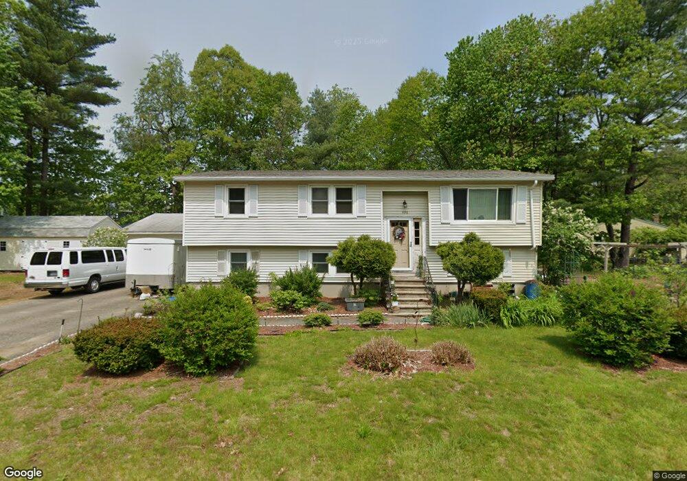
496 Beccaris Dr Rollinsford, NH 03869
Estimated Value: $468,000 - $545,000
4
Beds
2
Baths
1,876
Sq Ft
$268/Sq Ft
Est. Value
About This Home
This home is located at 496 Beccaris Dr, Rollinsford, NH 03869 and is currently estimated at $503,377, approximately $268 per square foot. 496 Beccaris Dr is a home located in Strafford County with nearby schools including Rollinsford Grade School, Berwick Academy, and Seacoast Christian School.
Ownership History
Date
Name
Owned For
Owner Type
Purchase Details
Closed on
Nov 17, 2003
Sold by
Bolsover Fletcher R and Bolsover Sheila E
Bought by
Laurion Tracey L and Laurion Timothy
Current Estimated Value
Home Financials for this Owner
Home Financials are based on the most recent Mortgage that was taken out on this home.
Original Mortgage
$205,100
Outstanding Balance
$93,828
Interest Rate
5.81%
Estimated Equity
$409,549
Purchase Details
Closed on
Jan 15, 1998
Sold by
Roberts Richard and Roberts Julie A
Bought by
Bolsover Fletcher R and Bolsover Sheila E
Home Financials for this Owner
Home Financials are based on the most recent Mortgage that was taken out on this home.
Original Mortgage
$20,000
Interest Rate
7.08%
Create a Home Valuation Report for This Property
The Home Valuation Report is an in-depth analysis detailing your home's value as well as a comparison with similar homes in the area
Home Values in the Area
Average Home Value in this Area
Purchase History
| Date | Buyer | Sale Price | Title Company |
|---|---|---|---|
| Laurion Tracey L | $227,900 | -- | |
| Bolsover Fletcher R | $115,000 | -- |
Source: Public Records
Mortgage History
| Date | Status | Borrower | Loan Amount |
|---|---|---|---|
| Open | Bolsover Fletcher R | $205,100 | |
| Previous Owner | Bolsover Fletcher R | $20,000 |
Source: Public Records
Tax History Compared to Growth
Tax History
| Year | Tax Paid | Tax Assessment Tax Assessment Total Assessment is a certain percentage of the fair market value that is determined by local assessors to be the total taxable value of land and additions on the property. | Land | Improvement |
|---|---|---|---|---|
| 2024 | $6,628 | $403,900 | $180,700 | $223,200 |
| 2023 | $6,212 | $403,900 | $180,700 | $223,200 |
| 2022 | $6,006 | $403,900 | $180,700 | $223,200 |
| 2021 | $5,961 | $244,500 | $107,500 | $137,000 |
| 2020 | $6,034 | $244,500 | $107,500 | $137,000 |
| 2019 | $5,528 | $244,500 | $107,500 | $137,000 |
| 2018 | $5,902 | $244,500 | $107,500 | $137,000 |
| 2016 | $5,806 | $207,500 | $66,600 | $140,900 |
| 2015 | $5,692 | $207,500 | $66,600 | $140,900 |
| 2014 | $5,499 | $207,500 | $66,600 | $140,900 |
| 2013 | $5,578 | $207,500 | $66,600 | $140,900 |
Source: Public Records
Map
Nearby Homes
- 442 Prospect St
- 26 Stevens Ct
- 37 Nealley St
- 24 Spillanes Hill
- 289 Main St
- 10 Portland St
- 23 Paul St
- 72 Moses Carr Rd
- 72 Vine St
- 10 Hill Dr
- 24 Farmgate Rd
- 22 High Knoll Dr
- 3 Bennett St
- 13 Beaver Dam Rd
- 10 Turgeon's Ln
- 17 2nd St
- 11 Country Club Estates Dr Unit 11
- 95 Oldfields Rd
- 29 Buffumsville Rd
- 13 Beech Rd
- 455 Stockdale Cir
- 459 Stockdale Cir
- 499 Beccaris Dr
- 4 Partridge Ln
- 451 Stockdale Cir
- 493 Beccaris Dr
- 504 Beccaris Dr
- 463 Stockdale Cir
- 12 Partridge Ln
- 447 Stockdale Cir
- 505 Beccaris Dr
- 510 Beccaris Dr
- 11 Partridge Ln
- 469 Stockdale Cir
- 464 Stockdale Cir
- 440 Stockdale Cir
- 443 Stockdale Cir
- 511 Beccaris Dr
- 460 Beccaris Dr
- 437 Stockdale Cir